Category:Aerial photographs of Prince Edward Island
Provinces and territories of Canada: Alberta · British Columbia · Manitoba · New Brunswick · Newfoundland and Labrador · Nova Scotia · Ontario · Prince Edward Island · Quebec · Saskatchewan · Northwest Territories · Nunavut · Yukon
Subcategories
This category has the following 4 subcategories, out of 4 total.
Media in category "Aerial photographs of Prince Edward Island"
The following 22 files are in this category, out of 22 total.
-
 A river runs through it (44196184722).jpg 3,264 × 2,448; 2.14 MB
-
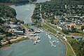 Aerial-view-of-Montague.jpg 350 × 233; 28 KB
-
 Bye Bye PEI (208645591).jpg 3,072 × 2,048; 3.35 MB
-
 Clouds and Moon (34680888).jpg 1,198 × 1,800; 1.32 MB
-
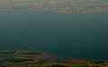 Confederation Bridge(2).jpg 2,288 × 1,436; 1.93 MB
-
 Confederation Bridge.jpg 3,888 × 2,592; 3.51 MB
-
 East Point Lighthouse from above - Prince Edward Island - PEI (Quintin Soloviev).png 5,272 × 3,948; 24.98 MB
-
 First Look at PEI (34680890).jpg 1,800 × 1,198; 2.03 MB
-
 Flight from Charlottetown to Halifax. Over Prince Edward Island (471472) (9448058949).jpg 3,410 × 1,918; 1.46 MB
-
 Goodbye Charlottetown (34499398).jpg 1,800 × 1,198; 1.68 MB
-
 Gorgeous Coastline (2477756727).jpg 2,272 × 1,704; 5.4 MB
-
 Icy (108426025).jpg 3,072 × 1,990; 5.61 MB
-
 ISS-42 Prince Edward Island and Nova Scotia.jpg 4,928 × 3,280; 1.48 MB
-
 Nearing St. John's, Nfl (26985015874).jpg 4,608 × 3,456; 3.56 MB
-
 On approach into Charlottetown (2477751093).jpg 2,272 × 1,704; 5.13 MB
-
 PEI (172897948).jpg 853 × 1,280; 142 KB
-
 PEI (172897961).jpg 853 × 1,280; 122 KB
-
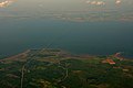
 Prince Edward Island (2478556306).jpg 2,272 × 1,704; 5.06 MB
-
 Prince Edward Island (3139648927).jpg 1,600 × 1,067; 228 KB
-
 Rustico Bay, Prince Edward Island Nat Park (11078273886).jpg 2,121 × 1,414; 1.85 MB
-
 St. Brigids, Foxley River PEI Aerial View.jpg 1,920 × 1,276; 827 KB
-
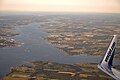
 Summerside, PEI (3140478422).jpg 1,600 × 1,067; 354 KB
.jpg)

.jpg)
.jpg)
.jpg)

.png)
.jpg)
_(9448058949).jpg)
.jpg)
.jpg)
.jpg)

.jpg)
.jpg)
.jpg)
.jpg)
.jpg)
.jpg)
.jpg)

.jpg)