Category:Bümpliz (Bern)
| Object location | | View all coordinates using: OpenStreetMap |
|---|
Deutsch: Bümpliz war bis 1919 eine selbständige Gemeinde und ist heute ein Quartier, respektive "Statistischer Bezirk", im Stadtteil Bümpliz-Oberbottigen, der auch als Stadtteil VI bekannt ist, in der Stadt Bern in der Schweiz. Siehe auch Grenzen Bümplizquartier auf OSM
quarter/"statistical district", in the district Bümpliz-Oberbottigen/quarter VI in the city of Bern, Switzerland   | |||||
| Upload media | |||||
| Instance of |
| ||||
|---|---|---|---|---|---|
| Part of | |||||
| Location | Bümpliz-Oberbottigen, Bern, Bern-Mittelland administrative district, Bernese Mittelland administrative region, Bern, Switzerland | ||||
| Heritage designation |
| ||||
| Area |
| ||||
| Elevation above sea level |
| ||||
 | |||||
Subcategories
This category has the following 13 subcategories, out of 13 total.
B
- Bern-Bodenweid (7 F)
- Bern-Hohliebe (4 F)
- Bern-Wangenmatt (1 F)
- Bern-Weidmatt (1 F)
- Berna Biotech AG (3 F)
H
Media in category "Bümpliz (Bern)"
The following 12 files are in this category, out of 12 total.
-
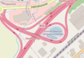 A12 Niederwangen, map OSM 2022.png 363 × 252; 74 KB
-
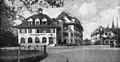
 Architektur Bümpliz.jpg 313 × 235; 13 KB
-
 Burgunderchronik Eidgenossen vor Bümpliz 1475.tif 2,068 × 3,070; 24.22 MB
-
 Bümpliz Switzerland CoA.svg 743 × 829; 20 KB
-
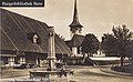
 Bümpliz-Postplatz, detail.jpg 896 × 465; 159 KB
-
 Karte Berner Quartiere Bümpliz.png 1,476 × 793; 276 KB
-
 Panorama Bümpliz von Niederbottigen aus gesehen.jpg 7,943 × 1,978; 1.81 MB
-
 Sammlung Hans-Ulrich Suter 1121.JPG 896 × 547; 160 KB
-
 Sammlung Hans-Ulrich Suter 1125.JPG 896 × 554; 119 KB
-
 Stadtbach,buemliz2.JPG 3,280 × 1,846; 1.56 MB
-
 Stadtbach.buempliz.JPG 3,280 × 1,846; 1.78 MB
-
 Strassenbahn Bümplitz Endstation.jpg 2,963 × 2,291; 1.89 MB


