Category:Location maps of Finland
 |
This category should only contain blank "Location maps" created for geo-location purposes which follow a same uniform standard, and have been created with a Geographic information system (GIS) software program using a compatible equirectangular or conical projection and for which the geographic coordinate system is known. For more information or questions see the wikiproject: German Wikipedia:Kartenwerkstatt/Positionskarten and this discussion page. |
Subcategories
This category has only the following subcategory.
Media in category "Location maps of Finland"
The following 15 files are in this category, out of 15 total.
-
 Finland 59,5–64N 18,83–30E.png 849 × 692; 592 KB
-
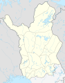
 Finland adm location map.svg 1,020 × 1,643; 951 KB
-
 Finland Lapland adm location map.svg 1,049 × 1,344; 415 KB
-
 Finland location map.svg 872 × 1,718; 1.1 MB
-
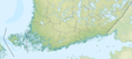
 Finland physical map.svg 427 × 843; 3.97 MB
-
 Finland rel location map.png 1,020 × 1,643; 2.01 MB
-
 Finland ≤ 62°N 30°E.png 847 × 384; 339 KB
-
 Helsinki location map (dark).svg 1,342 × 1,472; 5.62 MB
-
 Helsinki location map (light).svg 1,342 × 1,472; 5.8 MB
-
 Helsinki location map (light, small).svg 1,237 × 953; 5.79 MB
-
 Helsinki location map small dark.svg 1,237 × 953; 5.61 MB
-
 Helsinki location map.png 390 × 310; 179 KB
-
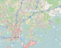
 Nötö, Nagu, Finland OSM-karta z4z8z12.png 812 × 548; 197 KB
-
 Topographic location map of Åland.svg 676 × 516; 126 KB
-
 Åland location map 2.svg 677 × 517; 83 KB


.svg)
.svg)
.svg)


