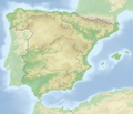
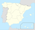
Category:Location maps of Spain
| This category should only contain blank "Location maps" created for geo-location purposes which follow a same uniform standard, and have been created with a Geographic information system (GIS) software program using a compatible equirectangular or conical projection and for which the geographic coordinate system is known. For more information or questions see the wikiproject: German Wikipedia:Kartenwerkstatt/Positionskarten and this discussion page. |
Subcategories
This category has the following 22 subcategories, out of 22 total.
!
*
A
- Location maps of Andalusia (25 F)
- Location maps of Aragon (10 F)
B
C
- Location maps of Catalonia (27 F)
E
G
- Location maps of Galicia (11 F)
M
- Location maps of Melilla (1 F)
N
- Location maps of Navarre (19 F)
Media in category "Location maps of Spain"
The following 14 files are in this category, out of 14 total.
-
Ceuta and Melilla - Spain map.png 297 × 112; 5 KB
-
Cármenes-loc.svg 2,720 × 2,087; 496 KB
-
España relieve M.png 2,356 × 2,778; 10.26 MB
-
Granada-loc.svg R.png 1,024 × 904; 2.66 MB
-
Mapa de El Portil y Nuevo Portil.png 512 × 669; 108 KB
-
Relief Map of Euskal Herria.jpg 266 × 229; 60 KB
-
Relief Map of Northeastern Spain.jpg 532 × 654; 306 KB
-
Relief Map of Northwestern Spain.jpg 632 × 389; 234 KB
-
Relief Map of Southern Spain.jpg 571 × 561; 290 KB
-
Relief Map of Spain.png 1,197 × 1,027; 1.9 MB
-
Reliefkarte Spanien.png 3,915 × 3,368; 14.68 MB
-
Spain 22 location map.jpg 527 × 387; 87 KB
-
Spain location map with Canary Islands (1833).png 699 × 600; 80 KB
-
Spain location map with Canary Islands.png 697 × 598; 68 KB


