Category:Location maps of Hungary
Countries of Europe: Albania · Andorra · Armenia‡ · Austria · Azerbaijan‡ · Belarus · Belgium · Bosnia and Herzegovina · Bulgaria · Croatia · Cyprus‡ · Czech Republic · Denmark · Estonia · Finland · France‡ · Georgia‡ · Germany · Greece · Hungary · Iceland · Republic of Ireland · Italy · Kazakhstan‡ · Latvia · Liechtenstein · Lithuania · Luxembourg · Malta · Moldova · Monaco · Montenegro · Netherlands‡ · North Macedonia · Norway · Poland · Portugal‡ · Romania · Russia‡ · San Marino · Serbia · Slovakia · Slovenia · Spain‡ · Sweden · Switzerland · Turkey‡ · Ukraine · United Kingdom · Vatican City
Specific status: Gibraltar – Limited recognition: Abkhazia‡ · Kosovo
‡: partly located in Europe
Specific status: Gibraltar – Limited recognition: Abkhazia‡ · Kosovo
‡: partly located in Europe
 |
This category should only contain blank "Location maps" created for geo-location purposes which follow a same uniform standard, and have been created with a Geographic information system (GIS) software program using a compatible equirectangular or conical projection and for which the geographic coordinate system is known. For more information or questions see the wikiproject: German Wikipedia:Kartenwerkstatt/Positionskarten and this discussion page. |
Subcategories
This category has the following 3 subcategories, out of 3 total.
Media in category "Location maps of Hungary"
The following 6 files are in this category, out of 6 total.
-
 Carte pays Hongrie administratif.svg 842 × 548; 2.41 MB
-
 Carte pays Hongrie relief.svg 842 × 548; 2.41 MB
-
 Hungary location map.svg 1,210 × 746; 246 KB
-
 Hungary physical map.svg 852 × 527; 977 KB
-
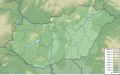
 Hungary relief location map.jpg 700 × 466; 197 KB
-
 Reliefkarte Ungarn.png 3,322 × 2,147; 11.09 MB


