Category:Maps from the National Archives and Records Administration
Subcategories
This category has the following 67 subcategories, out of 67 total.
U
Media in category "Maps from the National Archives and Records Administration"
The following 46 files are in this category, out of 46 total.
-

-

-
 A map of Illinois, 1836 - NARA - 306590.tif 3,061 × 3,750; 32.84 MB
-

-
 A Map of the British Colonies in North America - NARA - 109182675 (page 1).jpg 8,843 × 12,270; 13.17 MB
-
 A Map of the British Colonies in North America - NARA - 109182675 (page 2).jpg 8,922 × 12,347; 14.08 MB
-
 A Map of the British Colonies in North America - NARA - 109182675 (page 3).jpg 9,259 × 12,430; 11.08 MB
-
 A Map of the British Colonies in North America - NARA - 109182675 (page 4).jpg 8,998 × 12,324; 12.59 MB
-
 A Map of the British Colonies in North America - NARA - 109182675 (page 5).jpg 9,008 × 12,206; 12.05 MB
-
 A Map of the British Colonies in North America - NARA - 109182675 (page 6).jpg 9,035 × 12,430; 11.76 MB
-
 A Map of the British Colonies in North America - NARA - 109182675 (page 7).jpg 9,284 × 12,347; 11.8 MB
-
 A Map of the British Colonies in North America - NARA - 109182675 (page 8).jpg 9,057 × 12,062; 13.86 MB
-
 Air Objective Folders by Target Area Japan Nagoya area.jpg 3,468 × 4,731; 2.82 MB
-

-

-
 Approaches to Queen Charlotte Strait - NARA - 84785956.jpg 13,795 × 9,920; 9.46 MB
-
 AVERAGE WIND VELOCITIES OVER THE UNITED STATES - NARA - 17468605.jpg 6,126 × 4,901; 35.63 MB
-
 Base Map - NARA - 84786372.jpg 6,720 × 8,314; 6.15 MB
-
 Bright Angel Point Area -- North Rim - NARA - 84786376.jpg 11,371 × 6,496; 14.87 MB
-
 Broughton Strait and Malcolm Island - NARA - 84785952.jpg 13,811 × 8,896; 27.44 MB
-
 Early Survey of Land - NARA - 84786216.jpg 15,968 × 10,982; 8.08 MB
-
 Fire Control Map - NARA - 84786394.jpg 12,519 × 10,784; 10.64 MB
-
 Headquarters & Park Village - NARA - 84786370.jpg 11,059 × 6,976; 6.12 MB
-
 Hecate Strait - NARA - 84785948.jpg 10,240 × 15,039; 13.72 MB
-
 Illinois - NARA - 66799141.jpg 12,082 × 7,296; 9.21 MB
-
 Indiana - NARA - 66799143.jpg 7,104 × 10,523; 5.21 MB
-
 Indiana- Index to Field Notes - NARA - 84785988.jpg 7,136 × 10,530; 5.49 MB
-
 Inner Passages and Anchorages in Vicinity of Milbanke Sound - NARA - 84785950.jpg 12,283 × 8,608; 15.13 MB
-
 Iowa - NARA - 66799139.jpg 7,743 × 5,600; 4.38 MB
-
 Kansas - NARA - 66799145.jpg 13,437 × 9,209; 9.53 MB
-
 Korean Armistice Agreement Volume 2 Maps 1953 (Page 13).png 1,823 × 2,264; 5.51 MB
-
 Korean Armistice Agreement Volume 2 Maps 1953 (Page 15).png 1,877 × 1,500; 4.69 MB
-
 Korean Armistice Agreement Volume 2 Maps 1953 (Page 17).jpg 5,200 × 2,400; 3.55 MB
-
 Map and charts. German map of south Europe - DPLA - 97240853adae7ce071f376d46e675911.jpg 8,412 × 5,712; 23.58 MB
-
 Map of Lands Assigned to Indians, Western Territory, ca. 1834 - NARA - 306588.tif 4,875 × 5,600; 78.11 MB
-
 Map of Northeastern Virginia - NARA - 84786254.jpg 17,698 × 11,315; 16.69 MB
-
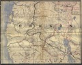 Map of Oregon traced in the Adjutant General's Office.tif 4,350 × 3,461; 43.07 MB
-
 Map of Picnic Grounds - NARA - 84786388.jpg 13,206 × 8,992; 13.43 MB
-
 Map of the United States Including Western Territories - NARA - 2127339.jpg 3,238 × 1,365; 4.07 MB
-

-
 Missouri - NARA - 66799149.jpg 7,679 × 5,696; 5.04 MB
-
 Mount McKinley National Park - DPLA - 9918afd25cf9388c77c9733a86bb8eac.jpg 6,592 × 4,157; 4.02 MB
-
 Ohio - NARA - 66799147.jpg 9,813 × 8,730; 6.76 MB
-
 Petition and map from John Muir and other founders of Sierra Club, page 4.tif 2,200 × 1,894; 11.95 MB
-

-


.jpg)
.jpg)
.jpg)
.jpg)
.jpg)
.jpg)
.jpg)
.jpg)


.png)
.png)
.jpg)


