Category:Maps of Champmotteux
Wikimedia category | |||||
| Upload media | |||||
| Instance of | |||||
|---|---|---|---|---|---|
| Category combines topics | |||||
| Champmotteux | |||||
commune in Essonne, France   | |||||
| Instance of | |||||
| Located in protected area | |||||
| Location |
| ||||
| Street address |
| ||||
| Head of government |
| ||||
| Population |
| ||||
| Area |
| ||||
| official website | |||||
 | |||||
Media in category "Maps of Champmotteux"
The following 16 files are in this category, out of 16 total.
-
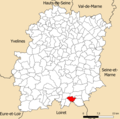
 91 Communes Essonne Champmotteux.png 723 × 750; 167 KB
-
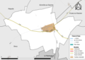
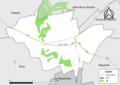
 91137-Champmotteux - Localisation.png 2,500 × 2,480; 1,017 KB
-
 91137-Champmotteux-cadastre.png 7,015 × 4,960; 4.28 MB
-
 91137-Champmotteux-géologie.png 7,015 × 4,960; 2.42 MB
-
 91137-Champmotteux-Hydro.jpeg 5,846 × 4,133; 1,019 KB
-
 91137-Champmotteux-Hydro.png 7,015 × 4,960; 1.87 MB
-
 91137-Champmotteux-Natura 2000.png 7,015 × 4,960; 2.01 MB
-
 91137-Champmotteux-Orthophoto.png 7,015 × 4,960; 3.57 MB
-
 91137-Champmotteux-sols.png 7,015 × 4,960; 2.09 MB
-
 91137-Champmotteux-Sols.png 3,270 × 2,598; 858 KB
-
 91137-Champmotteux-ZNIEFF1.png 7,015 × 4,960; 2.06 MB
-
 91137-Champmotteux-ZNIEFF2.png 7,015 × 4,960; 1.62 MB
-
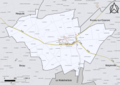
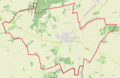 Champmotteux OSM 01.png 786 × 510; 210 KB
-
 Champmotteux OSM 02.png 786 × 510; 356 KB
-
 Champmotteux OSM 03.png 786 × 510; 291 KB
-
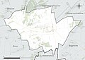
 Map commune FR insee code 91137.png 756 × 605; 24 KB


