Category:Maps of Cheptainville
Wikimedia category | |||||
| Upload media | |||||
| Instance of | |||||
|---|---|---|---|---|---|
| Category combines topics | |||||
| Cheptainville | |||||
commune in Essonne, France _%C3%89glise.JPG) .svg)  | |||||
| Instance of | |||||
| Location | |||||
| Street address |
| ||||
| Head of government |
| ||||
| Population |
| ||||
| Area |
| ||||
| official website | |||||
 | |||||
Media in category "Maps of Cheptainville"
The following 13 files are in this category, out of 13 total.
-
 91 Communes Essonne Cheptainville.png 723 × 750; 166 KB
-
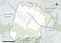
 91156-Cheptainville - Localisation.png 2,500 × 2,480; 1,016 KB
-
 91156-Cheptainville-cadastre.png 7,015 × 4,960; 7.19 MB
-
 91156-Cheptainville-géologie.png 7,015 × 4,960; 4.95 MB
-
 91156-Cheptainville-Hydro.jpeg 5,846 × 4,133; 1.7 MB
-
 91156-Cheptainville-Hydro.png 7,015 × 4,960; 4.88 MB
-
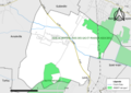
 91156-Cheptainville-Natura 2000.png 7,015 × 4,960; 2.77 MB
-
 91156-Cheptainville-Orthophoto.png 7,015 × 4,960; 3.88 MB
-
 91156-Cheptainville-sols.png 7,015 × 4,960; 5.1 MB
-
 91156-Cheptainville-Sols.png 3,270 × 2,598; 1.78 MB
-
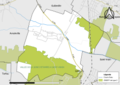
 91156-Cheptainville-ZNIEFF1.png 7,015 × 4,960; 3.14 MB
-
 91156-Cheptainville-ZNIEFF2.png 7,015 × 4,960; 3.25 MB
-
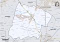
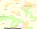 Map commune FR insee code 91156.png 756 × 605; 41 KB


