Category:Maps of Everglades National Park
United States national parks: Acadia · American Samoa · Arches · Badlands · Big Bend · Biscayne · Black Canyon of the Gunnison · Bryce Canyon · Canyonlands · Capitol Reef · Carlsbad Caverns · Channel Islands · Congaree · Crater Lake · Cuyahoga Valley · Death Valley · Denali · Dry Tortugas · Everglades · Gateway Arch · Gates of the Arctic · Glacier · Glacier Bay · Grand Canyon · Grand Teton · Great Basin · Great Smoky Mountains · Guadalupe Mountains · Haleakalā · Hawaii Volcanoes · Hot Springs · Indiana Dunes · Isle Royale · Joshua Tree · Kenai Fjords · Kings Canyon · Kobuk Valley · Lake Clark · Lassen Volcanic · Mammoth Cave · Mesa Verde · Mount Rainier · North Cascades · Olympic · Petrified Forest · Pinnacles · Redwood · Rocky Mountain · Saguaro · Sequoia · Shenandoah · Theodore Roosevelt · Virgin Islands · Voyageurs · White Sands · Wind Cave · Wrangell-St. Elias · Yellowstone · Yosemite · Zion
details of the natural environment of the Everglades | |||||
| Upload media | |||||
| Spoken text audio | |||||
|---|---|---|---|---|---|
| Instance of |
| ||||
| Location |
| ||||
| |||||
Subcategories
This category has only the following subcategory.
Media in category "Maps of Everglades National Park"
The following 41 files are in this category, out of 41 total.
-
 1857 Everglades map.jpg 600 × 455; 37 KB
-
 Blueprint for Everglades canals1921.jpg 554 × 750; 201 KB
-
 CapeSableTopo.jpg 600 × 400; 88 KB
-
 Designated areas in the Everglades.gif 355 × 418; 18 KB
-
 Designated areas in the Everglades.svg 713 × 845; 56 KB
-
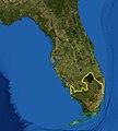 Everglades ecoregion.jpg 400 × 443; 145 KB
-
 Everglades National Park map 2005.11.png 3,369 × 3,180; 449 KB
-
 Everglades National Park, Florida LOC 79690124.jpg 10,049 × 7,051; 12.66 MB
-
 Everglades National Park, Florida LOC 79690124.tif 10,049 × 7,051; 202.72 MB
-
 Everglades National Park, Florida LOC 80690773.jpg 10,017 × 7,068; 12.95 MB
-
 Everglades National Park, Florida LOC 91685086.jpg 10,001 × 7,059; 12.39 MB
-
 Everglades National Park.svg 1,000 × 1,000; 4 KB
-
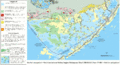
 Evergladesareamap.png 1,058 × 1,500; 1.22 MB
-
 Future Drainage in South Florida.jpg 551 × 415; 193 KB
-
 HFCA 1607 People Volume 2 266.jpg (268d3eb6a981430c8a07e4618c626be2).jpg 7,815 × 5,173; 1.73 MB
-
 HFCA 1607 People Volume 2 267.jpg (9163e956850e4a57a48629397ca30ea6).jpg 7,815 × 5,173; 3.05 MB
-

-

-
 Indigenous people of Everglades map.jpg 2,197 × 2,249; 479 KB
-
 LocMap Everglades National Park.png 280 × 183; 31 KB
-
 NPS everglades-9-mile-pond-trail-map.gif 1,275 × 1,567; 381 KB
-
 NPS everglades-anhinga-trail.gif 1,583 × 2,928; 165 KB
-
 NPS everglades-flamingo-canoe-trails-map.gif 1,234 × 1,386; 268 KB
-
 NPS everglades-flamingo-hiking-trails-map.gif 1,234 × 1,386; 229 KB
-
 NPS everglades-flamingo-map.gif 1,313 × 683; 134 KB
-
 NPS everglades-florida-bay-map.gif 4,108 × 2,241; 881 KB
-
 NPS everglades-gulf-coast-paddle-map.gif 1,535 × 857; 158 KB
-
 NPS everglades-hells-bay-trail-map.jpg 1,193 × 864; 277 KB
-
 NPS everglades-long-pine-key-trail-map.gif 1,712 × 1,084; 407 KB
-
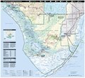
 NPS everglades-map.jpg 4,262 × 3,953; 2.55 MB
-
 NPS everglades-map.pdf 2,556 × 2,370; 4.06 MB
-
 NPS everglades-pa-hay-okee-trail-map.gif 1,400 × 2,094; 103 KB
-
 NPS everglades-pinelands-map.gif 680 × 874; 66 KB
-
 NPS everglades-wilderness-campsite-map.jpg 1,400 × 2,272; 740 KB
-
 Shark River Slough.jpg 1,000 × 708; 101 KB
-
 South Florida Big Cypress Swamp.jpg 1,000 × 1,069; 116 KB
-
 South Florida Pre-drainage.jpg 561 × 398; 129 KB
-
 South Florida Water Drainage Present Day.jpg 576 × 408; 174 KB
-
 STA Location Map.png 1,336 × 1,038; 1.59 MB
-
 US Geological Survey Water Conservation Area Map.gif 800 × 1,150; 61 KB
-
 USGS Everglades Protection Area Map.gif 580 × 739; 107 KB


.jpg)
.jpg)
.jpg)
.jpg)


