Category:Maps of Hagestein
Wikimedia category | |||||
| Upload media | |||||
| Instance of | |||||
|---|---|---|---|---|---|
| Category combines topics |
| ||||
| Hagestein | |||||
former municipality of the Netherlands   | |||||
| Instance of |
| ||||
| Location |
| ||||
| Dissolved, abolished or demolished date |
| ||||
| Population |
| ||||
| Replaced by | |||||
| |||||
Media in category "Maps of Hagestein"
The following 3 files are in this category, out of 3 total.
-
 Claes Florissen - Stadsplattegrond van Hagestein, 1583.jpg 4,624 × 2,439; 2.5 MB
-
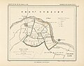 Hagestein, Gemeenteatlas van Nederland.jpg 2,720 × 2,143; 1.08 MB
-
 Map - NL - Vianen - Wijk 01 Hagestein.svg 625 × 575; 6 KB


