Category:Maps of Landkreis Oberspreewald-Lausitz
Districts of Brandenburg:
Urban districts (cities):
Wikimedia category | |||||
| Upload media | |||||
| Instance of | |||||
|---|---|---|---|---|---|
| Category combines topics | |||||
| Oberspreewald-Lausitz District | |||||
district in Brandenburg state, Germany    | |||||
| Instance of | |||||
| Location | Brandenburg, Germany | ||||
| Capital | |||||
| Head of government |
| ||||
| Inception |
| ||||
| Population |
| ||||
| Area |
| ||||
| Elevation above sea level |
| ||||
| official website | |||||
 | |||||
Media in category "Maps of Landkreis Oberspreewald-Lausitz"
The following 19 files are in this category, out of 19 total.
-
 Brandenburg osl.png 249 × 245; 10 KB
-
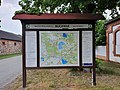 Hinweistafel Muckwar 2020.jpg 4,032 × 3,024; 3.89 MB
-
 Hohenbocka, Dorfaue gegenüber Hausnr. 1, Wanderkarte OSL Wandergebiet Süd, 01.jpg 2,112 × 2,816; 2.81 MB
-
 Hohenbocka, Dorfaue gegenüber Hausnr. 1, Wanderkarte OSL Wandergebiet Süd, 02.jpg 2,816 × 2,112; 680 KB
-
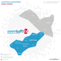 Karte Sendegebiet TV-2048x2048.png 2,048 × 2,048; 563 KB
-
 Kreiskarte Oberspreewald-Lausitz.png 2,800 × 3,623; 7.31 MB
-
 Lage des Landkreises Oberspreewald-Lausitz in Deutschland.png 176 × 234; 5 KB
-
 Locator map OSL in Brandenburg.svg 1,016 × 1,071; 178 KB
-
 Locator map OSL in Germany.svg 1,075 × 1,273; 499 KB
-
 OSL in Brandenburg.svg 825 × 826; 78 KB
-

-

-
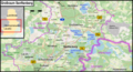
 Umgebung Lübbenau und Vetschau (Spreewald).png 4,500 × 2,527; 6.36 MB
-
 Umgebung Senftenberg.png 4,500 × 2,450; 5.32 MB
-
 Wanderweg-Info-Tafel mit Karte am OSL-Knotenpunkt 11, 01.jpg 4,000 × 3,000; 3.46 MB
-
 Wanderweg-Info-Tafel mit Karte am OSL-Knotenpunkt 23, 01.jpg 4,000 × 3,000; 3.22 MB
-
 Wanderweg-Info-Tafel mit Karte am OSL-Knotenpunkt 24, 01.jpg 3,000 × 4,000; 3.18 MB
-
 Wanderweg-Info-Tafel mit Karte am OSL-Knotenpunkt 25, 01.jpg 2,851 × 2,705; 898 KB
-
 Wokrejs gorneblotaluzyca.PNG 300 × 350; 9 KB


_H%C3%B6he_Hausnr._4,_Informationstafel_Radwegenetz_OSL_S%C3%BCdteil,_01.jpg)
.png)


