Category:Maps of Migration period
Wikimedia category | |||||
| Upload media | |||||
| Instance of | |||||
|---|---|---|---|---|---|
| Category combines topics | |||||
| Migration Period | |||||
period in European history with large migration of peoples, from the 4th to the 6th centuries | |||||
| Instance of |
| ||||
| Location | continental Europe | ||||
| Start time |
| ||||
| End time |
| ||||
| Different from | |||||
| |||||
Subcategories
This category has the following 15 subcategories, out of 15 total.
A
- Maps of the Alan migrations (30 F)
- Maps of the Antes (9 F)
- Maps of Eurasian Avars (71 F)
B
F
G
H
- Maps of the Heruli (17 F)
O
R
- Maps of the Rugii (21 F)
S
V
Media in category "Maps of Migration period"
The following 88 files are in this category, out of 88 total.
-
-ham and -ingham place names (1).png 1,632 × 2,016; 291 KB
-
C. 451 Europe.jpg 1,487 × 1,123; 669 KB
-
Europe Barbarian Migrations (Johnston).jpg 1,492 × 1,124; 704 KB
-
C. 476 Europe.jpg 1,173 × 879; 678 KB
-
C. 500 Europe.jpg 1,498 × 1,125; 718 KB
-
C. 526 Germanic Kingdoms.jpg 1,257 × 1,011; 925 KB
-
C. 565 Europe.jpg 1,609 × 1,193; 773 KB
-
533-600 Europe and Eastern Roman Empire.jpg 1,570 × 1,233; 1.17 MB
-
118 of '(Italy and her Invaders, Vol. 1-4.)' (11217175325).jpg 2,793 × 2,213; 1.47 MB
-
181 of 'Cours normal d'histoire de France, etc' (11058404876).jpg 2,693 × 2,254; 1.29 MB
-
T.V.(1857) - (3) MAPA DE LA IRRUPCION DE LOS BÂRBAROS.jpg 4,179 × 3,151; 5.79 MB
-
A history of Rome (1917) (14761644194).jpg 2,058 × 2,922; 1.26 MB
-
A history of Rome (1917) (14783871183).jpg 2,020 × 2,928; 844 KB
-
34 of 'An Introduction to the study of the Middle Ages, 375-814' (11251462693).jpg 1,297 × 1,993; 445 KB
-
476eur.jpg 620 × 411; 221 KB
-
63 of 'An Introduction to the study of the Middle Ages, 375-814' (11253794025).jpg 1,297 × 1,993; 552 KB
-
Atlas of ancient and classical geography (1909) (14779259551).jpg 1,666 × 3,417; 812 KB
-
Atlas of ancient and classical geography (1909) (14779260501).jpg 3,068 × 2,196; 1.42 MB
-
Butler Migrations of the Barbarians.jpg 2,984 × 1,995; 1.54 MB
-
C. 150-1066 Germanic Migrations.jpg 2,148 × 1,257; 2.02 MB
-
Christian states 495 AD (en).svg 2,436 × 1,372; 3.61 MB
-
Christian states 495 AD (pl).svg 946 × 631; 122 KB
-
Christian states 495 AD (ru).svg 946 × 631; 123 KB
-
Christian states 495 AD (tr).svg 946 × 631; 122 KB
-
Christian states 495 AD-hu.svg 946 × 631; 132 KB
-
Crossing of the Rhine map.jpg 5,476 × 3,310; 7.07 MB
-
Die slawische Besiedlung zwischen dem 5. und 7. Jh. n. Chr.jpg 902 × 648; 389 KB
-
Droysens-plate19.jpg 6,310 × 9,869; 29.36 MB
-
Europa BV042512114.jpg 1,171 × 1,197; 204 KB
-
Europa BV042518417 (cropped).jpg 1,132 × 1,066; 192 KB
-
Europa BV043417545.jpg 1,954 × 1,337; 311 KB
-
Europe at the fall of the Western Roman Empire in 476.jpg 5,491 × 3,506; 4.35 MB
-
Europe en 451.pdf 1,752 × 1,239; 456 KB
-
Europe in the Migration Period in the 4th and 5th centuries.jpg 5,476 × 3,310; 4.33 MB
-
Folkevandringene.jpg 1,400 × 991; 286 KB
-
Germanic-Nordic Tribes Migration to Germania Magna.gif 1,920 × 1,080; 1.49 MB
-
Grandes invasions de l'Empire romain.jpg 1,609 × 1,098; 425 KB
-
Grandes invasions Empire romain-fr.svg 1,800 × 1,300; 236 KB
-
Grandes invasions Empire romain-sh.svg 1,800 × 1,300; 236 KB
-
Grandes invasions Empire romain-sr.svg 1,800 × 1,300; 237 KB
-
Huns empire.png 998 × 571; 186 KB
-
Impero d'Occidente 421.PNG 900 × 595; 122 KB
-
Infotafel Völker im Alpenraum 493 n. Chr. 332.jpg 4,624 × 3,468; 3.52 MB
-
Invasi bangsa barbar ke Romawi.svg 1,800 × 1,300; 236 KB
-
Invasiones bárbaras Imperio romano-es.svg 1,800 × 1,300; 261 KB
-
Invasiones bárbares Imperiu romanu.svg 1,800 × 1,300; 236 KB
-
Invasioni dell'Impero Romano.png 1,962 × 1,374; 200 KB
-
Invasions of the Roman Empire 1.png 1,954 × 1,382; 269 KB
-
Invasions of the Roman Empire Arabic.png 2,943 × 2,061; 932 KB
-
Invasions of the Roman Empire Dutch.svg 1,766 × 1,237; 676 KB
-
Invasions of the Roman Empire el.svg 1,766 × 1,237; 162 KB
-
Invasions of the Roman Empire Greek.png 1,766 × 1,239; 547 KB
-
Invasions of the Roman Empire hu.svg 1,766 × 1,237; 213 KB
-
Invasions of the Roman Empire la.svg 1,766 × 1,237; 239 KB
-
Invasions-barbares.png 448 × 333; 5 KB
-
Karta pereseleniya.jpg 1,000 × 707; 121 KB
-
Karte Koenigreich Burgund DE.png 1,500 × 1,529; 405 KB
-
Karte völkerwanderung.jpg 1,000 × 663; 116 KB
-
Kavimler Göçü 2.png 16,767 × 12,231; 26.53 MB
-
Late Roman Migration Period deutsch.svg 2,050 × 1,213; 1.18 MB
-
Le royaume Burgonde au Ve siècle-ru.svg 586 × 753; 119 KB
-
Map Burgundia 443-476-hu.svg 1,068 × 1,081; 366 KB
-
Map Burgundian Kingdom EN.png 1,500 × 1,529; 242 KB
-
Map Burgundian Kingdom-el.png 1,500 × 1,529; 317 KB
-
Map Burgundian Kingdom443-476-es.svg 1,068 × 1,081; 1.14 MB
-
Map Burgundian Kingdom443-476-ru.svg 1,067 × 1,082; 361 KB
-
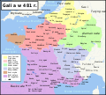
Map Gaul divisions 481-pl.svg 1,968 × 1,776; 1.09 MB
-
Mapa stahovania narodov.png 1,218 × 730; 464 KB
-
MapaWielkiejWedrowkiLudow.png 1,218 × 730; 232 KB
-
Migração dos Povos Bárbaros.png 1,218 × 730; 201 KB
-
Povos Barbaros.svg 668 × 600; 453 KB
-
Putz21.jpg 2,594 × 1,663; 474 KB
-
Putz90.jpg 851 × 629; 223 KB
-
Putz91.jpg 852 × 617; 245 KB
-
Regni romano barbarici.png 746 × 512; 16 KB
-
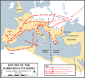
Routes of the barbarian invaders, 5th century AD-zh-classical.png 624 × 575; 33 KB
-
Routes of the barbarian invaders, 5th century AD.gif 624 × 575; 44 KB
-
Sivashovka group.svg 480 × 300; 644 KB
-
Voelkerwanderungkarte.png 1,218 × 730; 234 KB
-
Historical atlas of modern Europe 1903 (135895337).jpg 9,181 × 6,734; 53.44 MB
-
Гунны 2.jpg 696 × 435; 57 KB
-
Ժողովուրդների Մեծ գաղթ.png 1,545 × 773; 233 KB
-
对罗马帝国的入侵.png 1,962 × 1,374; 279 KB


