Category:Maps of Valence (Drôme)
Wikimedia category | |||||
| Upload media | |||||
| Instance of | |||||
|---|---|---|---|---|---|
| Category combines topics | |||||
| Valence | |||||
commune in Drôme, France   .svg)  | |||||
| Instance of | |||||
| Location |
| ||||
| Located in or next to body of water | |||||
| Head of government |
| ||||
| Population |
| ||||
| Area |
| ||||
| Elevation above sea level |
| ||||
| Different from | |||||
| official website | |||||
 | |||||
Subcategories
This category has the following 5 subcategories, out of 5 total.
Media in category "Maps of Valence (Drôme)"
The following 11 files are in this category, out of 11 total.
-
 07102-Guilherand-Granges-Sols.png 3,270 × 2,598; 4.46 MB
-
 26362-Valence-Hydro.jpeg 5,846 × 4,133; 3.83 MB
-
 26362-Valence-Sols.png 3,270 × 2,598; 6.19 MB
-
 Cosmographie universelle 50550.jpg 3,108 × 2,623; 5.59 MB
-
 Diocèse Valence 1789.svg 2,000 × 1,922; 801 KB
-
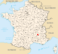 Localisation de Valence (26).svg 588 × 550; 296 KB
-
 Map commune FR insee code 26362.png 756 × 605; 103 KB
-
 Unités de paysage du Valentinois.JPG 633 × 555; 42 KB
-
 Valence (Drôme) OSM 02.png 831 × 691; 702 KB
-
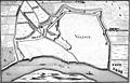 Valence 1661 Zeiller 15811.jpg 3,949 × 2,530; 6.54 MB
-
 Valence dot.png 640 × 599; 37 KB


.svg)


_OSM_02.png)
