Category:Maps of Washington County, Pennsylvania
Counties of Pennsylvania : Adams · Allegheny · Armstrong · Beaver · Bedford · Berks · Blair · Bradford · Bucks · Butler · Cambria · Cameron · Carbon · Centre · Chester · Clarion · Clearfield · Clinton · Columbia · Crawford · Cumberland · Dauphin · Delaware · Elk · Erie · Fayette · Forest · Franklin · Fulton · Greene · Huntingdon · Indiana · Jefferson · Juniata · Lackawanna · Lancaster · Lawrence · Lebanon · Lehigh · Luzerne · Lycoming · McKean · Mercer · Mifflin · Monroe · Montgomery · Montour · Northampton · Northumberland · Perry · Philadelphia · Pike · Potter · Schuylkill · Snyder · Somerset · Sullivan · Susquehanna · Tioga · Union · Venango · Warren · Washington · Wayne · Westmoreland · Wyoming · York
Wikimedia category | |||||
| Upload media | |||||
| Instance of | |||||
|---|---|---|---|---|---|
| Category combines topics | |||||
| Washington County | |||||
county in Pennsylvania, United States _south.jpg)   | |||||
| Instance of | |||||
| Named after | |||||
| Location | Pennsylvania | ||||
| Capital | |||||
| Inception |
| ||||
| Population |
| ||||
| Area |
| ||||
| Different from | |||||
| official website | |||||
 | |||||
Subcategories
This category has only the following subcategory.
.
Media in category "Maps of Washington County, Pennsylvania"
The following 117 files are in this category, out of 117 total.
-
 California, Washington County, Pennsylvania, 1902 LOC 86697141.jpg 6,108 × 3,817; 5.25 MB
-
 Map of Allenport, Washington County, Pennsylvania Highlighted.png 1,824 × 1,579; 145 KB
-
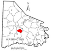
 Map of Amwell Township, Washington County, Pennsylvania Highlighted.png 1,824 × 1,579; 147 KB
-
 Map of Baidland, Washington County, Pennsylvania Highlighted.png 1,824 × 1,579; 145 KB
-
 Map of Beallsville, Washington County, Pennsylvania Highlighted.png 1,824 × 1,579; 145 KB
-
 Map of Bentleyville, Washington County, Pennsylvania Highlighted.png 1,824 × 1,579; 145 KB
-
 Map of Blaine Township, Washington County, Pennsylvania Highlighted.png 1,824 × 1,579; 146 KB
-
 Map of Buffalo Township, Washington County, Pennsylvania Highlighted.png 1,824 × 1,579; 146 KB
-
 Map of Burgettstown, Washington County, Pennsylvania Highlighted.png 1,824 × 1,579; 145 KB
-
 Map of California, Washington County, Pennsylvania Highlighted.png 1,824 × 1,579; 145 KB
-
 Map of Canonsburg, Washington County, Pennsylvania Highlighted.png 1,824 × 1,579; 145 KB
-
 Map of Canton Township, Washington County, Pennsylvania Highlighted.png 1,824 × 1,579; 147 KB
-
 Map of Carroll Township, Washington County, Pennsylvania Highlighted.png 1,824 × 1,579; 147 KB
-
 Map of Cecil Township, Washington County, Pennsylvania Highlighted.png 1,824 × 1,579; 146 KB
-
 Map of Cecil-Bishop, Washington County, Pennsylvania Highlighted.png 1,824 × 1,579; 145 KB
-
 Map of Centerville, Washington County, Pennsylvania Highlighted.png 1,824 × 1,579; 145 KB
-
 Map of Charleroi, Washington County, Pennsylvania Highlighted.png 1,824 × 1,579; 145 KB
-
 Map of Chartiers Township, Washington County, Pennsylvania Highlighted.png 1,824 × 1,579; 147 KB
-
 Map of Claysville, Washington County, Pennsylvania Highlighted.png 1,824 × 1,579; 145 KB
-
 Map of Coal Center, Washington County, Pennsylvania Highlighted.png 1,824 × 1,579; 145 KB
-
 Map of Cokeburg, Washington County, Pennsylvania Highlighted.png 1,824 × 1,579; 145 KB
-
 Map of Cross Creek Township, Washington County, Pennsylvania Highlighted.png 1,824 × 1,579; 146 KB
-
 Map of Deemston, Washington County, Pennsylvania Highlighted.png 1,824 × 1,579; 145 KB
-
 Map of Donegal Township, Washington County, Pennsylvania Highlighted.png 1,824 × 1,579; 146 KB
-
 Map of Donora, Washington County, Pennsylvania Highlighted.png 1,824 × 1,579; 145 KB
-
 Map of Dunlevy, Washington County, Pennsylvania Highlighted.png 1,824 × 1,579; 145 KB
-
 Map of East Bethlehem Township, Washington County, Pennsylvania Highlighted.png 1,824 × 1,579; 146 KB
-
 Map of East Finley Township, Washington County, Pennsylvania Highlighted.png 1,824 × 1,579; 145 KB
-
 Map of East Washington, Washington County, Pennsylvania Highlighted.png 1,824 × 1,579; 145 KB
-
 Map of Elco, Washington County, Pennsylvania Highlighted.png 1,824 × 1,579; 145 KB
-
 Map of Ellsworth, Washington County, Pennsylvania Highlighted.png 1,824 × 1,579; 145 KB
-
 Map of Fallowfield Township, Washington County, Pennsylvania Highlighted.png 1,824 × 1,579; 145 KB
-
 Map of Finleyville, Washington County, Pennsylvania Highlighted.png 1,824 × 1,579; 145 KB
-
 Map of Fredericktown-Millsboro, Washington County, Pennsylvania Highlighted.png 1,824 × 1,579; 145 KB
-
 Map of Gastonville, Washington County, Pennsylvania Highlighted.png 1,824 × 1,579; 145 KB
-
 Map of Green Hills, Washington County, Pennsylvania Highlighted.png 1,824 × 1,579; 145 KB
-
 Map of Hanover Township, Washington County, Pennsylvania Highlighted.png 1,824 × 1,579; 145 KB
-
 Map of Hopewell Township, Washington County, Pennsylvania Highlighted.png 1,824 × 1,579; 145 KB
-
 Map of Houston, Washington County, Pennsylvania Highlighted.png 1,824 × 1,579; 145 KB
-
 Map of Independence Township, Washington County, Pennsylvania Highlighted.png 1,824 × 1,579; 145 KB
-
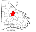
 Map of Jefferson Township, Washington County, Pennsylvania Highlighted.png 1,824 × 1,579; 145 KB
-
 Map of Long Branch, Washington County, Pennsylvania Highlighted.png 1,824 × 1,579; 145 KB
-
 Map of Marianna, Washington County, Pennsylvania Highlighted.png 1,824 × 1,579; 145 KB
-
 Map of McDonald, Allegheny and Washington County, Pennsylvania Highlighted.png 2,000 × 2,138; 689 KB
-
 Map of McDonald, Washington County, Pennsylvania Highlighted.png 1,824 × 1,579; 145 KB
-
 Map of McGovern, Washington County, Pennsylvania Highlighted.png 1,824 × 1,579; 145 KB
-
 Map of McMurray, Washington County, Pennsylvania Highlighted.png 1,824 × 1,579; 145 KB
-
 Map of Midway, Washington County, Pennsylvania Highlighted.png 1,824 × 1,579; 145 KB
-
 Map of Monongahela, Washington County, Pennsylvania Highlighted.png 1,824 × 1,579; 145 KB
-
 Map of Morris Township, Washington County, Pennsylvania Highlighted.png 1,824 × 1,579; 144 KB
-
 Map of Mount Pleasant Township, Washington County, Pennsylvania Highlighted.png 1,824 × 1,579; 145 KB
-
 Map of New Eagle, Washington County, Pennsylvania Highlighted.png 1,824 × 1,579; 145 KB
-
 Map of North Bethlehem Township, Washington County, Pennsylvania Highlighted.png 1,824 × 1,579; 145 KB
-
 Map of North Charleroi, Washington County, Pennsylvania Highlighted.png 1,824 × 1,579; 145 KB
-
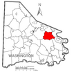
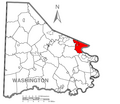
 Map of North Franklin Township, Washington County, Pennsylvania Highlighted.png 1,824 × 1,579; 145 KB
-
 Map of North Strabane Township, Washington County, Pennsylvania Highlighted.png 1,824 × 1,579; 145 KB
-
 Map of Nottingham Township, Washington County, Pennsylvania Highlighted.png 1,824 × 1,579; 145 KB
-
 Map of Pennsylvania highlighting Washington County.svg 1,980 × 1,138; 96 KB
-
 Map of Peters Township, Washington County, Pennsylvania Highlighted.png 1,824 × 1,579; 145 KB
-
 Map of Robinson Township, Washington County, Pennsylvania Highlighted.png 1,824 × 1,579; 145 KB
-
 Map of Roscoe, Washington County, Pennsylvania Highlighted.png 1,824 × 1,579; 39 KB
-
 Map of Smith Township, Washington County, Pennsylvania Highlighted.png 1,824 × 1,579; 145 KB
-
 Map of Somerset Township, Washington County, Pennsylvania Highlighted.png 1,824 × 1,579; 145 KB
-
 Map of South Franklin Township, Washington County, Pennsylvania Highlighted.png 1,824 × 1,579; 145 KB
-
 Map of South Strabane Township, Washington County, Pennsylvania Highlighted.png 1,824 × 1,579; 145 KB
-
 Map of Speers, Washington County, Pennsylvania Highlighted.png 1,824 × 1,579; 145 KB
-
 Map of Stockdale, Washington County, Pennsylvania Highlighted.png 1,824 × 1,579; 145 KB
-
 Map of Thompsonville, Washington County, Pennsylvania Highlighted.png 1,824 × 1,579; 145 KB
-
 Map of Twilight, Washington County, Pennsylvania Highlighted.png 1,824 × 1,579; 145 KB
-
 Map of Union Township, Washington County, Pennsylvania Highlighted.png 1,824 × 1,579; 145 KB
-
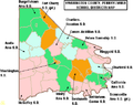 Map of Washington County Pennsylvania School Districts.png 472 × 372; 20 KB
-

-
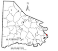
 Map of Washington County, Pennsylvania No Text.png 1,824 × 1,579; 82 KB
-
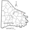
 Map of Washington County, Pennsylvania.png 1,824 × 1,579; 260 KB
-
 Map of Washington, Washington County, Pennsylvania Highlighted.png 1,824 × 1,579; 145 KB
-
 Map of West Alexander, Washington County, Pennsylvania Highlighted.png 1,824 × 1,579; 145 KB
-
 Map of West Bethlehem Township, Washington County, Pennsylvania Highlighted.png 1,824 × 1,579; 145 KB
-
 Map of West Brownsville, Washington County, Pennsylvania Highlighted.png 1,824 × 1,579; 145 KB
-
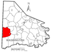
 Map of West Finley Township, Washington County, Pennsylvania Highlighted.png 1,824 × 1,579; 144 KB
-
 Map of West Middletown, Washington County, Pennsylvania Highlighted.png 1,824 × 1,579; 145 KB
-
 Map of West Pike Run Township, Washington County, Pennsylvania Highlighted.png 1,824 × 1,579; 145 KB
-
 Map of Wickerham Manor-Fisher, Washington County, Pennsylvania Highlighted.png 1,824 × 1,579; 145 KB
-
 Map of Wolfdale, Washington County, Pennsylvania Highlighted.png 1,824 × 1,579; 145 KB
-
-

-

-

-

-

-
-

-

-

-
-

-

-

-

-

-

-

-

-

-

-
-

-

-

-

-

-

-
-

-

-

-

-
 Wheeling Creek WV map.png 2,939 × 2,148; 6.97 MB


.jpg)


