Category:Maps of Western Australia
States of Australia: New South Wales · Queensland · South Australia · Tasmania · Victoria · Western Australia
Internal territories of Australia: Australian Capital Territory · Jervis Bay Territory · Northern Territory
External territories of Australia: Ashmore and Cartier Islands · Australian Antarctic Territory · Christmas Island · Cocos (Keeling) Islands · Coral Sea Islands · Heard Island and McDonald Islands · Norfolk Island
Wikimedia category | |||||
| Upload media | |||||
| Instance of | |||||
|---|---|---|---|---|---|
| Category combines topics | |||||
| Western Australia | |||||
state of Australia  someja da satełite in novenbre     | |||||
| Instance of |
| ||||
| Named after | |||||
| Location | AUS | ||||
| Located in or next to body of water |
| ||||
| Capital | |||||
| Legislative body | |||||
| Executive body | |||||
| Highest judicial authority | |||||
| Head of state |
| ||||
| Head of government |
| ||||
| Inception |
| ||||
| Highest point |
| ||||
| Population |
| ||||
| Area |
| ||||
| Elevation above sea level |
| ||||
| Replaces |
| ||||
| official website | |||||
 | |||||
Maps of w:Western Australia
Subcategories
This category has the following 15 subcategories, out of 15 total.
Pages in category "Maps of Western Australia"
This category contains only the following page.
Media in category "Maps of Western Australia"
The following 60 files are in this category, out of 60 total.
-
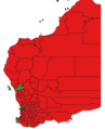
 'ndrangheta in Australia Occidentale.jpg 455 × 626; 30 KB
-
 Australie occidentale.png 1,000 × 1,367; 386 KB
-
 Batı Avusturalya.jpg 742 × 992; 237 KB
-
 BlueOutlineWesternAustralia.png 623 × 900; 13 KB
-
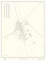
 Brown Hill and Trafalgar (Western Australia) road map 1969.jpg 995 × 1,393; 86 KB
-
 Bunbury-diocese-map.jpg 377 × 322; 20 KB
-
 Champion Lakes, Perth, WA, SMC.jpg 2,463 × 1,908; 1.19 MB
-
 Cooke weather map of Australia April 23and24 1900.png 953 × 1,623; 1.1 MB
-
 Coolgardie.png 1,000 × 1,367; 388 KB
-
 DBNGP.png 720 × 1,040; 148 KB
-
 Distribution of the honey possum on the wheat belt.jpg 3,944 × 3,976; 2.8 MB
-
 Flag-map of Western Australia.svg 512 × 739; 9 KB
-
 Great Western Woodlands location within Australia.jpg 510 × 415; 44 KB
-
 IBRA Esperance Plains vegetation.jpeg 4,960 × 2,842; 5.46 MB
-
 Jarrah Forest En.jpeg 4,960 × 3,508; 7.78 MB
-
 Kalgoorlie-Boulder regional road map 1969.jpg 5,000 × 6,612; 1.27 MB
-
 Kalgoorlie-Boulder Urban Area 1966.jpg 4,356 × 6,955; 6.04 MB
-
 Lakewood (Western Australia) road map 1969.jpg 1,288 × 1,803; 45 KB
-
 LocMap Hidden Valley National Park.PNG 235 × 347; 6 KB
-
 Map of Monte Bello Islands - 1952 atomic bomb test (AWM P00131.001).JPG 640 × 381; 178 KB
-
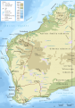
 Map of the Natural Regions of Western Australia.jpg 875 × 1,236; 194 KB
-

-
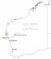
 Nwcoasthwywa.png 450 × 600; 31 KB
-
 Parkeston (Western Australia) road map 1969.jpg 918 × 1,285; 59 KB
-
 Perth Intrastate.gif 540 × 540; 25 KB
-
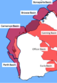 PetroleumBasinsWA.png 700 × 1,008; 181 KB
-
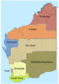 Proposed WA regions.png 744 × 1,052; 198 KB
-
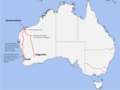
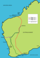 Rabbit-Proof Fence peta tunjuk perjalanan.png 1,111 × 1,632; 45 KB
-
 Regions of Legislative Council Western Australia.svg 420 × 595; 404 KB
-
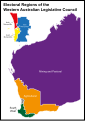 Regions of the Western Australian Legislative Council.svg 420 × 595; 2.23 MB
-
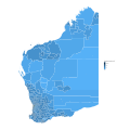
 Regions of Western Australia.svg 940 × 1,200; 4.94 MB
-
 Rietumaustrālija, fizioģeogrāfiskā karte.svg 1,236 × 1,766; 1.75 MB
-
 Rivière Murchinson.png 512 × 599; 49 KB
-
 SVG-Koort West-Australien.svg 1,240 × 1,830; 16 KB
-
 Tigris-Australia location Western Australia.svg 2,055 × 1,846; 156 KB
-
 Vakarų Australija, gamtinis žemėlapis.svg 1,236 × 1,766; 1.75 MB
-
 WA 25 04 2021.png 664 × 817; 71 KB
-
 WA Biogeography.jpg 720 × 960; 106 KB
-
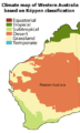
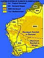 WA Climates.jpg 720 × 960; 106 KB
-
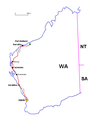
 WA Gas Crisis locator.png 960 × 720; 161 KB
-
 WA Gas Crisis locator2.png 960 × 720; 151 KB
-
 WA Gas Crisis locator3.png 720 × 960; 182 KB
-
 WA gas pipelines2008.png 652 × 998; 149 KB
-
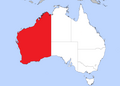
 WA in Australia map.png 200 × 186; 11 KB
-
 WA population density by SA1 (2016).svg 1,874 × 1,874; 4.3 MB
-
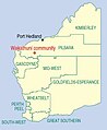 Wakathuni - Aboriginal Community.JPG 348 × 424; 19 KB
-
 WApipelines2.png 720 × 1,040; 1.18 MB
-
 WApopDist2006.png 643 × 983; 129 KB
-
 Warren Ecoregion En.jpg 4,960 × 3,508; 10.25 MB
-
 Western Australia in Australia.svg 2,055 × 1,846; 929 KB
-
 Western Australia Köppen.svg 765 × 1,413; 1.12 MB
-
 Western Australia location map.png 704 × 996; 15 KB
-
 Western Australia locator-MJC.png 563 × 476; 12 KB
-
 Western australia locator.svg 563 × 476; 116 KB
-
 Western Australia, regions, LT.svg 1,236 × 1,766; 432 KB
-
 Western Australia, regions, LV.svg 1,236 × 1,766; 432 KB
-
 Western Australia, transport, LT.svg 1,236 × 1,766; 744 KB
-
 Western Australia, transport, LV.svg 1,236 × 1,766; 744 KB
-
 Western Australia-climate-map.png 417 × 694; 27 KB
-
 WesternAustraliaMap.png 2,190 × 1,577; 152 KB


_road_map_1969.jpg)


_road_map_1969.jpg)

.JPG)


_road_map_1969.jpg)


.svg)


