Category:Maps of cities in France
Use the appropriate category for maps showing all or a large part of cities in France. See subcategories for smaller areas:
| If the map shows | Category to use |
|---|---|
| cities in France on a recently created map | Category:Maps of cities in France or its subcategories |
| cities in France on a map created more than 70 years ago | Category:Old maps of cities in France or its subcategories |
| the history of cities in France on a recently created map | Category:Maps of the history of cities in France or its subcategories |
| the history of cities in France on a map created more than 70 years ago | Category:Old maps of the history of cities in France or its subcategories |
Subcategories
This category has the following 120 subcategories, out of 120 total.
*
+
- Maps of France with cities (39 F)
A
B
- Maps of Bruz (10 F)
C
- Maps of Candé (13 F)
- Maps of Cassis (2 F)
- Cartes de Chaumont (7 F)
- Maps of Chéméré (5 F)
- Maps of Le Croisic (12 F)
D
- Maps of Deauville (16 F)
E
F
G
- Maps of Guérande (9 F)
H
I
K
- Maps of Kourou (5 F)
L
- Maps of La Flèche (22 F)
M
N
O
- Maps of Obernai (5 F)
- Maps of Ornans (7 F)
P
- Maps of Planoise (36 F)
- Maps of Provins (20 F)
Q
R
- Maps of La Rochelle (52 F)
S
- Maps of Salins-les-Bains (8 F)
- Maps of Sélestat (31 F)
T
- Maps of Thann (7 F)
V
- Maps of Villeurbanne (17 F)
- Maps of Vire (6 F)
W
- Maps of Wissous (32 F)
- Maps of Wittenheim (6 F)
Media in category "Maps of cities in France"
The following 35 files are in this category, out of 35 total.
-
57112-Brouck-Routes-Hydro.png 3,507 × 2,480; 867 KB
-
57207-Farébersviller-Routes-Hydro.png 3,507 × 2,480; 2.22 MB
-
57669-Théding-Routes-Hydro.png 3,507 × 2,480; 2.59 MB
-
Aigues mortes P.png 1,773 × 1,579; 861 KB
-
Plan.Aigues.Mortes.png 622 × 403; 77 KB
-
Aigues-Mortes.png 1,064 × 947; 437 KB
-
Beaune (Arrondissement) Plan.svg 447 × 507; 126 KB
-
Bourg-plan.jpg 1,632 × 1,808; 726 KB
-
Plan-brain-jp.jpg 1,429 × 1,527; 400 KB
-
Plan-brain-jp2.jpg 1,616 × 1,824; 669 KB
-
C lieu bat.jpg 531 × 686; 98 KB
-
Carte géographique 1 de Pontcharra-sur-Turdine.jpg 1,258 × 846; 247 KB
-
Carte géographique 2 de Pontcharra-sur-Turdine.jpg 1,236 × 839; 339 KB
-
Carte Vaulx-en-Velin.png 790 × 790; 894 KB
-
Karte Caudry.png 994 × 974; 142 KB
-
Cerisy-carte4.png 3,455 × 5,930; 1.82 MB
-
Agglomeration-Geneve.jpg 800 × 488; 154 KB
-
Grand (Vosges) map.svg 1,095 × 1,111; 966 KB
-
GrandeBorneToponymie.svg 1,052 × 1,134; 131 KB
-
Illustration accueil.jpg 366 × 476; 26 KB
-
Plan de la Grande Borne Grigny France.svg 744 × 900; 93 KB
-
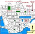
Plan de la ville du Havre.png 454 × 442; 21 KB
-
Map Fabregues.jpg 904 × 644; 249 KB
-
Quartiers melun.jpg 1,999 × 2,108; 520 KB
-
Neuf Brisach.jpg 877 × 862; 482 KB
-
Quartiers Pessac.png 494 × 310; 27 KB
-
Royannature.svg 1,331 × 895; 2.49 MB
-
Royanquartiers.svg 1,331 × 895; 95 KB
-
Royantransports.svg 1,331 × 895; 131 KB
-
Plan de Saint-Lô.svg 550 × 400; 61 KB
-
Sainte-Menehould hydrographie.jpg 1,400 × 1,400; 513 KB
-
Sainte-Menehould quartiers.jpg 1,400 × 1,400; 274 KB
-
Sainte-Menehould voies de communications.jpg 1,400 × 1,400; 525 KB
-
Thonon-les-Bains - morphologie.svg 818 × 581; 304 KB
-
Map commune FR insee code 58298.png 756 × 605; 41 KB


