Category:Maps of groups of communes in Indre
Departments of Metropolitan France: Ain [01] · Aisne [02] · Allier [03] · Alpes-de-Haute-Provence [04] · Hautes-Alpes [05] · Alpes-Maritimes [06] · Ardèche [07] · Ardennes [08] · Ariège [09] · Aube [10] · Aude [11] · Aveyron [12] · Bouches-du-Rhône [13] · Calvados [14] · Cantal [15] · Charente [16] · Charente-Maritime [17] · Cher [18] · Corrèze [19] · Corse-du-Sud [2A]† · Haute-Corse [2B]† · Côte-d’Or [21] · Côtes-d'Armor [22] · Creuse [23] · Dordogne [24] · Doubs [25] · Drôme [26] · Eure [27] · Eure-et-Loir [28] · Finistère [29] · Gard [30] · Haute-Garonne [31] · Gers [32] · Gironde [33] · Hérault [34] · Ille-et-Vilaine [35] · Indre [36] · Indre-et-Loire [37] · Isère [38] · Jura [39] · Landes [40] · Loir-et-Cher [41] · Loire [42] · Haute-Loire [43] · Loire-Atlantique [44] · Loiret [45] · Lot [46] · Lot-et-Garonne [47] · Lozère [48] · Maine-et-Loire [49] · Manche [50] · Marne [51] · Haute-Marne [52] · Mayenne [53] · Meurthe-et-Moselle [54] · Meuse [55] · Morbihan [56] · Moselle [57] · Nièvre [58] · Nord [59] · Oise [60] · Orne [61] · Pas-de-Calais [62] · Puy-de-Dôme [63] · Pyrénées-Atlantiques [64] · Hautes-Pyrénées [65] · Pyrénées-Orientales [66] · Bas-Rhin [67] · Haut-Rhin [68] · departmental district of the Rhône [69] · Rhône [69D]‡ · Haute-Saône [70] · Saône-et-Loire [71] · Sarthe [72] · Savoie [73] · Haute-Savoie [74] · Seine-Maritime [76] · Seine-et-Marne [77] · Yvelines [78] · Deux-Sèvres [79] · Somme [80] · Tarn [81] · Tarn-et-Garonne [82] · Var [83] · Vaucluse [84] · Vendée [85] · Vienne [86] · Haute-Vienne [87] · Vosges [88] · Yonne [89] · Territoire de Belfort [90] · Essonne [91] · Hauts-de-Seine [92] · Seine-Saint-Denis [93] · Val-de-Marne [94] · Val-d'Oise [95]
Overseas departments and regions: Guadeloupe [971] · Martinique [972] · French Guiana [973] · Réunion [974] · Mayotte [976]
Sui generis territories: New Caledonia [988]
Overseas departments and regions: Guadeloupe [971] · Martinique [972] · French Guiana [973] · Réunion [974] · Mayotte [976]
Sui generis territories: New Caledonia [988]
| NO WIKIDATA ID FOUND! Search for Maps of groups of communes in Indre on Wikidata | |
| Upload media |
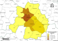
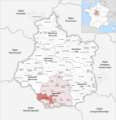
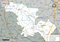
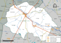
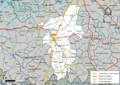
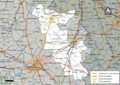
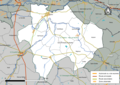
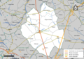
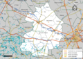
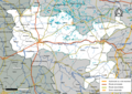
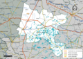
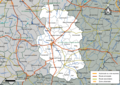
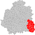
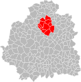
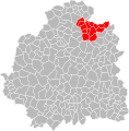
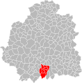
Français : Cartes des établissements publics de coopération intercommunale (communautés de communes, d’agglomération ou urbaines, métropoles, syndicats intercommunaux) et syndicats mixtes (dont les pôles métropolitains) du département français de l’Indre.

Subcategories
This category has the following 3 subcategories, out of 3 total.
Media in category "Maps of groups of communes in Indre"
The following 64 files are in this category, out of 64 total.
-
 Gemeindeverbände im Département Indre 2023.png 3,500 × 3,619; 2.56 MB
-
 36-Indre-intercos-2019.png 3,507 × 2,480; 1.87 MB
-
 36-Intercos2019-200007052-Densités.png 3,519 × 2,480; 1.13 MB
-
 36-Intercos2019-200018521-Densités.png 3,519 × 2,480; 1.06 MB
-
 36-Intercos2019-200035137-Densités.png 3,519 × 2,480; 1.37 MB
-
 36-Intercos2019-200035848-Densités.png 3,519 × 2,480; 884 KB
-
 36-Intercos2019-200040558-Densités.png 3,519 × 2,480; 1.6 MB
-
 36-Intercos2019-200068872-Densités.png 3,519 × 2,480; 1.78 MB
-
 36-Intercos2019-200068880-Densités.png 3,519 × 2,480; 2.09 MB
-
 36-Intercos2019-243600202-Densités.png 3,519 × 2,480; 1.06 MB
-
 36-Intercos2019-243600236-Densités.png 3,519 × 2,480; 1.71 MB
-
 36-Intercos2019-243600293-Densités.png 3,519 × 2,480; 1.14 MB
-
 36-Intercos2019-243600301-Densités.png 3,519 × 2,480; 1.16 MB
-
 36-Intercos2019-243600319-Densités.png 3,519 × 2,480; 1.55 MB
-
 36-Intercos2019-243600327-Densités.png 3,519 × 2,480; 1.18 MB
-
 36-Intercos2019-243600343-Densités.png 3,519 × 2,480; 1.28 MB
-
 36-Intercos2019-243600350-Densités.png 3,519 × 2,480; 1.93 MB
-
 Gemeindeverband Brenne - Val de Creuse 2023.png 3,500 × 3,619; 2.53 MB
-
 Gemeindeverband Chabris - Pays de Bazelle 2023.png 3,500 × 3,619; 2.52 MB
-
 Gemeindeverband Champagne Boischauts 2019.png 3,500 × 3,619; 2.57 MB
-
 Gemeindeverband Châteauroux Métropole 2019.png 3,500 × 3,619; 2.56 MB
-
 Gemeindeverband Châtillonnais en Berry 2019.png 3,500 × 3,619; 2.56 MB
-
 Gemeindeverband Châtre et Sainte Sévère 2019.png 3,500 × 3,619; 2.56 MB
-
 Gemeindeverband Cœur de Brenne 2019.png 3,500 × 3,619; 2.56 MB
-
 Intercos2019-200007052.png 3,519 × 2,480; 1.93 MB
-
 Intercos2019-200018521.png 3,519 × 2,480; 1.97 MB
-
 Intercos2019-200035137.png 3,519 × 2,480; 2.53 MB
-
 Intercos2019-200035848.png 3,519 × 2,480; 1.68 MB
-
 Intercos2019-200040558.png 3,519 × 2,480; 2.98 MB
-
 Intercos2019-200068872.png 3,519 × 2,480; 3.45 MB
-
 Intercos2019-200068880.png 3,519 × 2,480; 4.06 MB
-
 Intercos2019-243600202.png 3,519 × 2,480; 2.03 MB
-
 Intercos2019-243600293.png 3,519 × 2,480; 2.16 MB
-
 Intercos2019-243600301.png 3,519 × 2,480; 2.98 MB
-
 Intercos2019-243600319.png 3,519 × 2,480; 3.37 MB
-
 Intercos2019-243600327.png 3,519 × 2,480; 2.6 MB
-
 Intercos2019-243600343.png 3,519 × 2,480; 3 MB
-
 Intercos2019-243600350.png 3,519 × 2,480; 3.29 MB
-
 Gemeindeverband Levroux Boischaut Champagne 2023.png 3,500 × 3,619; 2.53 MB
-
 Localisation EPCI Brenne val de Creuse dans l'Indre, France.svg 1,000 × 1,016; 115 KB
-
 Localisation EPCI castelroussine dans l'Indre, France.svg 1,000 × 1,016; 115 KB
-
 Localisation EPCI Chabris pays de Bazelle dans l'Indre, France.svg 1,000 × 1,016; 115 KB
-
 Localisation EPCI Cœur de Brenne dans l'Indre, France.svg 1,000 × 1,016; 115 KB
-
 Localisation EPCI de Champagne berrichonne dans l'Indre, France.svg 1,000 × 1,016; 115 KB
-
 Localisation EPCI de La Châtre et Sainte-Sévère dans l'Indre, France.svg 1,000 × 1,016; 115 KB
-
 Localisation EPCI de la marche berrichonne dans l'Indre, France.svg 1,000 × 1,016; 114 KB
-
 Localisation EPCI de la région de Levroux dans l'Indre, France.svg 1,000 × 1,016; 115 KB
-
 Localisation EPCI du canton de Châtillon-sur-Indre dans l'Indre, France.svg 1,000 × 1,016; 114 KB
-
 Localisation EPCI du canton de Vatan dans l'Indre, France.svg 1,000 × 1,016; 115 KB
-
 Localisation EPCI du pays d'Argenton-sur-Creuse dans l'Indre, France.svg 1,000 × 1,016; 115 KB
-
 Localisation EPCI du pays d'Issoudun dans l'Indre, France.svg 1,000 × 1,016; 117 KB
-
 Localisation EPCI du pays d'Éguzon - Val de Creuse dans l'Indre, France.svg 1,000 × 1,016; 114 KB
-
 Localisation EPCI du pays de Valençay dans l'Indre, France.svg 1,000 × 1,016; 114 KB
-
 Localisation EPCI du val de Bouzanne dans l'Indre, France.svg 1,000 × 1,016; 115 KB
-
 Localisation EPCI Marche occitane - Val d'Anglin dans l'Indre, France.svg 1,000 × 1,016; 115 KB
-
 Localisation EPCI Pays Écueillé dans l'Indre, France.svg 1,000 × 1,016; 114 KB
-
 Localisation EPCI Val de l'Indre - Brenne dans l'Indre, France.svg 1,000 × 1,016; 115 KB
-
 Gemeindeverband Loches Sud Touraine 2019.png 3,500 × 3,619; 2.58 MB
-
 Gemeindeverband Marche Berrichonne 2019.png 3,500 × 3,619; 2.56 MB
-
 Gemeindeverband Marche Occitane - Val d’Anglin 2023.png 3,500 × 3,619; 2.52 MB
-
 Gemeindeverband Val de Bouzanne 2019.png 3,500 × 3,619; 2.56 MB
-
 Gemeindeverband Val de l’Indre - Brenne 2023.png 3,500 × 3,619; 2.53 MB
-
 Gemeindeverband Écueillé-Valençay 2019.png 3,500 × 3,619; 2.56 MB
-
 Gemeindeverband Éguzon - Argenton - Vallée de la Creuse 2023.png 3,500 × 3,619; 2.52 MB


