Category:Maps of groups of communes in Loire
Departments of Metropolitan France: Ain [01] · Aisne [02] · Allier [03] · Alpes-de-Haute-Provence [04] · Hautes-Alpes [05] · Alpes-Maritimes [06] · Ardèche [07] · Ardennes [08] · Ariège [09] · Aube [10] · Aude [11] · Aveyron [12] · Bouches-du-Rhône [13] · Calvados [14] · Cantal [15] · Charente [16] · Charente-Maritime [17] · Cher [18] · Corrèze [19] · Corse-du-Sud [2A]† · Haute-Corse [2B]† · Côte-d’Or [21] · Côtes-d'Armor [22] · Creuse [23] · Dordogne [24] · Doubs [25] · Drôme [26] · Eure [27] · Eure-et-Loir [28] · Finistère [29] · Gard [30] · Haute-Garonne [31] · Gers [32] · Gironde [33] · Hérault [34] · Ille-et-Vilaine [35] · Indre [36] · Indre-et-Loire [37] · Isère [38] · Jura [39] · Landes [40] · Loir-et-Cher [41] · Loire [42] · Haute-Loire [43] · Loire-Atlantique [44] · Loiret [45] · Lot [46] · Lot-et-Garonne [47] · Lozère [48] · Maine-et-Loire [49] · Manche [50] · Marne [51] · Haute-Marne [52] · Mayenne [53] · Meurthe-et-Moselle [54] · Meuse [55] · Morbihan [56] · Moselle [57] · Nièvre [58] · Nord [59] · Oise [60] · Orne [61] · Pas-de-Calais [62] · Puy-de-Dôme [63] · Pyrénées-Atlantiques [64] · Hautes-Pyrénées [65] · Pyrénées-Orientales [66] · Bas-Rhin [67] · Haut-Rhin [68] · departmental district of the Rhône [69] · Rhône [69D]‡ · Haute-Saône [70] · Saône-et-Loire [71] · Sarthe [72] · Savoie [73] · Haute-Savoie [74] · Seine-Maritime [76] · Seine-et-Marne [77] · Yvelines [78] · Deux-Sèvres [79] · Somme [80] · Tarn [81] · Tarn-et-Garonne [82] · Var [83] · Vaucluse [84] · Vendée [85] · Vienne [86] · Haute-Vienne [87] · Vosges [88] · Yonne [89] · Territoire de Belfort [90] · Essonne [91] · Hauts-de-Seine [92] · Seine-Saint-Denis [93] · Val-de-Marne [94] · Val-d'Oise [95]
Overseas departments and regions: Guadeloupe [971] · Martinique [972] · French Guiana [973] · Réunion [974] · Mayotte [976]
Sui generis territories: New Caledonia [988]
Overseas departments and regions: Guadeloupe [971] · Martinique [972] · French Guiana [973] · Réunion [974] · Mayotte [976]
Sui generis territories: New Caledonia [988]
| NO WIKIDATA ID FOUND! Search for Maps of groups of communes in Loire on Wikidata | |
| Upload media |
Français : Cartes des établissements publics de coopération intercommunale (communautés de communes, d’agglomération ou urbaines, métropoles, syndicats intercommunaux) et syndicats mixtes (dont les pôles métropolitains) du département français de la Loire.

Subcategories
This category has the following 3 subcategories, out of 3 total.
Media in category "Maps of groups of communes in Loire"
The following 36 files are in this category, out of 36 total.
-
 Gemeindeverbände im Département Loire 2023.png 3,500 × 2,793; 2.59 MB
-
 42-Loire-intercos-2019.png 3,507 × 2,480; 2.67 MB
-
 Aire géographique de l'AOC Côte roannaise (Département de la Loire, France).svg 1,000 × 1,402; 146 KB
-
 Aire géographique de l'AOC Côtes du Forez (Département de la Loire, France).svg 1,000 × 1,402; 163 KB
-
 Aire géographique de l'IGP Urfé (Département de la Loire, France).svg 1,000 × 1,402; 257 KB
-
 Carte Intercommunalités Loire 2019.svg 73 × 97; 160 KB
-
 Gemeindeverband Charlieu-Belmont Communauté 2019.png 3,500 × 2,793; 2.64 MB
-
 Gemeindeverband Forez-Est 2019.png 3,500 × 2,793; 2.64 MB
-
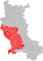
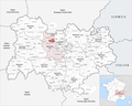
 Localisation EPCI 'Communauté d'agglomération de Loire Forez' dans la Loire en 2013.svg 1,000 × 1,402; 136 KB
-
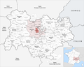
 Localisation EPCI de Balbigny dans la Loire, France.svg 1,000 × 1,402; 135 KB
-
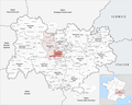
 Localisation EPCI de Feurs en Forez dans la Loire, France.svg 1,000 × 1,402; 135 KB
-
 Localisation EPCI de Forez en Lyonnais dans la Loire, France.svg 1,000 × 1,402; 135 KB
-
 Localisation EPCI de Forez-Est dans la Loire, France.svg 427 × 599; 228 KB
-
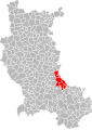
 Localisation EPCI de Saint-Étienne Métropole dans la Loire, France.svg 427 × 599; 246 KB
-
 Localisation EPCI des collines du matin dans la Loire, France.svg 1,000 × 1,402; 135 KB
-
 Localisation EPCI des montagnes du haut Forez dans la Loire, France.svg 1,000 × 1,402; 135 KB
-
 Localisation EPCI des monts du Pilat dans la Loire, France.svg 427 × 599; 204 KB
-
 Localisation EPCI des vals d'Aix et Isable dans la Loire, France.svg 569 × 799; 193 KB
-
 Localisation EPCI du pays d'Astrée dans la Loire, France.svg 1,000 × 1,402; 135 KB
-
 Localisation EPCI du pays d'Urfé dans la Loire, France.svg 427 × 599; 202 KB
-
 Localisation EPCI du pays de Charlieu Belmont dans la Loire, France.svg 427 × 599; 216 KB
-
 Localisation EPCI du pays de Saint-Bonnet-le-Château dans la Loire, France.svg 1,000 × 1,402; 135 KB
-
 Localisation EPCI du pays de Saint-Galmier dans la Loire, France.svg 1,000 × 1,402; 135 KB
-
 Localisation EPCI du pays entre Loire et Rhône dans la Loire, France.svg 427 × 599; 204 KB
-
 Localisation EPCI du Pilat rhodanien dans la Loire, France.svg 427 × 599; 198 KB
-
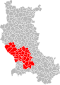
 Localisation EPCI du Roannais dans la Loire, France.svg 427 × 599; 242 KB
-
-
 Gemeindeverband Loire Forez Agglomération 2023.png 3,500 × 2,793; 2.58 MB
-
 Gemeindeverband Monts du Lyonnais 2019.png 3,500 × 2,793; 2.66 MB
-
 Gemeindeverband Monts du Pilat 2019.png 3,500 × 2,793; 2.64 MB
-
 Gemeindeverband Pays d’Urfé 2019.png 3,500 × 2,793; 2.64 MB
-
 Gemeindeverband Pays Entre Loire et Rhône 2019.png 3,500 × 2,793; 2.64 MB
-
 Gemeindeverband Pilat Rhodanien 2019.png 3,500 × 2,793; 2.64 MB
-
 Gemeindeverband Roannais Agglomération 2019.png 3,500 × 2,793; 2.64 MB
-
 Gemeindeverband Saint-Étienne Métropole 2019.png 3,500 × 2,793; 2.64 MB
-
 Gemeindeverband Vals d’Aix et Isable 2019.png 3,500 × 2,793; 2.64 MB


.svg)
.svg)
.svg)


_dans_la_Loire,_France.svg)


