Category:Maps of regions of Guyana
| NO WIKIDATA ID FOUND! Search for Maps of regions of Guyana on Wikidata | |
| Upload media |

Subcategories
This category has only the following subcategory.
Media in category "Maps of regions of Guyana"
The following 25 files are in this category, out of 25 total.
-
 Administrative divisions of Guyana (ka).svg 1,252 × 1,843; 493 KB
-
 Forest Cover of Guyanan Regions.png 6,600 × 6,639; 1.47 MB
-
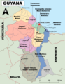
 Guyana Base Map.png 753 × 989; 274 KB
-
 Guyana Region 1 Barima-Waini Map.png 6,120 × 7,920; 821 KB
-
 Guyana Region 10 Upper Demerara-Berbice Map.png 6,120 × 7,920; 846 KB
-
 Guyana Region 2 Pomeroon-Supenaam Map.png 6,120 × 7,920; 795 KB
-
 Guyana Region 3 Essequibo Islands-West Demerara Map.png 6,120 × 7,920; 809 KB
-
 Guyana Region 4 Demerara-Mahaica Map.png 6,120 × 7,920; 781 KB
-
 Guyana Region 5 Mahaica-Berbice Map.png 6,120 × 7,920; 788 KB
-
 Guyana Region 6 East Berbice-Corentyne Map.png 6,120 × 7,920; 884 KB
-
 Guyana Region 7 Cuyuni-Mazaruni Map.png 6,120 × 7,920; 903 KB
-
 Guyana Region 8 Potaro-Siparuni Map.png 6,120 × 7,920; 851 KB
-
 Guyana Region 9 Upper Takutu- Upper Essequibo Map.png 6,120 × 7,920; 935 KB
-
 Guyana regions blank.png 2,000 × 2,905; 30 KB
-
 Guyana regions english.png 500 × 726; 24 KB
-
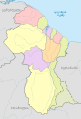
 Guyana Regions English.svg 595 × 769; 246 KB
-
 Guyana Regions Information Map.png 6,120 × 7,920; 2.22 MB
-
 Guyana Regions Map Blank.png 5,952 × 7,691; 752 KB
-
 Guyana Regions Map With Names.png 5,952 × 7,691; 995 KB
-
 Guyana regions numbered (GINA).png 187 × 272; 19 KB
-
 Guyana regions numbered.png 300 × 436; 10 KB
-
 Guyana regions Numbered.png 5,952 × 7,691; 820 KB
-
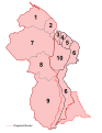 Guyana Regions Numbered.svg 595 × 769; 106 KB
-
 Guyana regions.png 836 × 1,326; 377 KB
-
 The right view of Guyana regions.png 187 × 272; 21 KB
.svg)


.png)


