Category:Maps of regions of Peru
Subcategories
This category has the following 27 subcategories, out of 27 total.
Media in category "Maps of regions of Peru"
The following 48 files are in this category, out of 48 total.
-
 2 JMK-Peru-blue.png 427 × 599; 73 KB
-
 4 JMK-Peru-Red-blue.png 427 × 599; 68 KB
-
 5 JMK-Peru-red.png 427 × 599; 70 KB
-
 6 JMK-Peru-green.png 427 × 599; 72 KB
-
 Administrative Map of Perú JMK.svg 520 × 730; 171 KB
-
 COVID-19 Tests in Peru per 100,000 inhabitants.svg 512 × 724; 76 KB
-
 Departamento de Pasco 2.png 3,500 × 2,293; 652 KB
-
 Departamento de Pasco.png 3,500 × 2,293; 607 KB
-
 Departamento de San Martín.png 4,000 × 5,374; 1.11 MB
-
 Flag-map of Peru regions.png 2,068 × 2,922; 722 KB
-
 Labelled JMK-Peru-ColorCoded labelled 2.png 426 × 599; 105 KB
-
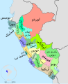
 Labelled JMK-Peru-ColorCoded labelled.png 1,238 × 775; 91 KB
-
 Labelled JMK-Peru-ColorCoded labelled.svg 512 × 718; 104 KB
-
 Map of COVID-19 vaccination by age group in Peru by region.svg 512 × 724; 79 KB
-
 Map of the Political Regions of Peru (1989-1991).png 520 × 730; 23 KB
-
 Mapa de Colores del Peru jmk ver castellana.png 363 × 524; 195 KB
-
 Maparegional.png 258 × 367; 8 KB
-
 Maparegional2.png 258 × 367; 9 KB
-
 Peru - (Template).svg 820 × 1,000; 1.6 MB
-
 Peru - 1989 Regions (locator map, labeled, ES).svg 820 × 1,000; 1.16 MB
-
 Peru - 2011 Region proposals (locator map, labeled ES).svg 820 × 1,000; 1.17 MB
-
 Peru - Regions and departments (labeled).svg 820 × 1,000; 1.26 MB
-
 Peru -2005 Region proposals (locator map, labeled ES).svg 820 × 1,000; 1.31 MB
-
 Peru Base Map.png 754 × 998; 356 KB
-
 Peru Blue Administrative Base Map.png 520 × 730; 31 KB
-
 Peru Blue Administrative Map.png 520 × 730; 37 KB
-
 Peru Edges Labelled Peru Edges Labelled Map.png 426 × 600; 146 KB
-
 Peru location map.svg 2,200 × 2,679; 15.72 MB
-
 Peru mapColorful jmk en version.png 363 × 524; 194 KB
-
 Peru regions, blank.png 238 × 347; 25 KB
-
 Peru Regions.png 816 × 1,056; 25 KB
-
 Peru-blue-1.png 520 × 730; 24 KB
-
 Peru-blue-4.PNG 520 × 730; 35 KB
-
 Peru-blue-5 (base).PNG 520 × 730; 26 KB
-
 Peru-blue-51.PNG 427 × 599; 99 KB
-
 Peru-earth-1.PNG 520 × 730; 24 KB
-
 Peru-green-1.PNG 520 × 730; 24 KB
-
 Peru-lime-1.PNG 520 × 730; 24 KB
-
 Peru-mint-1.PNG 520 × 730; 24 KB
-
 Peru-oker-1.PNG 520 × 730; 24 KB
-
 Peru-regions-multi-color-001.SVG 520 × 730; 180 KB
-
 Peru-wine-1.PNG 520 × 730; 24 KB
-
 Perú · (departamentos).png 520 × 730; 23 KB
-
 Regiones del Perú 2002.png 537 × 582; 89 KB
-
 Regions of Peru.PNG 320 × 467; 47 KB
-
 Regions-of-peru-blank-map-001.svg 820 × 1,000; 1.23 MB
-
 Scalable Vectorized Adminstrative Map of Perú JMK TH.SVG 520 × 730; 759 KB
-
 مناطق بيرو.svg 820 × 1,000; 1.29 MB


.png)


.svg)
.svg)
.svg)
.svg)
.svg)


.PNG)


.png)


