Category:Maps of the history of Chile
Subcategories
This category has the following 12 subcategories, out of 12 total.
Pages in category "Maps of the history of Chile"
This category contains only the following page.
Media in category "Maps of the history of Chile"
The following 45 files are in this category, out of 45 total.
-
 Alto Perú mapa.png 1,000 × 1,000; 44 KB
-
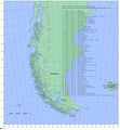
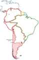
 Reino de la Araucanía y la Patagonia.jpg 520 × 1,004; 107 KB
-
 Baselines chile.png 1,653 × 1,787; 894 KB
-
 Borders Chile 1879 and 2006 SP.png 363 × 526; 9 KB
-

-
 Capitanía General de Chile, 1775, mapa satelital.svg 1,710 × 2,684; 8.84 MB
-
 Chile Antiguo en la Capitanía General de Chile.svg 1,710 × 2,679; 2.57 MB
-
 Chile location map (+claims, 1903).svg 1,183 × 2,679; 1.01 MB
-

-
 Cobertura Intercom 1987.png 940 × 630; 576 KB
-
 Cobertura Intercom 1993.png 1,008 × 841; 949 KB
-
 Colchagua-1750 01.png 2,550 × 3,300; 3.97 MB
-
 Colchagua-1800.png 2,550 × 3,300; 4.01 MB
-
 Concesiones en el Territorio de Aysén hacia 1920.svg 400 × 500; 1.15 MB
-

-
 Cuestion de Tarija.svg 2,240 × 2,573; 240 KB
-
 Cuestión de Tacna y Arica.png 4,213 × 4,090; 922 KB
-
 Expansion Chilevision 1993 1994.png 1,019 × 4,364; 684 KB
-
 Expansion TVN 1968 1974.png 1,280 × 4,376; 726 KB
-
 Expedicion Valdivia a Chile1.jpg 1,510 × 1,901; 473 KB
-
 ExploracionPastene.png 300 × 495; 211 KB
-
 Location Chile Capitania.png 250 × 115; 10 KB
-
 Location Chile Capitania2.png 250 × 115; 7 KB
-
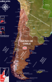
 Mapa Capitania Chile.png 1,038 × 1,599; 470 KB
-
 Mapa de Chile, año 1899.svg 1,183 × 2,679; 1.24 MB
-
 Mapa de Chile, año 1900.svg 1,183 × 2,679; 1.27 MB
-
 Mapa de Chile, año 1903.svg 1,183 × 2,679; 1.24 MB
-
 Mapa de Chile, año 1904.svg 1,183 × 2,679; 1.23 MB
-
 Mapa de corregimientos coloniales de Chile (1776).svg 1,474 × 2,685; 4.53 MB
-
 Mapa Gobernacion de Chile.PNG 151 × 211; 10 KB
-
 Mapa Telenorte.png 1,040 × 1,620; 141 KB
-
 Mapacolonialdechile.JPG 550 × 800; 54 KB
-
 Parte sudamericana del Reino de Chile.svg 1,576 × 3,543; 674 KB
-
 Pedro De Valdivia Siedlungen in Chile 1540 bis 1553-ar.jpg 400 × 1,283; 173 KB
-
 Pedro De Valdivia Siedlungen in Chile 1540 bis 1553.jpg 300 × 962; 268 KB
-
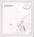 Plan d'Arica (1824, No. 428).jpg 1,477 × 1,600; 1.35 MB
-
 Provincias Unidas de Sud América -1816.png 286 × 532; 49 KB
-
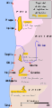 Saltpeter fields in 1876.es.svg 254 × 523; 57 KB
-
 Território mapuche.jpg 373 × 805; 90 KB
-
The War of the Pacific Every Week.ogv 41 s, 320 × 240; 1.73 MB
-
 Tierras Magallánicas o Chile Moderno en la Capitanía General de Chile.svg 1,710 × 2,679; 2.57 MB
-
 Traiguén.png 1,650 × 1,275; 155 KB
-
 ValdiviaCuzcoAtacama.JPG 1,496 × 1,901; 245 KB
-
 ValdiviaViajePeru.png 1,484 × 1,973; 545 KB
-
 Virreinato verde.jpg 180 × 271; 23 KB


.svg)


.svg)


.jpg)


