Category:Maps of the history of North America
Temperate regions: North America · South America · Africa · Europe · Asia · Oceania – Polar regions: – Other regions:
| NO WIKIDATA ID FOUND! Search for Maps of the history of North America on Wikidata | |
| Upload media |
Use the appropriate category for maps showing all or a large part of North America. See subcategories for smaller areas:
| If the map shows | Category to use |
|---|---|
| North America on a recently created map | Category:Maps of North America or its subcategories |
| North America on a map created more than 70 years ago | Category:Old maps of North America or its subcategories |
| the history of North America on a recently created map | Category:Maps of the history of North America or its subcategories |
| the history of North America on a map created more than 70 years ago | Category:Old maps of the history of North America or its subcategories |

Subcategories
This category has the following 29 subcategories, out of 29 total.
Media in category "Maps of the history of North America"
The following 53 files are in this category, out of 53 total.
-
 Oasisamérica-Hohokam.png 766 × 965; 1.19 MB
-
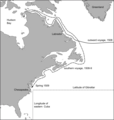 1508 voyage.png 1,971 × 2,077; 366 KB
-
 Coronado expedition.jpg 1,230 × 532; 130 KB
-
 Political Evolution of Central America and the Caribbean 1700 and on.gif 850 × 638; 348 KB
-

-
 Americas independence map.PNG 862 × 1,270; 74 KB
-
 Andean Community.png 418 × 628; 14 KB
-
 Arctic cultures 900-1500.png 259 × 989; 251 KB
-
 Beringia land bridge-noaagov.gif 700 × 458; 367 KB
-
 Bisons.JPG 1,262 × 1,107; 313 KB
-
 Book B10-178 Bethleham Iron.png 2,070 × 3,016; 70 KB
-
 Brockhaus and Efron Encyclopedic Dictionary b2 604-3.jpg 2,552 × 3,459; 3.45 MB
-
 Evolucion Territorio Mexicano.gif 626 × 599; 1.28 MB
-
 Evolución territorial de México (1821-1981).gif 800 × 760; 466 KB
-
 Expedition Cabeza de Vaca Karte borderless.png 1,990 × 895; 2.28 MB
-
 First Nation Control over North America about 1600 AD.jpg 5,660 × 5,196; 23.06 MB
-
 French Forts 1754.jpg 296 × 372; 108 KB
-
 French Forts 1754.png 263 × 386; 17 KB
-
 History of the American Civil War (1867) (14575956700).jpg 3,344 × 2,102; 965 KB
-
 History of the American Civil War (1867) (14760302234).jpg 2,010 × 2,882; 916 KB
-
 Ien.35556000974097-seq 87.tif 5,227 × 7,681; 17 MB
-
 Ivo 2007 track map.gif 895 × 716; 28 KB
-
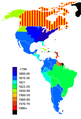
 Latin American independence countries.png 505 × 600; 73 KB
-
 Lewis and Clark track map published 1814 LoC.jpg 8,784 × 4,032; 8.71 MB
-
 Locatie Eerste Mexicaanse Keizerrijk.PNG 250 × 115; 5 KB
-
 LocationRioGrande.PNG 250 × 115; 1 KB
-
 Map of North America (1898).jpg 2,926 × 2,414; 1.22 MB
-
 Map of North America, 1782 (Life of William, Earl of Shelburne) (edited).jpg 1,733 × 2,692; 3.86 MB
-
 Map of North America, 1782 (Life of William, Earl of Shelburne).jpg 1,733 × 2,692; 3.11 MB
-
 Mapa Terytorium Indiańskiego w XIX wieku.png 427 × 585; 64 KB
-
 Mitchellmap-1755-telliquo.jpg 528 × 410; 75 KB
-
 Namigration.png 686 × 717; 219 KB
-
 NOAA Saint Paul Island elliott4.jpg 1,148 × 1,639; 494 KB
-
 North America 1810-1816.png 1,000 × 1,274; 422 KB
-
 North America in 18th century (pl).png 341 × 439; 27 KB
-
 North American lines of frontier, 1782 (edit).jpg 2,696 × 1,656; 2.78 MB
-
 North American lines of frontier, 1782.jpg 2,696 × 1,656; 2.26 MB
-
 Nouvellefrance-V2.jpg 1,530 × 1,090; 1.04 MB
-
 OAS membership map.png 418 × 628; 14 KB
-
 Oasisamerica.png 766 × 828; 949 KB
-
 OldestContinuouslyInhabitedCitiesInTheAmericas.svg 1,264 × 1,046; 876 KB
-
 Slavery in British American territory.png 384 × 356; 13 KB
-
 Sobel North America.JPG 457 × 431; 52 KB
-
 The Beaver map (1715).jpg 424 × 700; 152 KB
-
 TramCCFLmapa(NAmerica).svg 1,400 × 1,150; 313 KB
-
 Viking expansion.png 507 × 310; 109 KB
-
 VillistasvstheUnitedStates1915-1920.jpg 885 × 1,566; 238 KB
-
 Vinland-travel-hy.jpg 1,214 × 1,600; 488 KB
-
 War 1812-Locations.jpg 1,494 × 830; 139 KB
-
 Western North America 1778.png 1,202 × 1,213; 230 KB
-
 WikiConference North America 2018 - Bjork-James - Bellin map.jpg 4,032 × 3,024; 8.53 MB
-
 WikiConference North America 2018 - Bjork-James - European occupation.jpg 4,032 × 3,024; 9.1 MB
-
 Изменения территорий стран Северной Америки с 250 г. по современность.gif 1,212 × 627; 981 KB


.gif)


_(14575956700).jpg)
_(14760302234).jpg)


.jpg)
_(edited).jpg)
.jpg)


.png)
.jpg)


.jpg)
.svg)


