Category:Maps showing 1821
| ← 1820 1821 1822 1823 1824 1825 1826 1828 1829→ |
English: Maps showing the year 1821 (i.e. history maps)
See also category: 1821 maps. and 1820s maps for more maps showing this year usually created not long after the given year.
See also category: 1821 maps. and 1820s maps for more maps showing this year usually created not long after the given year.
Media in category "Maps showing 1821"
The following 5 files are in this category, out of 5 total.
-
 Creek Cessions of the Treaty of Indian Springs (1821).jpg 600 × 692; 115 KB
-
 Karte ErzbistumKoeln.png 2,713 × 2,391; 643 KB
-
 Provincias Unidas 1821.png 400 × 442; 97 KB
-
 United States 1820-1821-07.png 1,000 × 677; 108 KB
-
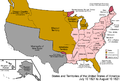 United States 1821-07-1821-08.png 1,000 × 677; 108 KB
.jpg)


