Category:Night in the London Borough of Ealing

Media in category "Night in the London Borough of Ealing"
The following 63 files are in this category, out of 63 total.
-
 3 x D78.jpg 512 × 384; 30 KB
-
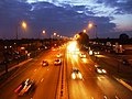 A40 - Western Avenue, Greenford - geograph.org.uk - 1031671.jpg 640 × 480; 95 KB
-
 Acton High Street Railway Bridge With Illuminated Sign.jpg 3,264 × 2,448; 2.19 MB
-
 Acton Lane, NW10 - geograph.org.uk - 989634.jpg 640 × 480; 92 KB
-
 Acton Town Station - geograph.org.uk - 3645644.jpg 2,560 × 1,920; 1.19 MB
-
 ASDA, Park Royal Road, NW10 - geograph.org.uk - 989633.jpg 640 × 480; 104 KB
-
 Bollo Bridge Road, Acton - geograph.org.uk - 4249394.jpg 2,560 × 1,920; 1.62 MB
-
 Bollo Lane, Chiswick - geograph.org.uk - 4249399.jpg 2,502 × 1,840; 1.09 MB
-
 Bond Street, Ealing - geograph.org.uk - 4240910.jpg 2,560 × 1,920; 1.41 MB
-
 Chandos Road, NW10 - geograph.org.uk - 989637.jpg 640 × 480; 86 KB
-
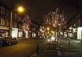 Christmas at Pitshanger Lane - geograph.org.uk - 299759.jpg 640 × 450; 123 KB
-
 Clarendon Road, Ealing - geograph.org.uk - 4301905.jpg 2,304 × 1,728; 845 KB
-
 D78 at night.jpg 2,048 × 1,536; 330 KB
-
 Ealing Broadway Christmas.jpg 768 × 1,024; 445 KB
-
 Ealing Broadway merging with The Mall - geograph.org.uk - 4240914.jpg 2,560 × 1,920; 2 MB
-
 Ealing Studios London England.jpg 800 × 600; 89 KB
-
 Ealing-hospital-main-entrance-after-dark.jpg 2,048 × 1,536; 534 KB
-
 Friary Road II, W3 - geograph.org.uk - 998205.jpg 640 × 480; 60 KB
-
 Friary Road, W3 - geograph.org.uk - 998189.jpg 640 × 480; 62 KB
-
 Gunnersbury Avenue looking towards High Street Acton - geograph.org.uk - 3645645.jpg 2,560 × 1,920; 1.97 MB
-
 Hamilton Road, Ealing - geograph.org.uk - 5189820.jpg 4,128 × 3,096; 3.67 MB
-
 Hamilton Road, Ealing - geograph.org.uk - 5189821.jpg 4,128 × 3,096; 3.55 MB
-
 Hanger Lane tube station - geograph.org.uk - 3596655.jpg 2,544 × 1,898; 1.75 MB
-
 Hanger Lane, Ealing - geograph.org.uk - 3596642.jpg 2,560 × 1,920; 1.06 MB
-
 Haven Green at night - geograph.org.uk - 4264842.jpg 2,560 × 1,920; 1.33 MB
-
 Haven Green at night - geograph.org.uk - 4264843.jpg 2,560 × 1,920; 1.72 MB
-
 Horn Lane at night - geograph.org.uk - 3765435.jpg 2,304 × 1,728; 1.15 MB
-
 London, UK - panoramio (219).jpg 2,048 × 1,536; 430 KB
-
 London, UK - panoramio (222).jpg 2,048 × 1,536; 482 KB
-
 Medway Underpass, Western Avenue - geograph.org.uk - 1031672.jpg 640 × 480; 93 KB
-
 Minerva Road, NW10 - geograph.org.uk - 998246.jpg 640 × 480; 90 KB
-
 Mount Park Road, Ealing - geograph.org.uk - 4264840.jpg 2,560 × 1,920; 1.68 MB
-
 Noel Road, W3 - geograph.org.uk - 2059021.jpg 3,504 × 2,336; 1.9 MB
-
 Northfields London Underground depot at night.JPG 3,428 × 2,628; 4.36 MB
-
 Northfields Tube Station - geograph.org.uk - 49077.jpg 640 × 480; 68 KB
-
 Parade of shops on Ealing Broadway - geograph.org.uk - 4240916.jpg 2,560 × 1,920; 2.01 MB
-
 Park Royal Road, NW10 - geograph.org.uk - 989641.jpg 640 × 480; 93 KB
-
 Park Royal Road, W3 - geograph.org.uk - 998195.jpg 640 × 480; 66 KB
-
 Polski Sklep on South Ealing Road - geograph.org.uk - 4240926.jpg 2,560 × 1,920; 1.58 MB
-
 Popes Lane, South Ealing - geograph.org.uk - 4264839.jpg 2,560 × 1,920; 2.01 MB
-
 Real IRA bomb damage in Ealing.jpg 1,600 × 1,200; 1.1 MB
-
 Shops on Ealing Green - geograph.org.uk - 4240909.jpg 2,560 × 1,920; 1.98 MB
-
 Shops on Ealing Green - geograph.org.uk - 4240911.jpg 2,560 × 1,920; 1.35 MB
-
 Signal outside South Greenford station - geograph.org.uk - 1035069.jpg 640 × 480; 102 KB
-
 South Ealing Road - geograph.org.uk - 4240924.jpg 2,560 × 1,920; 1.99 MB
-
 South Ealing Road - geograph.org.uk - 4240928.jpg 2,470 × 1,794; 1.44 MB
-
 South Ealing tube station at night.jpg 2,592 × 1,552; 1.03 MB
-
 South Greenford station - geograph.org.uk - 1031663.jpg 640 × 480; 95 KB
-
 Southall, Veľká Británia - panoramio (1).jpg 2,048 × 1,536; 1.13 MB
-
 Southall, Veľká Británia - panoramio (2).jpg 2,048 × 1,536; 1.24 MB
-
 Southall, Veľká Británia - panoramio.jpg 1,536 × 2,048; 891 KB
-
 Stockdove Way - geograph.org.uk - 1035401.jpg 640 × 480; 111 KB
-
 The A40 in Park Royal - geograph.org.uk - 3788507.jpg 2,304 × 1,728; 864 KB
-
 Top and Tail.jpg 512 × 384; 30 KB
-
 Travis Perkins on Popes Lane, South Ealing - geograph.org.uk - 4272595.jpg 2,504 × 1,844; 1.5 MB
-
 Victoria Road, NW10 - geograph.org.uk - 998192.jpg 640 × 480; 48 KB
-
 Wales Farm Road, W3 - geograph.org.uk - 989639.jpg 640 × 480; 93 KB
-
 Wells House Road, NW10 - geograph.org.uk - 998198.jpg 640 × 480; 41 KB
-
 Wells House Road, NW10 - geograph.org.uk - 998200.jpg 640 × 480; 43 KB
-
 West Acton station, W3 - geograph.org.uk - 1614224.jpg 640 × 480; 65 KB
-
 West Acton station, W3 - geograph.org.uk - 1614228.jpg 640 × 480; 59 KB
-
 Western Avenue - geograph.org.uk - 1035402.jpg 640 × 480; 107 KB
-
 Winchester Street at the junction of High Street Acton - geograph.org.uk - 3820584.jpg 2,304 × 1,728; 1.19 MB


.jpg)
.jpg)


.jpg)
.jpg)


