Category:Night in the London Borough of Haringey

Media in category "Night in the London Borough of Haringey"
The following 43 files are in this category, out of 43 total.
-
 2012 Holland Heinken House.jpg 500 × 375; 55 KB
-
 Boxes of green grocery on The Roundway Tottenham London England.jpg 4,608 × 3,456; 7.97 MB
-
New Year's Eve London fireworks 20-21 01.webm 20 s, 1,920 × 1,080; 36.14 MB
-
New Year's Eve London fireworks 20-21 02.webm 48 s, 1,920 × 1,080; 77.28 MB
-
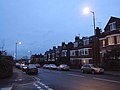 Alexandra Park Road, Muswell Hill - geograph.org.uk - 1126992.jpg 640 × 480; 60 KB
-
 Archway Road, Highgate - geograph.org.uk - 3312691.jpg 768 × 1,024; 200 KB
-
-
 Black Boy Buildings, South Tottenham - geograph.org.uk - 5220941.jpg 2,304 × 1,728; 881 KB
-
 Burbridge Way N17 - Sunset.jpg 1,929 × 1,895; 927 KB
-
 Cycle path on The Roundway Tottenham London England.jpg 4,608 × 3,456; 9.39 MB
-
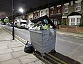 Dumped Bin - Dawlish Road, Tottenham N17 (27167676657).jpg 3,854 × 3,000; 1.73 MB
-
 Harringay railway station MMB 30.jpg 4,023 × 2,601; 3.35 MB
-
 Harringay railway station MMB 31.jpg 4,048 × 2,559; 3.19 MB
-
 Harringay railway station MMB 32 365XXX.jpg 4,084 × 2,578; 3.09 MB
-
 Hermitage road at night - panoramio.jpg 2,592 × 1,944; 796 KB
-
 Highgate Village - geograph.org.uk - 1626435.jpg 640 × 464; 101 KB
-
 Highgate Village - geograph.org.uk - 1626446.jpg 640 × 439; 179 KB
-
 Hornsey railway station MMB 24 313XXX 313134.jpg 4,167 × 2,523; 3.21 MB
-
 Hornsey railway station MMB 25 91122.jpg 4,198 × 2,535; 3.23 MB
-
 Hornsey railway station MMB 26.jpg 4,047 × 2,196; 3 MB
-
 Hornsey railway station MMB 27 365XXX.jpg 4,005 × 2,217; 3.14 MB
-
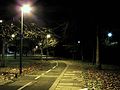
 It's dark on Weston Park - geograph.org.uk - 3870848.jpg 2,206 × 1,588; 1.22 MB
-
 Local supermarket on The Roundway Tottenham London England.jpg 4,608 × 3,456; 7.95 MB
-
 Looking along the pavement on Weston Park - geograph.org.uk - 3870849.jpg 2,304 × 1,728; 1.25 MB
-
-

-
 Park Road at the junction of Priory Road, Hornsey - geograph.org.uk - 3870846.jpg 2,262 × 1,670; 1.51 MB
-
 Perth Road, Finsbury Park, 2AM - geograph.org.uk - 910536.jpg 640 × 480; 49 KB
-
 Photograph of current state of Tottenham Hale Station.jpg 3,264 × 1,822; 3.9 MB
-
 Shops on Broad Lane, Tottenham - geograph.org.uk - 5225342.jpg 2,304 × 1,728; 1.21 MB
-
 Shops on Broad Lane, Tottenham - geograph.org.uk - 5225347.jpg 2,230 × 1,624; 1.27 MB
-
 Shops on West Green Road, South Tottenham - geograph.org.uk - 5225328.jpg 2,304 × 1,728; 1.06 MB
-
 Shops on West Green Road, South Tottenham - geograph.org.uk - 5225360.jpg 2,304 × 1,728; 897 KB
-
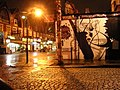
 Slipstitch London at night.jpg 4,032 × 3,024; 2.81 MB
-
 Snowy night - geograph.org.uk - 1168539.jpg 640 × 427; 59 KB
-
 Spurs stadium January 2020.jpg 5,472 × 3,078; 8.33 MB
-
 The Salisbury at night, August 2021.jpg 4,032 × 3,024; 3.51 MB
-
 The Village, Muswell Hill - geograph.org.uk - 1100169.jpg 640 × 480; 88 KB
-
 Tottenham Hale National Rail platforms.jpg 3,648 × 2,736; 4.35 MB
-
 West Green Road, Tottenham - geograph.org.uk - 1105238.jpg 640 × 480; 56 KB
-
 Weston Park looking towards Crouch End Broadway - geograph.org.uk - 3870847.jpg 2,304 × 1,728; 1.33 MB
-
 Wood green cinema.jpg 3,008 × 2,000; 1.26 MB
-
 Woodstock Road, Finsbury Park - geograph.org.uk - 1100174.jpg 640 × 480; 66 KB


.jpg)


