Category:Night in the London Borough of Hammersmith and Fulham

Subcategories
This category has only the following subcategory.
H
- Hammersmith Bridge at night (9 F)
Media in category "Night in the London Borough of Hammersmith and Fulham"
The following 111 files are in this category, out of 111 total.
-
 A3220 - West Cross Route, W12 - geograph.org.uk - 1026756.jpg 640 × 480; 52 KB
-
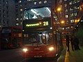 Abellio Bus route 211.jpg 3,072 × 2,304; 2.65 MB
-
 Adelaide Grove, W12 - geograph.org.uk - 843719.jpg 640 × 480; 61 KB
-
 Aldbourne Road, W12 - geograph.org.uk - 843712.jpg 640 × 480; 44 KB
-
 All shut up - geograph.org.uk - 1220136.jpg 640 × 480; 86 KB
-
 Au Morandarte Flickr DSC00227 (11381271923).jpg 3,072 × 2,304; 2.82 MB
-
 Au Morandarte Flickr DSC00507 (10233061376).jpg 3,072 × 2,304; 2.75 MB
-
 Au Morandarte Flickr DSC01513 (11850199734).jpg 3,072 × 2,304; 3.29 MB
-
 Au Morandarte Flickr DSC02262 (10623013606).jpg 3,072 × 2,304; 2.74 MB
-
 Au Morandarte Flickr London Overground 378209, Shepherds Bush (10368512406).jpg 3,072 × 2,304; 2.75 MB
-
 Au Morandarte Flickr London United SP175 on Route N9, Hammersmith (10499220986).jpg 3,072 × 2,304; 3.25 MB
-
 Australia Road, W12 - geograph.org.uk - 846295.jpg 640 × 480; 83 KB
-
 Australia Road, White City Estate - geograph.org.uk - 849089.jpg 640 × 480; 76 KB
-
 Bagley's Lane, SW6 - geograph.org.uk - 1035409.jpg 640 × 480; 89 KB
-
 BBC Television Centre - geograph.org.uk - 7407.jpg 640 × 480; 131 KB
-
 BBC Television Centre.jpg 800 × 600; 546 KB
-
 Beadon Road W6 - geograph.org.uk - 1769356.jpg 480 × 640; 61 KB
-
 Beadon Road, Hammersmith - geograph.org.uk - 4081957.jpg 2,304 × 1,728; 830 KB
-
 Big Yellow self storage on Scrubs Lane - geograph.org.uk - 3804655.jpg 2,304 × 1,728; 1.2 MB
-
 Blaxland House, White City Estate - geograph.org.uk - 849087.jpg 640 × 480; 76 KB
-
 Bloemfontein Road, W12 - geograph.org.uk - 837047.jpg 640 × 480; 65 KB
-
 Bridge Avenue, W6 - geograph.org.uk - 889595.jpg 640 × 480; 130 KB
-
 Chalkhill Road II, W6 - geograph.org.uk - 1077585.jpg 640 × 480; 91 KB
-
 Chalkhill Road, W6 - geograph.org.uk - 1076293.jpg 640 × 480; 95 KB
-
 Cleverley Estate, W12 - geograph.org.uk - 849092.jpg 640 × 480; 64 KB
-

-
 Fulham Town Hall, SW6 - geograph.org.uk - 1036256.jpg 640 × 480; 67 KB
-
 Galloway Road, W12 - geograph.org.uk - 843714.jpg 640 × 480; 55 KB
-
 Goldhawk Road station, W12 - geograph.org.uk - 849097.jpg 640 × 480; 71 KB
-
 Hammersmith Bridge Road approaching Queen Caroline Street - geograph.org.uk - 3804645.jpg 2,304 × 1,728; 1.21 MB
-
 Hammersmith Bus Station - geograph.org.uk - 839860.jpg 640 × 480; 63 KB
-
 Hammersmith Flyover III, W6 - geograph.org.uk - 892594.jpg 640 × 480; 80 KB
-
 Hammersmith Flyover, W6 - geograph.org.uk - 890726.jpg 640 × 480; 75 KB
-
 Hammersmith Town Hall - geograph.org.uk - 800792.jpg 640 × 480; 64 KB
-
 Hammersmith, the Apollo by night - geograph.org.uk - 3842654.jpg 640 × 480; 58 KB
-
 Harris's Cafe Rest.jpg 3,648 × 2,736; 2.7 MB
-
 Harwood Road, SW6 - geograph.org.uk - 1036259.jpg 640 × 480; 63 KB
-

-
 Joslings Close, W12 - geograph.org.uk - 849090.jpg 640 × 480; 58 KB
-
 King Street, Hammersmith, W6 - geograph.org.uk - 673269.jpg 640 × 480; 137 KB
-
 Lille Bridge depot 2012-09-20 00.34.49.jpg 2,592 × 1,944; 1.4 MB
-
 Lillie Road, SW6 - geograph.org.uk - 852420.jpg 640 × 480; 83 KB
-
 Lime Grove, W12 - geograph.org.uk - 849524.jpg 640 × 480; 73 KB
-
 London , Hammersmith And Fulham - Parsons Green Tube Station - geograph.org.uk - 5058859.jpg 5,887 × 3,925; 7.37 MB
-
 London Underground S7 21340 at Hammersmith (10640686633).jpg 3,072 × 2,304; 4.71 MB
-
 London United ADH1 on Route 27, Hammersmith Bus Station (16403816897).jpg 3,888 × 2,592; 7.33 MB
-
 London United bus LT69 (LTZ 1069), route 9, 26 October 2013 (5).jpg 3,072 × 2,304; 2.63 MB
-
 London United bus LT69 (LTZ 1069), route 9, 9 November 2013.jpg 3,072 × 2,304; 3.17 MB
-
 London United bus LT80 (LTZ 1080), route 9, 26 October 2013 (1).jpg 3,072 × 2,304; 3.14 MB
-
 London United bus LT92 (LTZ 1092), route 9, 27 October 2013.jpg 3,072 × 2,304; 2.84 MB
-
 London United DE120 on Route 33, Hammersmith (16380532164).jpg 3,105 × 2,071; 3.25 MB
-
 London United DE47 on Route 72, Hammersmith (13293521005).jpg 3,264 × 2,448; 2.68 MB
-
 London United OV50 on Route 283, Hammersmith (13293513765).jpg 3,264 × 2,448; 2.57 MB
-
 London United OV51 on Route 283 via Wood Lane, at Hammersmith (12018045165).jpg 3,072 × 2,304; 3.17 MB
-
 Lyric Square by Beadon Road, Hammersmith - geograph.org.uk - 4081956.jpg 2,194 × 1,570; 1.28 MB
-
 Lyric Square, Hammersmith, W6 - geograph.org.uk - 678601.jpg 640 × 480; 61 KB
-
 Lyric Square, W6 - geograph.org.uk - 1620314.jpg 640 × 480; 101 KB
-
 Metroline West VW1210 on Route 295, Hammersmith (22916517890).jpg 3,888 × 2,592; 4.46 MB
-
 Night-time traffic on the Westway - geograph.org.uk - 1060473.jpg 640 × 480; 69 KB
-
 Night-time traffic on the Westway - geograph.org.uk - 1060478.jpg 640 × 480; 71 KB
-
 Night-time traffic on the Westway - geograph.org.uk - 1060486.jpg 640 × 480; 59 KB
-
 O2 Shepherds Bush Empire 1 Nov 2011.jpg 2,816 × 2,112; 1 MB
-
 OdeonHammersmith.jpg 5,880 × 3,296; 10.31 MB
-
 Oh, my head hurts - geograph.org.uk - 1621257.jpg 480 × 640; 98 KB
-
 Ormiston Grove, W12 - geograph.org.uk - 843717.jpg 640 × 480; 70 KB
-
 Pansy Gardens, W12 - geograph.org.uk - 843715.jpg 640 × 480; 53 KB
-

-
 Poplar Mews, W12 - geograph.org.uk - 922636.jpg 640 × 480; 78 KB
-
 Postbox - Dunraven Road, W12 - geograph.org.uk - 849094.jpg 640 × 480; 78 KB
-
 Putney Bridge at night.jpg 5,712 × 4,284; 1.97 MB
-
 Putney Bridge stn look north night Oct 2015.JPG 2,560 × 1,920; 1.1 MB
-
 Putney Bridge stn look south night Oct 2015.JPG 2,560 × 1,920; 1.17 MB
-
 QPR FC floodlights, W12 - geograph.org.uk - 889508.jpg 640 × 480; 49 KB
-
 QPR vs Hull City prematch (23537871154).jpg 3,840 × 1,080; 834 KB
-
 Ravenscourt Park station II, W6 - geograph.org.uk - 1025108.jpg 640 × 480; 115 KB
-
 Ravenscourt Park station III, W6 - geograph.org.uk - 1025117.jpg 640 × 480; 117 KB
-
 Riverside Studios front external.jpg 2,048 × 1,536; 398 KB
-
 Riverside Studios front windows.jpg 600 × 400; 112 KB
-
 Sawley Road, W12 - geograph.org.uk - 843716.jpg 640 × 480; 62 KB
-
 Scrubs Lane at the junction of Harrow Road - geograph.org.uk - 3804638.jpg 2,304 × 1,728; 1.37 MB
-
 Scrubs Lane at the junction of Hythe Road - geograph.org.uk - 3804637.jpg 2,304 × 1,728; 1.29 MB
-
 Shepherd's Bush Market station l - geograph.org.uk - 1026786.jpg 640 × 427; 47 KB
-

-

-
 Shepherd's Bush tube station at night.JPG 2,816 × 2,112; 1.11 MB
-
 Shepherds Bush - geograph.org.uk - 4851592.jpg 4,000 × 2,711; 1.82 MB
-
 Shepherds Bush Green at night - geograph.org.uk - 4081958.jpg 1,728 × 2,304; 1.13 MB
-
 Shepherds Bush Road, Hammersmith - geograph.org.uk - 3804649.jpg 2,260 × 1,668; 1.37 MB
-
 Shops on Shepherds Bush Green - geograph.org.uk - 3804663.jpg 2,304 × 1,728; 1.86 MB
-
 Shops on Shepherds Bush Road - geograph.org.uk - 3804646.jpg 2,304 × 1,728; 1.32 MB
-
 St Peter's Church, Hammersmith - geograph.org.uk - 3792740.jpg 2,304 × 1,728; 817 KB
-
 Stamford Bridge Chelsea v Spurs.jpg 4,000 × 3,000; 1.81 MB
-
 Stanlake Road, W12 - geograph.org.uk - 1621251.jpg 640 × 480; 73 KB
-
 Sundew Ave-Stephenton Rd, W12 - geograph.org.uk - 837046.jpg 640 × 480; 37 KB
-
 Sundew Avenue, W12 - geograph.org.uk - 837043.jpg 640 × 480; 63 KB
-
 Talgarth Road, W6 - geograph.org.uk - 1076288.jpg 640 × 480; 88 KB
-
 Texaco filling station - Scrubs Lane, W10 - geograph.org.uk - 889410.jpg 640 × 480; 124 KB
-
 The Bryony Centre, W12 - geograph.org.uk - 889501.jpg 640 × 480; 66 KB
-
 The Curve, W12 - geograph.org.uk - 844074.jpg 640 × 480; 51 KB
-

-
 Thorpebank Road, W12 - geograph.org.uk - 837048.jpg 640 × 480; 42 KB
-
 TV crew tidying up - geograph.org.uk - 1220137.jpg 640 × 480; 66 KB
-
 Wandsworth Bridge Road, SW6 - geograph.org.uk - 1013112.jpg 640 × 480; 61 KB
-
 West Bridge Close, W12 - geograph.org.uk - 837045.jpg 640 × 480; 59 KB
-
 West Cromwell Road, West Kensington - geograph.org.uk - 3803346.jpg 2,304 × 1,728; 847 KB
-
 Westfield London - Day 1 IV - geograph.org.uk - 1029037.jpg 640 × 480; 62 KB
-
 White City London vc.jpg 4,491 × 3,088; 4.37 MB
-
 Willow Vale, W12 - geograph.org.uk - 848750.jpg 480 × 640; 63 KB
-
 Wood Lane by the railway bridge - geograph.org.uk - 3804642.jpg 2,304 × 1,728; 857 KB
-
 Wormholt Road, W12 - geograph.org.uk - 849533.jpg 640 × 480; 70 KB
-
 Yew Tree Road, W12 - geograph.org.uk - 846400.jpg 640 × 480; 49 KB


.jpg)
.jpg)
.jpg)
.jpg)
.jpg)
.jpg)


_-_geograph.org.uk_-_1026760.jpg)


.jpg)
.jpg)
,_route_9,_26_October_2013_(5).jpg)
,_route_9,_9_November_2013.jpg)
,_route_9,_26_October_2013_(1).jpg)
,_route_9,_27_October_2013.jpg)
.jpg)
.jpg)
.jpg)
.jpg)


.jpg)


.jpg)