Category:Old maps of Kent
Ceremonial counties of England: Bedfordshire · Berkshire · Buckinghamshire · Cambridgeshire · Cheshire · Cornwall · Cumbria · Derbyshire · Devon · Dorset · Durham · East Riding of Yorkshire · East Sussex · Essex · Gloucestershire · Greater London · Greater Manchester · Hampshire · Herefordshire · Hertfordshire · Isle of Wight · Kent · Lancashire · Leicestershire · Lincolnshire · Merseyside · Norfolk · North Yorkshire · Northamptonshire · Northumberland · Nottinghamshire · Oxfordshire · Rutland · Shropshire · Somerset · South Yorkshire · Staffordshire · Suffolk · Surrey · Warwickshire · West Midlands · West Sussex · West Yorkshire · Wiltshire · Worcestershire
City-counties: Bristol · City of London
Former historic counties: Cumberland · Huntingdonshire · Middlesex · Sussex · Westmorland · Yorkshire
Other former counties:
City-counties: Bristol · City of London
Former historic counties: Cumberland · Huntingdonshire · Middlesex · Sussex · Westmorland · Yorkshire
Other former counties:
Subcategories
This category has the following 11 subcategories, out of 11 total.
- Old county maps of Kent (19 F)
- 17th-century maps of Kent (16 F)
- 18th-century maps of Kent (30 F)
- 19th-century maps of Kent (44 F)
- 20th-century maps of Kent (19 F)
C
D
M
- Old maps of Maidstone (2 F)
- Maps of Chatham, Kent (11 F)
Media in category "Old maps of Kent"
The following 41 files are in this category, out of 41 total.
-
 002osd00000027bu00434000.jpg 4,000 × 3,694; 4.67 MB
-
 448 of 'The Records of the Woolwich District' (11106461393).jpg 1,511 × 615; 194 KB
-
 A Map of the Beacons in Kent (BM 1872,0113.1137).jpg 2,467 × 1,925; 860 KB
-
 Print, map (BM 1848,0212.8).jpg 1,646 × 2,500; 1.3 MB
-
 Roman Encampments at Chilham in Kent, Telegraph, etc. (BM 1946,0710.274).jpg 1,406 × 2,373; 1 MB
-
 34 of 'A History of the Ville of Birchington, Thanet, Kent' (11224117915).jpg 1,426 × 2,278; 630 KB
-
 Cliffe and Cliffe Woods area historical map.png 349 × 466; 306 KB
-
 Dartfordmap1945.jpg 3,504 × 2,544; 1.92 MB
-

-
 Elmham Map Thanet All Saints St Nicholas St Giles.jpg 1,186 × 1,023; 631 KB
-
 Ford map.jpg 619 × 789; 265 KB
-
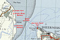 Grain-Garrison Point forts OS 7th Series map.jpg 685 × 458; 157 KB
-
 Historical map of Sutton.jpg 370 × 300; 56 KB
-
 Isle of Thanet - Rutupiae.jpg 1,200 × 804; 539 KB
-
 Mapofrocheseterenglandfromfreemanswilliamrufus1882.jpg 4,934 × 2,670; 1.95 MB
-
 Mapofrocheseterenglandfromfreemanswilliamrufus1882e.jpg 4,934 × 2,670; 1.67 MB
-
 Mappa Thaneti Insule.jpg 1,833 × 2,444; 1.41 MB
-
 Naval engagement in the Roadstead of the Downs, 1639 RCIN 722141.a.jpg 2,250 × 1,106; 1.12 MB
-
 Naval engagement in the Roadstead of the Downs, 1639 RCIN 722142.b.jpg 2,250 × 425; 442 KB
-
 New Tavern Fort OS Nat Grid map 1963.jpg 490 × 588; 137 KB
-
 Ordnance Survey 1-250000 - TR.tif 4,000 × 4,000; 856 KB
-
 OS old series 1 63360 6.jpg 6,976 × 4,655; 8.83 MB
-
 Plan of Durovernum.jpg 1,447 × 1,749; 856 KB
-
 Plan of Durovernum.png 2,893 × 3,498; 1.62 MB
-
 Print, map (BM 1912,1227.389).jpg 2,500 × 1,625; 222 KB
-
 Print, map (BM 1912,1227.390).jpg 2,500 × 1,274; 182 KB
-
 Print, map (BM 1912,1227.391 1).jpg 2,500 × 678; 213 KB
-
 Print, map (BM 1912,1227.391 2).jpg 678 × 2,500; 215 KB
-
 Print, map (BM 1912,1227.391).jpg 2,500 × 1,268; 172 KB
-
 Print, map (BM 1912,1227.392).jpg 2,500 × 1,391; 185 KB
-
 Ramsgate tunnels map.png 1,599 × 1,168; 1.36 MB
-
 Ramsgatemap1945.jpg 1,126 × 841; 682 KB
-

-
 Royal Tunbridge Wellsmap 1946.jpg 1,677 × 1,141; 1.33 MB
-
 S england railways 1840.jpg 800 × 371; 88 KB
-

-
 The Forest of Anderida during the Roman Occupation of Britain.jpg 1,500 × 1,171; 515 KB
-
 Tonbridgemap 1946.jpg 1,691 × 1,181; 1.21 MB
-
 Tunbridge wellsmap 1945.jpg 2,544 × 3,504; 2.02 MB
-
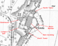 Upnor Castle OS map annotated.png 673 × 541; 245 KB
-
 Worth 20th Century Map.JPG 708 × 599; 106 KB

.jpg)
.jpg)
.jpg)


,_RP-P-OB-82.041.jpg)


.jpg)
.jpg)
.jpg)
.jpg)


.jpg)
.jpg)
.jpg)
.jpg)