Category:Old maps of Somerset
Ceremonial counties of England: Bedfordshire · Berkshire · Buckinghamshire · Cambridgeshire · Cheshire · Cornwall · Cumbria · Derbyshire · Devon · Dorset · Durham · East Riding of Yorkshire · East Sussex · Essex · Gloucestershire · Greater London · Greater Manchester · Hampshire · Herefordshire · Hertfordshire · Isle of Wight · Kent · Lancashire · Leicestershire · Lincolnshire · Norfolk · North Yorkshire · Northamptonshire · Northumberland · Nottinghamshire · Oxfordshire · Rutland · Shropshire · Somerset · South Yorkshire · Staffordshire · Suffolk · Surrey · Warwickshire · West Midlands · West Sussex · West Yorkshire · Wiltshire · Worcestershire
City-counties: Bristol · City of London
Former historic counties: Cumberland · Huntingdonshire · Middlesex · Sussex · Westmorland · Yorkshire
Other former counties:
City-counties: Bristol · City of London
Former historic counties: Cumberland · Huntingdonshire · Middlesex · Sussex · Westmorland · Yorkshire
Other former counties:
Subcategories
This category has the following 3 subcategories, out of 3 total.
- Old county maps of Somerset (17 F)
*
- Ordnance Survey 1st series 1:10560, Map of Somerset (1 P, 662 F)
B
Media in category "Old maps of Somerset"
The following 48 files are in this category, out of 48 total.
-
-

-
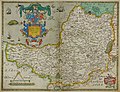
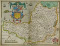
 Somerset Shire - By H. Moll Geographer - btv1b530568661.jpg 4,192 × 3,160; 2.17 MB
-
 Ordnance Survey Drawings - Cullompton (OSD 41-2).jpg 2,480 × 4,000; 4.74 MB
-
 Ordnance Survey Drawings - Lydeard, St. Lawrence (OSD 43-1).jpg 2,404 × 4,000; 3.64 MB
-
 Ordnance Survey Drawings - Taunton (OSD 44-2).jpg 2,407 × 4,000; 4.45 MB
-
 Ordnance Survey Drawings - South Petherton (OSD 52).jpg 3,849 × 4,000; 4.72 MB
-
 Ordnance Survey Drawings - Frome (OSD 59).jpg 3,062 × 5,810; 4.42 MB
-
 Ordnance Survey Drawings - Wincanton (OSD 51).jpg 4,000 × 2,873; 4.32 MB
-
 Ordnance Survey Drawings - Wick St Lawrence (OSD 47).jpg 4,186 × 5,786; 2.75 MB
-
 Ordnance Survey Drawings - Bedminster (OSD 48).jpg 4,000 × 3,089; 4.45 MB
-
 Ordnance Survey Drawings - Bath (OSD 60).jpg 4,000 × 2,708; 3.03 MB
-
 1815somersetsmall.jpg 720 × 514; 217 KB
-
 46 of 'Home Geography of England and Wales ... With ... maps, etc' (11223726854).jpg 1,284 × 2,087; 798 KB
-

-
 512 of '(The Geological Observer.)' (11041804684).jpg 1,417 × 2,376; 945 KB
-
 59 of '(A Guide to Farleigh-Hungerford, Co. Somerset.)' (11059155596).jpg 1,517 × 2,406; 606 KB
-
 96 of 'The Story of Johnstown ... Illustrated, etc' (11115382953).jpg 806 × 973; 122 KB
-

-

-

-
 Bathampton Down Somerset Map.jpg 1,042 × 688; 148 KB
-

-
 Cow Castle Somerset Map.jpg 460 × 300; 28 KB
-

-
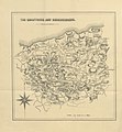
 Hundreds of Somerset.png 616 × 768; 499 KB
-
 Littledown Camp Somerset Map.jpg 945 × 490; 67 KB
-
 Minehead map 1937.jpg 467 × 469; 54 KB
-
 Mineheadmap 1937.jpg 3,504 × 2,544; 2.71 MB
-
 Montacute Castle.jpg 367 × 345; 39 KB
-
 Ordnance Survey Quarter-inch sheet 15 South West England, published 1962.jpg 9,712 × 9,031; 8.25 MB
-
 Ordnance Survey Drawings - Minehead (OSD 42-1).jpg 2,519 × 4,000; 4.59 MB
-
 Ordnance Survey Drawings - Dunster (OSD 42-2).jpg 2,512 × 4,000; 4.43 MB
-
 Ordnance Survey Drawings - Burnham on Sea (OSD 43-2).jpg 1,994 × 4,000; 2.4 MB
-
 Ordnance Survey Drawings - Milverton (OSD 44-1).jpg 2,656 × 4,000; 5.05 MB
-
 Ordnance Survey Drawings - Ilminster (OSD 46A).jpg 1,208 × 4,000; 1.2 MB
-
 Ordnance Survey Drawings - Ilminster (OSD 46B).jpg 1,048 × 4,000; 1.11 MB
-
 Ordnance Survey Drawings - Axbridge (OSD 49).jpg 5,056 × 3,747; 5.31 MB
-
 Ordnance Survey Drawings - Glastonbury (OSD 50).jpg 4,000 × 2,752; 4.77 MB
-

-
 Porlock map 1937.jpg 478 × 484; 204 KB
-
 Somerset, Pennsylvania 1900. LOC 75696540.jpg 7,464 × 5,864; 10.75 MB
-
 Somerset, Pennsylvania 1900. LOC 75696540.tif 7,464 × 5,864; 125.22 MB
-
-
-
 Stantonbury Camp Somerset Map.jpg 818 × 436; 57 KB
-
 StMichaels Hill Montacute Somerset Map.jpg 727 × 864; 111 KB
-
 The Quarterly journal of the Geological Society of London (12893755843).jpg 1,656 × 1,911; 1,018 KB
)%27_(11211330005).jpg)
.jpg)

.jpg)
.jpg)
.jpg)
.jpg)
.jpg)
.jpg)
.jpg)
.jpg)
.jpg)

.jpg)
%27_(10999098125).jpg)
%27_(11041804684).jpg)
%27_(11059155596).jpg)
.jpg)

s_Jefferys,_Geographer_to_his_Majesty_;_To_John_Baring_of..._-_btv1b53056953n_(03_of_12).jpg)
s_Jefferys,_Geographer_to_his_Majesty_;_To_John_Baring_of..._-_btv1b53056953n_(04_of_12).jpg)

.jpg)

.png)


.jpg)
.jpg)
.jpg)
.jpg)
.jpg)
.jpg)


_hec_ob_oculus_ponit_Tabula_Anno_1575_et_D_Elizabethe_Regine_Ao_17.jpg)


.jpg)
.jpg)
.jpg)