Category:Paths in Belgium
Countries of Europe: Austria · Belgium · Bulgaria · Croatia · Cyprus‡ · Czech Republic · Denmark · Estonia · Finland · France‡ · Germany · Greece · Hungary · Iceland · Republic of Ireland · Italy · Lithuania · Luxembourg · Malta · Netherlands‡ · Norway · Poland · Portugal‡ · Romania · Russia‡ · Slovakia · Slovenia · Spain‡ · Sweden · Switzerland · Ukraine · United Kingdom
‡: partly located in Europe
‡: partly located in Europe
For media related to "official" (signposted) walking routes, see the subcategory Category:Hiking trails in Belgium.
Subcategories
This category has the following 18 subcategories, out of 18 total.
- Boardwalks in Belgium (41 F)
B
- Walking paths in Bassenge (1 F)
C
G
H
J
K
- Knuppelpad Hooglatem (4 F)
R
- Remains of tram route 456 (8 F)
S
- Sentier de l'étrange (10 F)
- Sentier du Bocq (8 F)
T
- Towpaths in Belgium (5 F)
Media in category "Paths in Belgium"
The following 200 files are in this category, out of 204 total.
(previous page) (next page)-
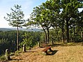
 20130505 Plateau van Caestert 04.JPG 3,968 × 2,976; 3.07 MB
-
 2017 - 31ème randonnée - Avril (33492825663).jpg 5,472 × 3,216; 10.15 MB
-
 Aardrede tussen Jabekestraat en jaagpad 2.jpg 6,016 × 4,000; 15.48 MB
-
 Aardrede tussen Jabekestraat en jaagpad.jpg 6,016 × 4,000; 17.93 MB
-
 Abdij van Tongerlo 02.jpg 5,472 × 3,648; 6.57 MB
-
 Achter Olenpad.jpg 1,296 × 1,728; 293 KB
-
 Afsnee-Keuzewandelroute.jpg 1,536 × 2,048; 456 KB
-
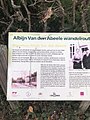 Albijn Van den Abeele wandelroute St M Latem.jpg 1,536 × 2,048; 433 KB
-
 Albijn Van den Abeele-wandelroute - Sint-Martens-Latem.jpg 3,864 × 5,152; 7.17 MB
-
 Albijn van den Abele wandelroute.jpg 960 × 960; 181 KB
-
 Alley between Dendermondsesteenweg and Lege Weg, Wetteren, 2020.jpg 5,895 × 3,919; 14.1 MB
-
 Alveringem Brouckmolenwandeling.jpg 960 × 960; 85 KB
-
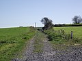
 Andenne Ohey-1.jpg 4,000 × 3,000; 3.38 MB
-
 Andenne-Ohey-2.jpg 4,000 × 2,248; 2.26 MB
-
 Andenne-Ohey-3.jpg 2,248 × 4,000; 2.5 MB
-
 Andenne-Ohey-4.jpg 4,000 × 2,248; 1.83 MB
-
 Andenne-Ohey-5.jpg 4,000 × 2,248; 2.41 MB
-
 André Demedtspad - Dentergem en Wielsbeke.jpg 1,509 × 2,169; 967 KB
-
 André Demedtspad Sint-Baafs-Vijve.jpg 1,397 × 863; 320 KB
-
 Ardooieveld wandelroute.jpg 2,048 × 1,366; 267 KB
-
 Ardooieveldwandelroute 2.jpg 2,048 × 2,048; 1,005 KB
-
 Ardooieveldwandelroute.jpg 2,048 × 1,536; 1.29 MB
-
 Arteveldewandelroute Westrozebeke.jpg 1,536 × 2,048; 415 KB
-
 Asselkouter wandelroute Munte Merelbeke.jpg 1,536 × 2,048; 442 KB
-
 Baekelandtpad.jpg 1,782 × 1,188; 147 KB
-
 Balenberg 02.jpg 1,536 × 2,048; 239 KB
-
 Balenbergwandelpad.jpg 1,536 × 2,048; 262 KB
-
 Bayehon.jpg 1,536 × 2,048; 528 KB
-
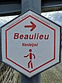 Beaulieuwandelpad Diegem 2.jpg 1,536 × 2,048; 254 KB
-
 Begin eigen baan Noordkant in Saint-Vaast.JPG 4,000 × 2,248; 1.74 MB
-
 Begin Molenweg aan Jabekestraat.jpg 6,016 × 4,000; 13.46 MB
-
 Berchembos met daslook in volle bloei.jpg 4,592 × 3,448; 5.63 MB
-
 Bevrijdingspad Vosselaar.jpg 1,536 × 2,048; 920 KB
-
 Bivakzone Koppenbergbos - Melden, Oudenaarde (DSCF9202).jpg 4,310 × 3,296; 13.59 MB
-
 Brouckmolenwandelroute.jpg 720 × 960; 95 KB
-
 Champlon-Amberloup SNCV 4.jpg 4,000 × 3,000; 3.01 MB
-
 Champlon-Amberloup SNCV 5.jpg 4,000 × 3,000; 2.28 MB
-
 Chapelle Saint-Guy - Gleixhe.jpg 2,592 × 3,872; 4.9 MB
-
 Chemin de Diependelle dans la Forêt de Soignes (DSCF7147).jpg 4,592 × 3,022; 13.57 MB
-
 Chemin numéro 26 à Vottem 2.jpg 3,716 × 2,787; 4.82 MB
-
 Chemin numéro 26 à Vottem.jpg 3,922 × 2,942; 4.68 MB
-
 Crêtes de la Warche.jpg 2,048 × 1,536; 452 KB
-
 Rièzes - Petite-Chapelle SNCV 2.jpg 4,000 × 2,248; 2.91 MB
-
 Damiaan wandelpad Tremelo.jpg 2,009 × 2,048; 672 KB
-
 De Blankaartwandelroute.jpg 2,048 × 1,536; 902 KB
-
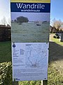 Diksmuide wandrillewandelroute.jpg 1,536 × 2,048; 424 KB
-
 Doeveren wandelroute.jpg 1,533 × 1,396; 715 KB
-
 Doeverenwandelroute.jpg 1,542 × 2,048; 539 KB
-
 Doode bemde1.jpg 2,444 × 1,661; 875 KB
-
 Doornpanne wandelpad.jpg 1,536 × 2,048; 538 KB
-
 Doornpanne wandelroute 2.jpg 720 × 960; 67 KB
-
 Doornpanne wandelroute.jpg 1,152 × 2,048; 273 KB
-
 Driekastelenwandelroute 2.jpg 970 × 2,048; 360 KB
-
 Driekastelenwandelroute.jpg 970 × 2,048; 166 KB
-
 Duinbossen.jpg 720 × 960; 78 KB
-
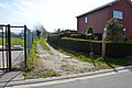
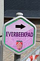 Everbeek 07.jpg 3,648 × 5,472; 5.8 MB
-
 Everbeek 14.jpg 3,648 × 5,472; 6.73 MB
-
 Everbeek 15.jpg 5,472 × 3,648; 4.8 MB
-
 Footpath in Fraiture (Sprimont) - Wallonia - Belgium.png 2,848 × 4,288; 64.16 MB
-
 SNCV Forges bos II.jpg 4,000 × 2,248; 1.91 MB
-
 SNCV Forges Bos.jpg 2,248 × 4,000; 2.36 MB
-
 Galgenveld wandelroute.jpg 1,536 × 2,048; 649 KB
-
 Galgenveldwandelroute 01.jpg 1,536 × 2,048; 531 KB
-
 Galgenveldwandelroute.jpg 1,585 × 2,048; 448 KB
-
 Geutelingenpad.jpg 2,048 × 1,536; 303 KB
-
 Gewestbos Ravels 02.jpg 2,048 × 1,365; 866 KB
-
 Gleixhe - Chateau Hautepenne.jpg 3,872 × 2,592; 2.67 MB
-
 Godendreef (DSC 3491).jpg 6,063 × 4,039; 16.14 MB
-
 GR België 01.jpg 1,944 × 1,458; 345 KB
-
 GR België 02.jpg 1,944 × 1,458; 366 KB
-
 GR België 03.jpg 1,944 × 1,458; 374 KB
-
 GR126.jpg 960 × 584; 43 KB
-
 Halvemaanroute Gijzenzele.jpg 5,472 × 3,648; 7.97 MB
-
 Ham wandelroutes.jpg 1,153 × 2,048; 218 KB
-
 Hannut buurtspoorweg 1.jpg 2,592 × 1,944; 1.06 MB
-
 Heihoekwandelpad.jpg 720 × 960; 112 KB
-
 Heirbaanwandeling.jpg 1,242 × 2,048; 271 KB
-
 Helststraat tussen Jabekestraat en jaagpad.jpg 5,809 × 3,862; 14.08 MB
-
 Henri Roselethpad Hekelgem.jpg 2,048 × 1,536; 296 KB
-
 Herenthout Bergenpad 2.jpg 2,048 × 1,518; 888 KB
-
 Herstal 86 partie sud.jpg 4,128 × 3,096; 5.55 MB
-
 Hettingenwandelroute.jpg 847 × 781; 289 KB
-
 Huy Ohey 10.jpg 2,592 × 1,944; 1.07 MB
-
 Huy Ohey 7.jpg 2,592 × 1,944; 1.03 MB
-
 Ichtegem Tijl en Nelepad.jpg 1,536 × 2,048; 322 KB
-
 Kasteelroute Herzele.jpg 2,048 × 1,366; 341 KB
-
 Kemmelberg wandelpad.jpg 1,536 × 2,048; 495 KB
-
 Klein Zwitserlandwandeling Boutersem.jpg 1,536 × 2,048; 492 KB
-
 Kleine Kluisroute Anzegem.jpg 1,536 × 2,048; 576 KB
-
 Krakkepad Veldegem.jpg 720 × 960; 99 KB
-
 Kustwandelroute Koksijde.jpg 1,152 × 2,048; 275 KB
-
 Kuurne Ezelgempad.jpg 1,536 × 2,048; 646 KB
-
 Lange Brouckeroute Oosterzele.jpg 1,293 × 1,159; 504 KB
-
 Le sentier no 1 a Gleixhe.jpg 3,872 × 2,592; 4.18 MB
-
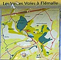 Les vertes voies de Flemalle.jpg 2,236 × 2,190; 3.77 MB
-
 Liereman 3.jpg 1,536 × 2,048; 296 KB
-
 Lijn77 Zelzate 1.jpg 2,816 × 2,112; 2.38 MB
-
 Lijn77 Zelzate 2.jpg 2,816 × 2,112; 2.59 MB
-
 Lijn85 Leupegem.jpg 800 × 600; 286 KB
-
 Malmedy 2b.jpg 1,536 × 2,048; 641 KB
-
 SNCV Marbais Tilly start voetpad.JPG 2,248 × 4,000; 1.76 MB
-
 Mariemont Splitsing.jpg 2,592 × 1,944; 430 KB
-
 Mariemont tunnel lijn 30.JPG 1,944 × 2,592; 1.34 MB
-
 Mellet SNCV route leaving the road II.JPG 2,248 × 4,000; 2.44 MB
-
 Mellet SNCV route on dike.JPG 4,000 × 2,248; 2.52 MB
-
 Mellet SNCV route turn.JPG 4,000 × 2,248; 2.76 MB
-
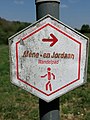 Mene- en Jordaanwandelpad.jpg 450 × 600; 54 KB
-
 Middelkerke IJzermondingwandeling.jpg 1,536 × 2,048; 270 KB
-
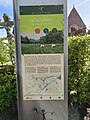
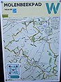
 Molenbeekpad Wetteren.jpg 1,542 × 2,048; 446 KB
-
 Molsbroek-Buylaerswandelroute.jpg 1,423 × 1,321; 654 KB
-
 Morlanwelz lijn 80 wandelroute.JPG 2,592 × 1,944; 1.87 MB
-
 Mortsel gordellijn 2.jpg 2,592 × 1,944; 1.91 MB
-
 National park Trail Nationaal Park Hoge Kempen.jpg 2,936 × 1,427; 1.46 MB
-
 Nonnenbossen wandelroute.jpg 2,048 × 1,634; 337 KB
-
 Ooidonk 02.jpg 3,648 × 5,472; 4.91 MB
-
 Ooidonk wandelroute.jpg 946 × 2,048; 229 KB
-
 Oostendse Krekenwandelroute 2.jpg 600 × 600; 101 KB
-
 Oostendse Krekenwandelroute.jpg 922 × 2,048; 402 KB
-
 Orveytwandelroute.jpg 720 × 960; 143 KB
-
 Oude kalevalleiwandelroute.jpg 1,536 × 2,048; 305 KB
-
 Pannendorpwandelroute Alveringem.jpg 640 × 1,082; 87 KB
-
 Panorama wandelroute.jpg 1,536 × 2,048; 331 KB
-
 Pays des Collines 12.jpg 3,648 × 5,472; 12.09 MB
-
 Pays des Collines 13.jpg 3,648 × 5,472; 13.97 MB
-
 Pays des Collines 14.jpg 3,648 × 5,472; 15.21 MB
-
 Polygon Wood wandelroute.jpg 593 × 395; 49 KB
-
 RAVeL 48.jpg 2,560 × 1,920; 2.8 MB
-
 René Mertenspad Essene.jpg 1,536 × 2,048; 464 KB
-
 Nmvb Vaart Merksplas (1).JPG 4,000 × 2,248; 1.7 MB
-
 Nmvb Vaart Merksplas (2).JPG 4,000 × 2,248; 1.51 MB
-
 Rocourt - Ligne 31.JPG 2,048 × 1,536; 1.29 MB
-
 Roger Raveelwandelroute.jpg 1,290 × 2,048; 459 KB
-
 Rooigemsebeekwandelroute 2.jpg 1,536 × 2,048; 426 KB
-
 Rooigemsebeekwandelroute 3.jpg 640 × 1,422; 116 KB
-
 Rooigemsebeekwandelroute.jpg 1,538 × 2,048; 419 KB
-
 Royal Golf Club Oudenaarde 07.jpg 5,472 × 3,648; 5.08 MB
-
 Rumes chemin de randonnée.JPG 2,943 × 2,482; 1.41 MB
-
 Rumes circuit du Rau-Rufaluche (2).JPG 4,896 × 2,752; 5.63 MB
-
 Rumes circuit du Rau-Rufaluche.JPG 2,752 × 4,896; 5.51 MB
-
 Rumes Rue de Clairmaie (1).JPG 2,752 × 3,771; 1.95 MB
-
 Rumes rue de la cure (3) (39328869264).jpg 3,279 × 2,428; 2.09 MB
-
 Rumes Rue de la Deroderie.JPG 2,752 × 4,896; 5.75 MB
-
 Rumes- Rue du Gros Tilleul.JPG 2,752 × 4,896; 5.46 MB
-
 Ex SNCV 90 St Vaast.JPG 4,000 × 2,248; 2.38 MB
-
 SNCV ligne 37 I.JPG 4,000 × 2,248; 1.93 MB
-
 SNCV ligne 37 II.JPG 4,000 × 2,248; 1.9 MB
-
 SNCV ligne 37 III.JPG 4,000 × 2,248; 2.09 MB
-
 St Vaast bifurcation I.JPG 4,000 × 2,248; 2.07 MB
-
 St Vaast bifurcation II.JPG 4,000 × 2,248; 2.27 MB
-
 St Vaast bifurcation III.JPG 4,000 × 2,248; 2.14 MB
-
 Vroegere tramlijn 90 pré-Ravel La louviere - Saint-Vaast.jpg 4,000 × 2,248; 2.26 MB
-
 Scherpenheuvel - Spoorlijn 30.jpg 2,048 × 1,536; 2.26 MB
-
 Schipgatwandelroute.jpg 801 × 1,159; 205 KB
-
 Sentier de l'Amour Frasnes 01.jpg 3,648 × 5,472; 4.84 MB
-
 Sentier de l'Amour Frasnes 02.jpg 3,648 × 5,472; 5.17 MB
-
 Sentier de l'Amour Frasnes 03.jpg 3,648 × 5,472; 5.01 MB
-
 Sentier de l'Amour Frasnes 04.jpg 3,648 × 5,472; 4.59 MB
-
 Slodderspook wandelroute Merendree.jpg 540 × 960; 90 KB
-
 Snaaskerkewandeling Gistel.jpg 2,048 × 1,365; 602 KB
-
 Buurtspoorlijn bij de brug in Solre.jpg 4,000 × 2,248; 2.51 MB
-
 NMVB brug over de Samber in Solre-sur-Sambre 2.jpg 4,000 × 2,248; 2.32 MB
-
 Spa Belvedere R01.jpg 3,072 × 2,304; 8.3 MB
-
 Sprinkelstraat tussen Jabekestraat en jaagpad.jpg 3,714 × 5,586; 10.87 MB
-
 Streek-GR Groene Gordel.jpg 1,289 × 1,117; 218 KB
-
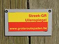 Streek-GR Uilenspiegel.jpg 1,944 × 1,458; 357 KB
-
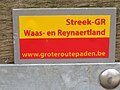 Streek-GR Waas- en Reynaertland.jpg 1,944 × 1,458; 323 KB
-
 Ter Doest wandelroute 2.jpg 2,048 × 2,016; 634 KB
-
 Ter Yde.jpg 1,536 × 2,048; 317 KB
-
 Tielt Ommegank plukwandelroute.jpg 1,536 × 2,048; 336 KB
-
 SNCV Marbais Tilly 3.JPG 4,000 × 2,248; 2.54 MB
-
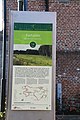
 Toeristisch infobord Gent 74.jpg 5,472 × 3,648; 6.39 MB
-
 Toeristische infoborden Lierde 05.jpg 3,648 × 5,472; 4.69 MB
-
 Toeristische infoborden Lierde 07.jpg 3,648 × 5,472; 5.63 MB
-
 Toeristische infoborden Lierde 12.jpg 3,648 × 5,472; 5.22 MB
-
 Toeristische infoborden Oostende 32.jpg 3,648 × 5,472; 5.14 MB
-
 Toeristische infoborden Oostende 33.jpg 3,648 × 5,472; 5.24 MB
-
 Toeristische infoborden Oostende 35.jpg 3,648 × 5,472; 5.54 MB
-
 Trage wegenwandelpad Peutie Houtem.jpg 1,440 × 1,800; 281 KB
-
 Tweebossenpad Brakel.jpg 2,048 × 1,365; 454 KB
-
 Ulrich Libbrechtpad 01.jpg 5,472 × 3,648; 13.88 MB
-
 Velpehoevewandeling.jpg 1,536 × 2,048; 442 KB
-
 Vichtepad Anzegem.jpg 2,048 × 1,365; 708 KB
-
 SNCV Marbais Tilly 1.JPG 2,248 × 4,000; 2.65 MB
-
 SNCV Marbais Tilly 2.JPG 4,000 × 2,248; 2.32 MB
-
 SNCV Marbais Tilly kruising.JPG 4,000 × 2,248; 2.42 MB
-
 Vlasroterswandelroute 02.jpg 1,536 × 2,048; 547 KB
-
 Vlasroterswandelroute.jpg 1,536 × 2,048; 424 KB
-
 Voylete oirbire.jpg 640 × 480; 62 KB
-
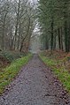
 Walking path bordered with fallen leaves in Parc naturel de l'Ardenne méridionale (DSCF6388).jpg 3,202 × 4,913; 10.56 MB
-
 Walking path in Bois d'Havré (DSC 1344).jpg 3,988 × 6,023; 18.06 MB
-
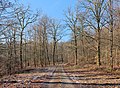
 Walking path in Parc Naturel de Gaume (DSCF7203).jpg 3,274 × 4,903; 17.63 MB
-
 Walking path in Parc naturel de Gaume (DSCF7205).jpg 4,047 × 2,953; 8.21 MB
-
 Weerdse kronkelwandelpad.jpg 720 × 960; 50 KB
-
 Wetteren Molenbeekpad.jpg 720 × 960; 78 KB
-
 Wildenburg 02.jpg 1,538 × 2,048; 430 KB
-
 Witte Burgwandelroute Koksijde.jpg 2,048 × 1,152; 384 KB
-
 Woods trail in Chiny (DSCF7131).jpg 4,804 × 3,295; 20.41 MB
-
 Zammelen.jpg 1,278 × 2,048; 1 MB
-
 Zegelsem 02.jpg 3,648 × 5,472; 4.54 MB
-
 Zegelsem 06.jpg 3,648 × 5,472; 11.31 MB

.jpg)


.jpg)


.jpg)


_-_Wallonia_-_Belgium.png)


.jpg)


.JPG)
.JPG)


.JPG)

.JPG)
_(39328869264).jpg)


.jpg)
.jpg)
.jpg)
.jpg)


.jpg)


