Category:Robert Wilkinson (cartographer)
English map maker | |||||
| Upload media | |||||
| Date of birth | unknown value unknown value | ||||
|---|---|---|---|---|---|
| Date of death | 1825 unknown value | ||||
| Work period (start) |
| ||||
| Work period (end) |
| ||||
| Country of citizenship | |||||
| Occupation | |||||
| Work location | |||||
| |||||
Pages in category "Robert Wilkinson (cartographer)"
This category contains only the following page.
Media in category "Robert Wilkinson (cartographer)"
The following 42 files are in this category, out of 42 total.
-
 SeaEst in Koeea18c.jpg 730 × 564; 283 KB
-
 1800 Wilkinson Map of the 4 Eastern Churches rectified.jpg 1,678 × 1,308; 895 KB
-
 1800 Wilkinson Map of the 4 Eastern Churches.jpg 1,802 × 1,378; 1.95 MB
-
 1808 Aleppo map Africa by Robert Wilkinson BPL 14643 detail.png 1,069 × 737; 1.77 MB
-
 1808 Dongola map Africa by Robert Wilkinson BPL 14643 detail.png 1,069 × 737; 1.77 MB
-
 1808 map of Turkey in Asia (cropped).jpg 5,633 × 4,244; 17.26 MB
-
 1808 map of Turkey in Asia.jpg 7,025 × 5,841; 30.62 MB
-
 1808 Medina map Africa by Robert Wilkinson BPL 14643 detail.png 1,069 × 737; 1.77 MB
-
 1808 Mourzouk map Africa by Robert Wilkinson BPL 14643 detail.png 1,069 × 737; 1.77 MB
-
 1808 Tombuctoo map Africa by Robert Wilkinson BPL 14643 detail.png 1,069 × 737; 1.77 MB
-
 A New Map of South America Drawn from the latest Discoveries.jpg 622 × 765; 166 KB
-

-
 Africa, including the Mediterranean (5961362258).jpg 1,688 × 2,000; 3.35 MB
-
 Atlas Classica, Robert Wilkinson, 1797.pdf 1,722 × 2,079, 65 pages; 64.16 MB
-
 Battle of Providien, 1782 RCIN 734079.jpg 2,000 × 1,569; 1.48 MB
-
 Bellum Trojanuj.jpg 6,771 × 5,415; 6.91 MB
-
 Central and southern parts of Colchis and part of Iberia.jpg 3,457 × 2,368; 6.43 MB
-
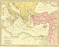
 Eslam or the countries which have professed the faith of Mahomet (7537858388).jpg 2,000 × 1,284; 2.44 MB
-
 Fawkes Hall, Lambeth (detail).jpg 1,000 × 350; 110 KB
-

-
 Iberian Peninsula antique map.jpg 2,096 × 1,700; 5.81 MB
-
 North America (2673858513).jpg 1,587 × 2,000; 2.98 MB
-
 Print, map (BM 1880,1113.3890).jpg 2,500 × 1,589; 588 KB
-

-
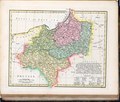 Robert Wilkinson - Prussia.pdf 13,875 × 11,808; 5.06 MB
-

-
-

-
 Robert Wilkinson, Palaestina seu Terra Sancta (FL200036813 2369177).jpg 3,233 × 4,140; 19.93 MB
-
 Robert Wilkinson, Patriarchati Orientales (FL200036696 2369176).jpg 4,145 × 3,250; 19.07 MB
-
 Robert Wilkinson, The countries travelled by the Apostles (FL200037220 2369175).jpg 4,168 × 3,259; 19.23 MB
-
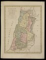
 Robert Wilkinson, The dominions of Solomon and his Allies (FL200037280 2369173).jpg 4,176 × 3,258; 18.62 MB
-

-

-
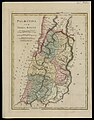
 Robert Wilkinson, The Places recorded in the Five Books of Moses (FL200037336 2369171).jpg 4,232 × 3,214; 18.18 MB
-
 Robert Wilkinson, The purveyorships in the reign of Solomon (FL200037191 2369174).jpg 3,237 × 4,186; 18.67 MB
-
 South America (4579411550).jpg 3,216 × 4,032; 5.28 MB
-
 The Islands of the East Indies with the Channels between India, China & New Holland.png 7,012 × 5,944; 49.32 MB
-
 The Kingdom of Jerusalem with Its Environs at the Time of the Crusades (1807 map).jpg 5,594 × 4,417; 3.75 MB
-

-
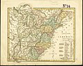 The United States of America confirmed by treaty 1783 (4231300083).jpg 2,000 × 1,585; 3.5 MB
-
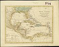 The West Indies and coast adjacent, reduced from the sheet map (4586553801).jpg 2,000 × 1,592; 2.93 MB


.jpg)


.jpg)


.jpg)


.jpg)
.jpg)

.jpg)
.jpg)
.jpg)
.jpg)
.jpg)
.jpg)
.jpg)
.jpg)
.jpg)
.jpg)
.jpg)
.jpg)

.jpg)
.jpg)
.jpg)
.jpg)
.jpg)