Category:SVG maps of Hawaii
States of the United States: Alabama · Alaska · Arizona · Arkansas · California · Colorado · Connecticut · Delaware · Florida · Georgia · Hawaii · Idaho · Illinois · Indiana · Iowa · Kansas · Kentucky · Louisiana · Maine · Maryland · Massachusetts · Michigan · Minnesota · Mississippi · Missouri · Montana · Nebraska · Nevada · New Hampshire · New Jersey · New Mexico · New York · North Carolina · North Dakota · Ohio · Oklahoma · Oregon · Pennsylvania · Rhode Island · South Carolina · South Dakota · Tennessee · Texas · Utah · Vermont · Virginia · Washington · West Virginia · Wisconsin · Wyoming – Washington, D.C.
American Samoa · Guam · Northern Mariana Islands · Puerto Rico – Navassa Island · Palmyra Atoll
American Samoa · Guam · Northern Mariana Islands · Puerto Rico – Navassa Island · Palmyra Atoll
A collection of maps of Hawaii or portions thereof in SVG format.
Subcategories
This category has the following 2 subcategories, out of 2 total.
Media in category "SVG maps of Hawaii"
The following 32 files are in this category, out of 32 total.
-
 1873 Hawaiian election for the Monarch.svg 2,213 × 1,360; 59 KB
-
 2014 Hawaii gubernatorial election results map by county.svg 1,052 × 614; 2.12 MB
-
 2018 Hawaii gubernatorial election results map by county.svg 1,052 × 614; 2.12 MB
-
 Hawaii Presidential Election Results 2012.svg 1,052 × 614; 2.12 MB
-
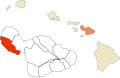
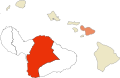
 Hawaii racial and ethnic map.svg 274 × 160; 3 KB
-
 Hawaii's constitutional ban on same-sex unions.svg 959 × 593; 88 KB
-
 HawaiiIslandDistrict-NorthKona.svg 1,400 × 1,400; 75 KB
-
 HawaiiIslandDistrict-SouthKohala.svg 1,400 × 1,400; 75 KB
-
 Historic Mokus of Maui Map (Hamakualoa).svg 758 × 490; 270 KB
-
 Historic Mokus of Maui Map (Hamakuapoko).svg 758 × 490; 270 KB
-
 Historic Mokus of Maui Map (Honuaula).svg 758 × 490; 270 KB
-
 Historic Mokus of Maui Map (Kaanapali).svg 758 × 490; 270 KB
-
 Historic Mokus of Maui Map (Kahikinui).svg 758 × 490; 270 KB
-
 Historic Mokus of Maui Map (Kaupo).svg 758 × 490; 270 KB
-
 Historic Mokus of Maui Map (Kipahulu).svg 758 × 490; 270 KB
-
 Historic Mokus of Maui Map (Koolau).svg 758 × 490; 270 KB
-
 Historic Mokus of Maui Map (Kula).svg 758 × 490; 270 KB
-
 Historic Mokus of Maui Map (Lahaina).svg 758 × 490; 270 KB
-
 Historic Mokus of Maui Map (Wailuku).svg 758 × 490; 270 KB
-

-
 Kilauea caldeira geologic map-fr.svg 1,765 × 1,110; 4.62 MB
-
 Kilauea caldeira topographic map-fr.svg 3,543 × 3,315; 2.21 MB
-
 Kilauea geological map-fr.svg 3,543 × 2,480; 3.33 MB
-
 Kilauea topographic map protected area-fr.svg 3,543 × 2,480; 5.38 MB
-
 Kilauea topographic map-fr.svg 3,543 × 2,480; 5.22 MB
-
 LGBT flag map of Hawaii.svg 1,039 × 679; 21 KB
-
 Midway Atoll map de.svg 548 × 588; 38 KB
-
 Modern Districts of Maui Map (Lahaina).svg 758 × 490; 270 KB
-
 Modern Districts of Maui Map (Makawao).svg 758 × 490; 270 KB
-
 Modern Districts of Maui Map (Wailuku).svg 758 × 490; 270 KB
-
 Pearl Harbor 1941 en.svg 595 × 575; 100 KB
-
 Superfund sites in Hawaii.svg 533 × 344; 8 KB


.svg)
.svg)
.svg)
.svg)
.svg)
.svg)
.svg)
.svg)
.svg)
.svg)
.svg)


.svg)
.svg)
.svg)

