Category:SVG maps of Maine
States of the United States: Alabama · Alaska · Arizona · Arkansas · California · Colorado · Connecticut · Delaware · Florida · Georgia · Hawaii · Idaho · Illinois · Indiana · Iowa · Kansas · Kentucky · Louisiana · Maine · Maryland · Massachusetts · Michigan · Minnesota · Mississippi · Missouri · Montana · Nebraska · Nevada · New Hampshire · New Jersey · New Mexico · New York · North Carolina · North Dakota · Ohio · Oklahoma · Oregon · Pennsylvania · Rhode Island · South Carolina · South Dakota · Tennessee · Texas · Utah · Vermont · Virginia · Washington · West Virginia · Wisconsin · Wyoming – Washington, D.C.
American Samoa · Guam · Northern Mariana Islands · Puerto Rico – Navassa Island · Palmyra Atoll
American Samoa · Guam · Northern Mariana Islands · Puerto Rico – Navassa Island · Palmyra Atoll
Subcategories
This category has only the following subcategory.
Media in category "SVG maps of Maine"
The following 19 files are in this category, out of 19 total.
-
 1972 ME 02.svg 205 × 322; 34 KB
-

-
 Blank Map of Maine.svg 790 × 1,178; 27 KB
-
 Carte administrative des Provinces Maritimes du Canada.svg 2,928 × 2,106; 900 KB
-
 Carte topographique des Provinces Maritimes du Canada.svg 2,928 × 2,106; 973 KB
-
 LGBT flag map of Maine.svg 3,252 × 4,876; 90 KB
-
 Maine 1954 Senate.svg 205 × 322; 22 KB
-
 Maine county map, cb 500k.svg 810 × 810; 41 KB
-
 Maine Gubernatorial Election Results by County, 2010.svg 205 × 322; 20 KB
-
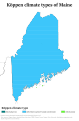 Maine Köppen.svg 945 × 1,440; 817 KB
-
 Maine Presidential Election Results by County, 2000.svg 790 × 1,178; 27 KB
-
 Maine Presidential Election Results by County, 2004.svg 790 × 1,178; 27 KB
-
 Maine racial and ethnic map.svg 205 × 322; 20 KB
-

-

-
 Map of USA ME.svg 286 × 186; 167 KB
-
 Messalonskee Lake.svg 521 × 600; 229 KB
-
 NRHP Maine Map.svg 765 × 990; 5.76 MB
-
 USA Maine relief location map.svg 820 × 1,250; 2.84 MB


