Category:SVG maps of West Virginia
States of the United States: Alabama · Alaska · Arizona · Arkansas · California · Colorado · Connecticut · Delaware · Florida · Georgia · Hawaii · Idaho · Illinois · Indiana · Iowa · Kansas · Kentucky · Louisiana · Maine · Maryland · Massachusetts · Michigan · Minnesota · Mississippi · Missouri · Montana · Nebraska · Nevada · New Hampshire · New Jersey · New Mexico · New York · North Carolina · North Dakota · Ohio · Oklahoma · Oregon · Pennsylvania · Rhode Island · South Carolina · South Dakota · Tennessee · Texas · Utah · Vermont · Virginia · Washington · West Virginia · Wisconsin · Wyoming – Washington, D.C.
American Samoa · Guam · Northern Mariana Islands · Puerto Rico – Navassa Island · Palmyra Atoll
American Samoa · Guam · Northern Mariana Islands · Puerto Rico – Navassa Island · Palmyra Atoll
A collection of maps of West Virginia or portions thereof in SVG format.
Subcategories
This category has only the following subcategory.
Media in category "SVG maps of West Virginia"
The following 42 files are in this category, out of 42 total.
-
 2020 West Virginia Attorney General Election Results.svg 810 × 719; 38 KB
-
 2020 West Virginia Treasurer Election Results.svg 810 × 719; 38 KB
-
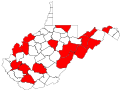
 Achalarus lyciades wv map red.svg 1,000 × 750; 177 KB
-
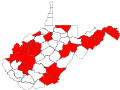
 Amblyscirtes hegon wv map red.svg 1,000 × 750; 177 KB
-
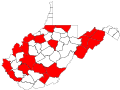
 Amblyscirtes vialis wv map red.svg 1,000 × 750; 177 KB
-
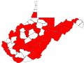
 Anatrytone logan wv map red.svg 1,000 × 750; 177 KB
-
 Ancyloxypha numitor wv map red.svg 1,000 × 750; 178 KB
-
 Atalopedes campestris wv map red.svg 1,000 × 750; 177 KB
-
 Atrytonopsis hianna wv map red.svg 1,000 × 750; 177 KB
-
 Autochton cellus wv map red.svg 1,000 × 750; 177 KB
-
 Eastern Panhandle of West Virginia Location Map.svg 1,196 × 1,026; 27.81 MB
-
 Epargyreus clarus wv map red.svg 1,000 × 750; 178 KB
-
 Erynnis brizo wv map red.svg 1,000 × 750; 177 KB
-
 Erynnis horatius wv map red.svg 1,000 × 750; 177 KB
-
 Erynnis icelus wv map red.svg 1,000 × 750; 178 KB
-
 Erynnis juvenalis wv map red.svg 1,000 × 750; 178 KB
-
 Erynnis lucilius wv map red.svg 1,000 × 750; 177 KB
-
 Erynnis martialis wv map red.svg 1,000 × 750; 177 KB
-
 Lampropeltis getula niger.svg 1,000 × 750; 177 KB
-
 LGBT flag map of West Virginia.svg 4,270 × 3,805; 55 KB
-
 Map of USA WV.svg 286 × 186; 167 KB
-
 Maryland Campaign (September 10—13, 1862) - ru.svg 1,332 × 943; 593 KB
-
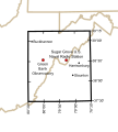 National Radio Quiet Zone.svg 679 × 753; 121 KB
-
 Raid on Chambersburg - ru.svg 1,473 × 1,549; 833 KB
-
 Romney West Virginia Location Map.svg 2,619 × 2,370; 7.26 MB
-
 US federal courts in West Virginia.svg 1,000 × 750; 197 KB
-
 USA Virginia West Virginia border location map.svg 717 × 561; 209 KB
-
 USA West Virginia location map.svg 1,201 × 1,118; 523 KB
-
 USA West Virginia relief location map.svg 1,201 × 1,118; 5.84 MB
-
 Virginia valeriae pulchra wv map red.svg 1,000 × 750; 177 KB
-
 West Virginia Counties by race (2020 census).svg 291 × 277; 20 KB
-
 West Virginia county map, cb 500k.svg 810 × 719; 33 KB
-
 West Virginia geographic map-en.svg 2,250 × 2,000; 15.67 MB
-
 West Virginia in United States (US48).svg 1,181 × 731; 2.36 MB
-
 West Virginia in United States.svg 1,181 × 731; 3.46 MB
-
 West Virginia Köppen.svg 900 × 1,152; 697 KB
-
 West Virginia racial and ethnic map.svg 290 × 276; 15 KB
-
 West Virginia Senate 2022 District Map.svg 512 × 466; 199 KB
-
 West Virginia Senate Current.svg 3,436 × 2,019; 140 KB
-
 Western Maryland Railway 1950s.svg 990 × 765; 42 KB
-
 WestVirginiaWith Counties.svg 1,000 × 750; 197 KB
-
 WV regions.svg 528 × 456; 125 KB


_-_ru.svg)


.svg)


.svg)


