Category:SVG maps of Spain
| NO WIKIDATA ID FOUND! Search for SVG maps of Spain on Wikidata | |
| Upload media |

Autonomous communities of Spain: Andalusia · Aragon · Asturias · Balearic Islands · Basque Autonomous Community · Canary Islands · Cantabria · Castile and León · Castilla–La Mancha · Catalonia · Extremadura · Galicia · Community of Madrid · Region of Murcia · Navarre · La Rioja · Valencian Community · Autonomous cities: Ceuta · Melilla
Subcategories
This category has the following 9 subcategories, out of 9 total.
!
- SVG location maps of Spain (7 F)
*
B
- SVG blank maps of Spain (15 F)
F
L
S
T
- SVG topographic maps of Spain (23 F)
Media in category "SVG maps of Spain"
The following 200 files are in this category, out of 295 total.
(previous page) (next page)-
 Comunidades autónomas de España (blank).svg 778 × 413; 888 KB
-
 Comunidades autónomas de España smn.svg 923 × 658; 462 KB
-
 Comunidades autónomas de España.svg 923 × 658; 464 KB
-
 Municipalities of Spain.svg 572 × 395; 3.04 MB
-
 Provinces of Spain-HE.svg 569 × 392; 519 KB
-
 Provinces of Spain.svg 569 × 392; 519 KB
-
 مقاطعات إسبانيا.svg 569 × 392; 519 KB
-
 España-Canarias-loc.svg 512 × 462; 919 KB
-
 Spain complete location map.svg 512 × 462; 1.04 MB
-
 Alar del Rey mapa municipal.svg 778 × 413; 374 KB
-
 Alava - Mapa municipal.svg 778 × 413; 136 KB
-
 Alava y Treviño - Mapa municipal.svg 778 × 413; 149 KB
-
 Albacete-loc.svg 512 × 473; 301 KB
-
 Albacete - Mapa municipal.svg 778 × 413; 229 KB
-
 Alicante-loc.svg 2,134 × 2,157; 275 KB
-
 Alicante - Mapa municipal.svg 387 × 397; 229 KB
-
 Almeria - Mapa municipal.svg 778 × 413; 225 KB
-
 Ao en e svog.svg 1,705 × 1,185; 572 KB
-
 Astorga-loc.svg 512 × 297; 489 KB
-
 Autonomies, provinces and municipalities of Spain.svg 1,488 × 1,052; 9.41 MB
-
 Autonomous communities of Spain-HAM.svg 700 × 643; 651 KB
-
 AVE map.svg 884 × 884; 343 KB
-
 Ávila-loc.svg 512 × 459; 521 KB
-
 Aytos palencia.svg 596 × 841; 3.11 MB
-
 Aŭtonomaj komunumoj de Hispanio.svg 923 × 658; 324 KB
-
 Badajoz-loc.svg 512 × 386; 373 KB
-
 Badajoz - Mapa municipal.svg 778 × 413; 492 KB
-
 Baixo Miño County in Pontevedra Province-gl.svg 736 × 499; 147 KB
-
 Bajo Miño County in Pontevedra Province-es.svg 736 × 499; 147 KB
-
 Blank Map-Alboran.svg 1,052 × 744; 11 KB
-
 Burgos-loc.svg 512 × 643; 661 KB
-
 Término municipal de Villadiego.svg 978 × 744; 3.38 MB
-
 Burgos - Mapa municipal.svg 310 × 400; 390 KB
-
 Burgos Alava Treviño location map.svg 614 × 642; 172 KB
-
 Burgos Capital - Mapa municipal.svg 310 × 400; 390 KB
-
 Caceres - Mapa municipal.svg 778 × 413; 561 KB
-
 Cadiz - Mapa municipal.svg 406 × 386; 131 KB
-
 Caldas County in Pontevedra Province-es.svg 736 × 499; 144 KB
-
 Caldas County in Pontevedra Province-gl.svg 736 × 499; 144 KB
-
 Califato de Córdoba - 1000-en.svg 686 × 594; 339 KB
-
 Califato de Córdoba - 1000-zh-hans.svg 686 × 594; 279 KB
-
 CampañaGraco Interior peninsular.svg 745 × 1,272; 419 KB
-
 Carreteras de España - A-12.svg 512 × 407; 3.66 MB
-
 Carreteras de Martos.svg 512 × 387; 542 KB
-
 Castellon - Mapa municipal.svg 420 × 388; 259 KB
-
 Castellón-loc.svg 2,259 × 2,265; 250 KB
-
 Castilla loc.svg 690 × 521; 669 KB
-
 Centros de acción sobre España.svg 640 × 514; 442 KB
-
 Ciudad Real-loc.svg 512 × 354; 351 KB
-
 Ciudad Real - Mapa municipal.svg 778 × 413; 319 KB
-
 Collazos de Boedo Mapa municipal.svg 778 × 413; 381 KB
-
 Comarca Cerrato (Palencia).svg 255 × 387; 234 KB
-
 Comarca de Alfoz de Toro (Provincia de Zamora, España).svg 778 × 413; 444 KB
-
 Comarca de Aliste (Provincia de Zamora, España).svg 778 × 413; 448 KB
-
 Comarca de Benavente y Los Valles (Provincia de Zamora, España).svg 778 × 413; 450 KB
-
 Comarca de la Guareña (Provincia de Zamora, España).svg 778 × 413; 444 KB
-
 Comarca de la Tierra del Pan (Zamora, España).svg 778 × 413; 440 KB
-
 Comarca de la Tierra del Vino (Provincia de Zamora, España).svg 778 × 413; 444 KB
-
 Comarca de la Tierra del Vino 1(Provincia de Zamora, España).svg 778 × 413; 444 KB
-
 Comarca de Sanabria (Provincia de Zamora, España).svg 778 × 413; 440 KB
-
 Comarca de Sayago 1(Provincia de Zamora, España).svg 778 × 413; 440 KB
-
 Comarca de Tierra de Alba (Provincia de Zamora, España).svg 778 × 413; 450 KB
-
 Comarca de Tierra de Campos (Provincia de Zamora, España).svg 778 × 413; 443 KB
-
 Comarca de Tierra de Tábara (Provincia de Zamora, España).svg 778 × 413; 450 KB
-
 Comarca Montaña (Palencia).svg 255 × 387; 234 KB
-
 Comarca Paramos-Valles (Palencia).svg 255 × 387; 234 KB
-
 Comarca Tierra de campos (Palencia).svg 255 × 387; 234 KB
-
 Comarcas administrativas de la Provincia de Palencia (España).svg 350 × 390; 240 KB
-
 Comarcas de la Provincia de Zamora 1(España).svg 778 × 413; 451 KB
-
 Comarcas naturales palencia.svg 744 × 1,052; 73 KB
-
 Comunidades autónomas de España-fr.svg 923 × 658; 462 KB
-
 Comunidaes autónomes d'España.svg 923 × 658; 464 KB
-
 Comunitats autònomes d'Espanya he.svg 644 × 458; 493 KB
-
 Condado County in Pontevedra Province-es.svg 736 × 499; 143 KB
-
 Condado County in Pontevedra Province-gl.svg 736 × 499; 144 KB
-
 Cordoba - Mapa municipal.svg 778 × 413; 273 KB
-
 La Coruña-loc.svg 512 × 527; 399 KB
-
 COVID-19 Cases in Spain per Capita by Community.svg 2,667 × 1,935; 895 KB
-
 Cuenca-loc.svg 512 × 455; 398 KB
-
 Cuenca - Mapa municipal.svg 420 × 400; 477 KB
-
 Cuenca Beteta Mapa municipal.svg 420 × 400; 483 KB
-
 Cuenca Chumillas Mapa municipal.svg 420 × 400; 478 KB
-
 Cuenca LasValeras Mapa municipal.svg 420 × 400; 478 KB
-
 Cuenca OlmedadelRey Mapa municipal.svg 420 × 400; 477 KB
-
 Cuenca OlmedaDelReyDehesadeFuenlabrada Mapa municipal.svg 420 × 400; 479 KB
-
 Cáceres-loc.svg 512 × 373; 378 KB
-
 Cádiz-loc.svg 512 × 580; 338 KB
-
 Córdoba-loc.svg 512 × 655; 345 KB
-
 Dehesa in Spain and Portugal.svg 1,140 × 855; 555 KB
-
 Demarcacion por cable en España.svg 467 × 374; 643 KB
-
 Deza County in Pontevedra Province-es.svg 736 × 499; 143 KB
-
 Deza County in Pontevedra Province-gl.svg 736 × 499; 146 KB
-
 Distribuciones GNU Linux de Espana.svg 744 × 1,052; 253 KB
-
 DO Cava locator map.svg 800 × 600; 2.5 MB
-
 DO Ribera del Guadiana locator map.svg 800 × 600; 8.51 MB
-
 DO Rueda locator map.svg 800 × 600; 2.69 MB
-
 Eleiciones rexonalistes y nacionalistes.svg 700 × 643; 537 KB
-
 Empuriabrava map.svg 873 × 893; 868 KB
-
 Erdialdeko sistema.svg 819 × 622; 677 KB
-
 Espainiako Erliebea1.svg 935 × 609; 617 KB
-
 España Finales Del XVIII.svg 1,154 × 1,044; 187 KB
-
 Espinosa de Villagonzalo- Mapa municipal.svg 778 × 413; 374 KB
-
 Extremadura-loc.svg 512 × 552; 530 KB
-
 Spain Extremadura location map.svg 512 × 552; 465 KB
-
 Ferrocarril urbano en España.svg 512 × 413; 1.01 MB
-
 Galicia-loc.svg 512 × 553; 602 KB
-
 Spain Galicia location map.svg 512 × 553; 576 KB
-
 Gerona-loc.svg 3,037 × 2,192; 351 KB
-
 Gerona - Mapa municipal.svg 550 × 394; 187 KB
-
 Gomera map.svg 936 × 708; 52 KB
-
 Granada - Mapa municipal.svg 480 × 380; 442 KB
-
 Guadalaja - Mapa municipal.svg 778 × 413; 506 KB
-
 Guadalajara-loc.svg 512 × 390; 435 KB
-
 Guipúzcoa-loc.svg 512 × 388; 161 KB
-
 Herrera de Pisuerga mapa municipal.svg 778 × 413; 392 KB
-
 Hierro map.svg 909 × 726; 44 KB
-
 Hispania roads-pt.svg 707 × 559; 76 KB
-
 Hispania roads.svg 707 × 559; 80 KB
-
 Huelva - Mapa municipal.svg 778 × 413; 238 KB
-
 Huesca-loc.svg 512 × 634; 686 KB
-
 IBERIA (freehand map).svg 512 × 289; 152 KB
-
 Iberia sry2627 map.svg 1,183 × 1,015; 839 KB
-
 Iberian Peninsula location map.svg 1,184 × 1,016; 413 KB
-
 Kastilien heute.svg 800 × 643; 310 KB
-
 La Almarcha map.svg 767 × 494; 26 KB
-
 La Coruna - Mapa municipal.svg 450 × 415; 379 KB
-
 La Vid de Ojeda Mapa municipal.svg 778 × 413; 374 KB
-
 Larráun-loc.svg 512 × 576; 1.09 MB
-
 Lerida - Mapa municipal.svg 778 × 413; 495 KB
-
 Localització de Communidad Vasca.svg 686 × 518; 501 KB
-
 Localització de Regiòn de Murcia.svg 686 × 518; 501 KB
-
 Localització del Carxe a la Regió de Múrcia.svg 1,052 × 1,052; 299 KB
-
 Localización de la parroquia de Pedrafita (Guitiriz, Lugo).svg 710 × 857; 1.43 MB
-
 Localización de la provincia de Palencia-2.svg 424 × 358; 516 KB
-
 LocAlmería.svg 512 × 559; 300 KB
-
 Locator map of Spain.svg 680 × 520; 657 KB
-
 Lugo-loc.svg 512 × 764; 314 KB
-
 Lugo - Mapa municipal.svg 300 × 400; 135 KB
-
 Lérida-loc 3.svg 512 × 665; 386 KB
-
 Lérida-loc.svg 512 × 665; 378 KB
-
 Spain Lleida localion map.svg 512 × 665; 386 KB
-
 Madrid-loc.svg 512 × 553; 239 KB
-
 Malaga - Mapa municipal.svg 778 × 413; 223 KB
-
 Map Almanzor campaigns-es.svg 720 × 571; 99 KB
-
 Map Almanzor campaigns-hu.svg 720 × 571; 103 KB
-
 Map Almanzor campaigns-pt.svg 720 × 571; 103 KB
-
 Map Iberian Peninsula 750-en a.svg 827 × 574; 181 KB
-
 Map Iberian Peninsula 750-en.svg 827 × 574; 91 KB
-
 Map Iberian Peninsula 750-hu.svg 827 × 574; 88 KB
-
 Map of the Canary Islands-smn.svg 3,152 × 1,400; 829 KB
-
 Mapa Autonómico Cs.svg 536 × 389; 382 KB
-
 Mapa autonómico IU.svg 536 × 389; 382 KB
-
 Mapa autonómico Podemos.svg 536 × 389; 382 KB
-
 Mapa autonómico PP.svg 536 × 389; 382 KB
-
 Mapa autonómico PSOE.svg 536 × 389; 382 KB
-
 Mapa autonómico Vox.svg 536 × 389; 382 KB
-
 Mapa comarcal de España (vers. 2021-12-16).svg 512 × 512; 455 KB
-
 Mapa comarcal de España (vers. 2022-09-19).svg 512 × 512; 1.59 MB
-
 Mapa comarcal de España (vers. 2022-09-29) Comarca El Bierzo.svg 512 × 512; 1.79 MB
-
 Mapa comarcal de España (vers. 2022-09-29).svg 512 × 512; 1.79 MB
-
 Mapa de la Franja de Ponent(1).svg 853 × 3,020; 120 KB
-
 Mapa de la Franja de Ponent.svg 853 × 3,020; 122 KB
-
 Mapa de las Diócesis de España.svg 1,285 × 822; 1.26 MB
-
 Mapa de peligrosidad sísmica de España.svg 1,184 × 1,016; 836 KB
-
 Mapa España Rugby B.svg 732 × 553; 503 KB
-
 Mapa municipal Cascajares de la Sierra.svg 310 × 400; 767 KB
-
 Mapa reconquiesta almuades.svg 474 × 368; 90 KB
-
 Mapa reconquista almohades-en.svg 474 × 368; 42 KB
-
 Mapa reconquista almohades.svg 474 × 368; 42 KB
-
 Matrimonios homosexuales en España 2008.svg 700 × 643; 483 KB
-
 Morrazo County in Pontevedra Province-es.svg 736 × 499; 144 KB
-
 Morrazo County in Pontevedra Province-gl.svg 736 × 499; 144 KB
-
 Municipios d'A Riocha que mugan con Aragón.svg 512 × 352; 178 KB
-
 Municipios d'os Altos Pireneus que mugan con Aragón.svg 675 × 881; 245 KB
-
 Municipios d'os Pireneus Atlanticos mugants con Aragón.svg 1,045 × 691; 1.87 MB
-
 Municipios de Castellón que mugan con Aragón.svg 2,259 × 2,265; 176 KB
-
 Municipios de Cuenca que mugan con Aragón.svg 512 × 455; 218 KB
-
 Municipios de Guadalachara que mugan con Aragón.svg 512 × 390; 318 KB
-
 Municipios de Leida que mugan con Aragón.svg 512 × 665; 301 KB
-
 Municipios de Soria que mugan con Aragón.svg 512 × 441; 206 KB
-
 Munpropob.svg 953 × 542; 781 KB
-
 Murcia-loc.svg 512 × 562; 86 KB
-
 Spain Murcia location map.svg 512 × 562; 87 KB
-
 Murcia - Mapa municipal.svg 377 × 396; 110 KB
-
 North and south of the Pyrenees (Year 760).svg 549 × 478; 205 KB
-
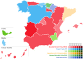
 November 2019 Spanish general election - Simple Results.svg 536 × 389; 768 KB
-
-
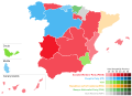 November 2019 Spanish general election - Vote Strength by Community.svg 536 × 389; 488 KB
-
 November 2019 Spanish general election - Vote Strength.svg 536 × 389; 899 KB
-
 Nuclear power plants map Spain-es.svg 811 × 633; 548 KB
-
 Nuclear power plants map Spain-fr.svg 811 × 633; 548 KB
-
 Orense-loc.svg 512 × 352; 311 KB
-
 Orense - Mapa municipal.svg 550 × 400; 141 KB
-
 Otras ubicaciones de Alce.svg 924 × 762; 347 KB
-
 Palencia-loc.svg 512 × 717; 461 KB
-
 Palencia - Mapa municipal.svg 778 × 413; 349 KB
-
 Paradanta County in Pontevedra Province-es.svg 736 × 499; 144 KB
-
 Paradanta County in Pontevedra Province-gl.svg 736 × 499; 144 KB
-
 Países nabarrés aragonés aranés e catalans.svg 811 × 795; 8.99 MB
-
 Personas por diputado en España.svg 467 × 374; 580 KB


.svg)
.svg)
.svg)
.svg)
.svg)
.svg)
.svg)
.svg)
.svg)
.svg)
.svg)
.svg)
.svg)
.svg)
.svg)
.svg)
.svg)
.svg)


.svg)


.svg)


.svg)
.svg)
_Comarca_El_Bierzo.svg)
.svg)


.svg)


.svg)
.svg)