Category:SVG maps of the history of Poland

Subcategories
This category has only the following subcategory.
P
Media in category "SVG maps of the history of Poland"
The following 74 files are in this category, out of 74 total.
-
 Teutonic Order 1466-es.svg 1,210 × 1,053; 1.79 MB
-
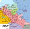
 Polish-Lithuanian Commonwealth at its maximum extent.svg 1,410 × 1,109; 197 KB
-
 Church in poland 12-13c.svg 742 × 651; 3.35 MB
-
 Curzon line fi.svg 563 × 513; 135 KB
-
 Europa Jagellonica.svg 517 × 457; 503 KB
-
 Grand Duchy of Lithuania 1462 within modern boundaries-en.svg 1,152 × 1,028; 792 KB
-
 Katyn massacres 1940 map-de.svg 1,053 × 825; 191 KB
-
 Lemko Republic in Poland cropped-es.svg 637 × 355; 411 KB
-
 Lemko Republic in Poland cropped.svg 637 × 355; 412 KB
-
 Lemko Republic in Poland.svg 1,042 × 1,058; 406 KB
-
 Panstwo mieclawa-es.svg 14,016 × 11,345; 5.08 MB
-
 Panstwo mieclawa.svg 700 × 567; 3.3 MB
-
 Państwo wczesnopiatowskie-es.svg 1,521 × 2,000; 535 KB
-
 Państwo wczesnopiatowskie.svg 430 × 567; 608 KB
-
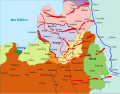
 PBW August 1920-es.svg 2,014 × 1,567; 1.33 MB
-
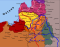
 PBW December 1919-es.svg 2,014 × 1,567; 1.35 MB
-
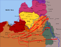
 PBW June 1920-es.svg 2,014 × 1,567; 1.36 MB
-
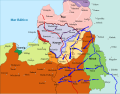
 PBW March 1919-es.svg 2,014 × 1,567; 1.3 MB
-
 PBW March 1919.svg 2,014 × 1,567; 441 KB
-
 PL-RU war 1919 phase I-es.svg 5,416 × 4,237; 288 KB
-
 PL-RU war 1919 phase I.svg 5,416 × 4,237; 381 KB
-
 PL-RU war 1919 phase II de.svg 2,705 × 2,112; 897 KB
-
 PL-RU war 1919 phase II-es.svg 5,416 × 4,237; 315 KB
-
 PL-RU war 1919 phase II.svg 5,416 × 4,237; 411 KB
-
 PL-RU war 1919 phase III-es.svg 5,416 × 4,237; 297 KB
-
 PL-RU war 1919 phase III.svg 5,416 × 4,237; 392 KB
-
 Plemiona polskie-es.svg 747 × 615; 595 KB
-
 Plemiona polskie.svg 700 × 576; 138 KB
-
 Poland 1956-1990.svg 450 × 456; 474 KB
-
 Poland and Lithuania in 1526-es.svg 1,408 × 1,122; 1.08 MB
-
 Polish and Lithuanian Conflict with Prussia. 1377-1435 - it.svg 599 × 517; 1.47 MB
-
 Polish and Lithuanian Conflict with Prussia. 1377-1435-es.svg 341 × 286; 1.86 MB
-
 Polish Government in exile territorial claims.svg 450 × 456; 514 KB
-
 Polish-Lithuanian Commonwealth (1619)-es.svg 1,410 × 1,109; 154 KB
-
 Polish-Lithuanian Commonwealth 1582-es.svg 1,408 × 1,118; 1.18 MB
-
 Polish-Lithuanian Commonwealth at its maximum extent-es.svg 1,410 × 1,109; 147 KB
-
 Polish-Lithuanian Commonwealth in 1648-es.svg 1,406 × 1,124; 1.5 MB
-
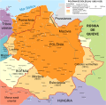
 Pologne-16-18.svg 1,494 × 2,124; 369 KB
-
 PoloniaDeEntreguerras.svg 1,084 × 1,096; 2.2 MB
-
 Polska 1333 - 1370-es.svg 2,962 × 2,817; 3.76 MB
-
 Polska 1370 - 1382-es.svg 2,962 × 2,817; 3.62 MB
-
 Polska 1370 - 1382-it.svg 2,962 × 2,817; 3.58 MB
-
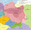
 Polska 1773 i zabory - mapa lokalizacyjna.svg 1,900 × 1,839; 737 KB
-
 Polska 1794 i zabory - mapa lokalizacyjna.svg 1,900 × 1,839; 730 KB
-
 Polska 1796 i zabory - mapa lokalizacyjna.svg 1,900 × 1,839; 727 KB
-
 Polska 960 - 992-es.svg 11,510 × 11,360; 2.5 MB
-
 Polska 960 - 992.svg 11,510 × 11,360; 2.37 MB
-
 Polska 992 - 1025-es.svg 11,510 × 11,360; 2.55 MB
-
 Polska 992 - 1025-pt.svg 12,277 × 12,117; 2.19 MB
-
 Polska 992 - 1025.svg 1,500 × 1,480; 2.38 MB
-
 Polska WladLokietka (1275-1300) es.svg 1,187 × 1,039; 1.55 MB
-
 Polska WladLokietka (1275-1300) hu.svg 1,187 × 1,039; 1.42 MB
-
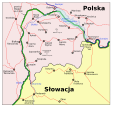 Polski Spisz 1.svg 656 × 625; 152 KB
-
 Prussia during the Second Northern War--1654-es.svg 506 × 365; 556 KB
-
 Prussia during the Second Northern War--Königsberg1656-es.svg 506 × 365; 605 KB
-
 Prussia during the Second Northern War--Labiau1656-es.svg 506 × 365; 555 KB
-
 Prussia during the Second Northern War--Wehlau-Bromberg1657-es.svg 506 × 365; 561 KB
-
 Церковь в Польше XII-XIII векe.svg 742 × 651; 3.14 MB
-
 RepúblicaDeLasDosNaciones1569-es.svg 1,408 × 1,122; 1.24 MB
-
 Rzeczpospolita 1937 noname.svg 2,014 × 1,567; 199 KB
-
 Stany Zjednoczone Polski.svg 2,422 × 2,228; 530 KB
-
 Territorial changes of Poland 1655-es.svg 1,409 × 1,124; 1.29 MB
-
 Truce of Andrusovo 1667-es.svg 1,407 × 1,119; 1.42 MB
-
 Truce of Deulino 1618-1619-es.svg 1,500 × 1,193; 6.13 MB
-
 Truce of Jam Zapolski 1582-es.svg 1,408 × 1,118; 1.2 MB
-
 Warmia i mazury-es.svg 777 × 784; 763 KB
-
 Warsaw 1920 battlefield.svg 1,432 × 796; 1.04 MB
-
 West slavs 9th-10th c.2-es.svg 1,454 × 1,092; 897 KB
-
 Wielkopolska.svg 744 × 1,000; 654 KB
-
 ZCZW okręg brzeski map.svg 750 × 829; 28 KB
-
 ZCZW okręg miński map.svg 750 × 829; 28 KB
-
 ZCZW okręg wileński map.svg 750 × 829; 28 KB
-
 ZCZWiFP okręg podolski map.svg 750 × 920; 20 KB
-
 ZCZWiFP okręg wołyński map.svg 750 × 920; 20 KB


-es.svg)


_es.svg)
_hu.svg)


