Category:St Bartholomew's, Haslemere
| Object location | | View all coordinates using: OpenStreetMap |
|---|
church building in Haslemere, Waverley, Surrey, UK _(1).JPG) | |||||
| Upload media | |||||
| Instance of | |||||
|---|---|---|---|---|---|
| Location | Haslemere, Waverley, Surrey, South East England, England | ||||
| Diocese | |||||
| Has part(s) |
| ||||
| Heritage designation |
| ||||
| Religion or worldview | |||||
 | |||||
Subcategories
This category has the following 3 subcategories, out of 3 total.
Media in category "St Bartholomew's, Haslemere"
The following 28 files are in this category, out of 28 total.
-
 Entrance to St Bartholomew's, Haslemere - geograph.org.uk - 646080.jpg 640 × 480; 100 KB
-

-
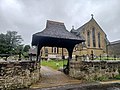
 Lych gate of St. Bartholomew's Church, Haslemere 02.jpg 3,000 × 4,000; 3.57 MB
-
 Lych gate of St. Bartholomew's Church, Haslemere 03.jpg 4,000 × 3,000; 3.31 MB
-
 Porch at St Bartholomew's - geograph.org.uk - 646070.jpg 640 × 480; 98 KB
-
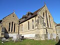
 Rear view of St Bartholomew's - geograph.org.uk - 646043.jpg 640 × 480; 65 KB
-
 St Bartholomew's Church - geograph.org.uk - 2074410.jpg 640 × 430; 129 KB
-
 St Bartholomew's Church - geograph.org.uk - 2074413.jpg 640 × 430; 129 KB
-
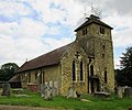
 St Bartholomew's Church - geograph.org.uk - 21397.jpg 640 × 480; 108 KB
-
 St Bartholomew's Church Hall - geograph.org.uk - 646179.jpg 640 × 480; 47 KB
-
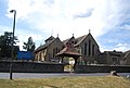
 St Bartholomew's Church, Church Lane, Haslemere (June 2015) (1).JPG 2,800 × 2,400; 1.39 MB
-
 St Bartholomew's Church, Church Lane, Haslemere (June 2015) (2).JPG 3,200 × 2,800; 1.75 MB
-
 St Bartholomew's Church, Church Lane, Haslemere (June 2015) (3).JPG 3,600 × 3,000; 2.25 MB
-
 St Bartholomew's Church, Church Lane, Haslemere (June 2015) (4).JPG 3,400 × 3,000; 1.67 MB
-
 St Bartholomew's Church, Church Lane, Haslemere (June 2015) (5).JPG 4,200 × 2,800; 1.89 MB
-
 St Bartholomew's Church, Church Lane, Haslemere (June 2015) (6).JPG 4,200 × 3,000; 2.19 MB
-
 St Bartholomew's Church, Church Lane, Haslemere (June 2015) (7).JPG 4,600 × 3,400; 3.41 MB
-
 St Bartholomew's Church, Haslemere (geograph 3038382).jpg 640 × 480; 87 KB
-
 St Bartholomew's Church, Haslemere 02.jpg 5,152 × 3,864; 4.32 MB
-
 St Bartholomew's Church, Haslemere 03.jpg 5,152 × 3,864; 4.19 MB
-
 St Bartholomew's Church, Haslemere 05.jpg 5,152 × 3,864; 4.21 MB
-
 St Bartholomew's Church, Haslemere 07.jpg 5,152 × 3,864; 4.4 MB
-
 St Bartholomew's Church, Haslemere 08.jpg 3,864 × 5,152; 4.38 MB
-
 St Bartholomew's Church, Haslemere 15.jpg 5,152 × 3,864; 4.39 MB
-
 St Bartholomew's Church, Haslemere 16.jpg 5,152 × 3,864; 4.31 MB
-
 St Bartholomew's Church, Haslemere 17.jpg 5,152 × 3,864; 4.39 MB
-
 St Bartholomew's Church, Haslemere 18.jpg 5,152 × 3,864; 4.32 MB
-
 St Bartholomew's Rectory - geograph.org.uk - 646134.jpg 640 × 480; 75 KB


_(2).JPG)
_(3).JPG)
_(4).JPG)
_(5).JPG)
_(6).JPG)
_(7).JPG)
.jpg)


