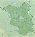
Category:Topographic maps of Brandenburg
Federal states of Germany:
Media in category "Topographic maps of Brandenburg"
The following 22 files are in this category, out of 22 total.
-
Barnimteltow um 1250.png 1,807 × 1,414; 135 KB
-
Barnimteltow um 1250p.jpg 1,807 × 1,414; 576 KB
-
Brandenburg in Germany (relief) (shade) (special marker).svg 1,073 × 1,272; 6.54 MB
-
Brandenburg in Germany (relief) (shade).svg 1,073 × 1,272; 6.52 MB
-
Brandenburg in Germany (relief).svg 1,073 × 1,272; 6.53 MB
-
Brandenburg Landschaften.png 999 × 986; 1.14 MB
-
Brandenburg relief location map.jpg 1,578 × 1,661; 794 KB
-
Brandenburg relief location map.png 1,578 × 1,661; 2.89 MB
-
Fichkona map.png 1,200 × 1,490; 1.19 MB
-
Gamengrund Reliefkarte.png 3,147 × 8,344; 756 KB
-
Gamengrund Süd.png 3,147 × 4,096; 435 KB
-
Genaue Lage der ehemaligen Elstermühle Postberga.jpg 1,728 × 2,228; 1.46 MB
-
Gotischer Backstein um Nord- & südliche Ostsee.png 5,248 × 2,250; 11.33 MB
-
Havelland FHSW.gif 1,035 × 781; 129 KB
-
Karte Hoher Barnim.jpg 1,280 × 720; 153 KB
-
Lange diercke sachsen deutsche landschaften bruchlandschaft.jpg 1,254 × 1,019; 811 KB
-
Luche FHSW.gif 811 × 459; 61 KB
-
Rotes Luch.gif 1,062 × 743; 135 KB
-
Rotes Luch.png 1,062 × 743; 133 KB
-
TK25 Germany 1952 Schlepzig 3949 Third Edition-AMS.jpg 11,536 × 8,738; 14.86 MB
-
Uebersicht Brandenburg.png 1,315 × 1,518; 367 KB


