Category:Topographic maps of Mecklenburg-Vorpommern
Federal states of Germany:
Media in category "Topographic maps of Mecklenburg-Vorpommern"
The following 17 files are in this category, out of 17 total.
-
Fichkona map.png 1,200 × 1,490; 1.19 MB
-
Gotischer Backstein um Nord- & südliche Ostsee.png 5,248 × 2,250; 11.33 MB
-
Karte des Deutschen Reichs (Vogel) - Section 08 - Schwerin.png 4,980 × 4,170; 11.81 MB
-
Kühlung LRO.png 1,876 × 1,589; 184 KB
-
Lange diercke sachsen deutschland bodenverhaeltnisse 2 (Mecklenburg).jpg 858 × 674; 316 KB
-
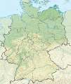
Mecklenburg-Vorpommern in Germany (relief) (shade) (special marker).svg 1,073 × 1,272; 6.58 MB
-
Mecklenburg-Vorpommern in Germany (relief) (shade).svg 1,073 × 1,272; 6.52 MB
-
Mecklenburg-Vorpommern in Germany (relief).svg 1,073 × 1,272; 6.53 MB
-
Mecklenburg-Vorpommern Relief Kreise Namen Grenze.png 1,744 × 1,197; 1.67 MB
-
Mecklenburg-Vorpommern relief location map.jpg 1,744 × 1,197; 504 KB
-
Mecklenburg-Vorpommern relief location map.png 1,744 × 1,197; 1.62 MB
-
Mecklenburg-Vorpommern.gif 1,562 × 1,190; 360 KB
-
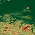
MeckPommPeene minus 5.jpg 696 × 696; 324 KB
-
MeckPommPeene.jpg 696 × 696; 367 KB
-
Recknitz.png 1,413 × 2,238; 2.95 MB
-
Vorpommern physisch.png 951 × 1,051; 175 KB


