Category:Topographic maps of Germany
Countries of Europe: Albania · Andorra · Armenia‡ · Austria · Azerbaijan‡ · Belarus · Belgium · Bosnia and Herzegovina · Bulgaria · Croatia · Cyprus‡ · Czech Republic · Denmark · Estonia · Finland · France‡ · Georgia‡ · Germany · Greece · Hungary · Iceland · Republic of Ireland · Italy · Kazakhstan‡ · Latvia · Liechtenstein · Lithuania · Luxembourg · Malta · Moldova · Monaco · Montenegro · Netherlands‡ · North Macedonia · Norway · Poland · Portugal‡ · Romania · Russia‡ · San Marino · Serbia · Slovakia · Slovenia · Spain‡ · Sweden · Switzerland · Turkey‡ · Ukraine · United Kingdom
Specific status: Faroe Islands · Isle of Man · Svalbard – Limited recognition: Kosovo
‡: partly located in Europe
Specific status: Faroe Islands · Isle of Man · Svalbard – Limited recognition: Kosovo
‡: partly located in Europe
Subcategories
This category has the following 13 subcategories, out of 13 total.
Media in category "Topographic maps of Germany"
The following 61 files are in this category, out of 61 total.
-
 After Action Report - Bonn - NARA - 100384907.jpg 12,613 × 8,848; 32.38 MB
-
 After Action Report - Branau - NARA - 100384927.jpg 10,724 × 7,793; 9.93 MB
-
 After Action Report - Freiburg - NARA - 100384909.jpg 10,766 × 7,776; 22.27 MB
-
 After Action Report - Fulda - NARA - 100384481 (page 1).jpg 10,530 × 8,492; 22.46 MB
-
 After Action Report - Hersfeld - NARA - 100384484 (page 1).jpg 10,589 × 8,800; 25.03 MB
-
 After Action Report - Köln - NARA - 100384913.jpg 12,934 × 8,228; 27.93 MB
-
 Allemagne carte générale.png 1,979 × 2,521; 7.05 MB
-
 Aller Flusssystem topo.png 1,974 × 2,703; 7.54 MB
-

-
 Berchtesgadener Alpen.png 3,493 × 3,413; 2.52 MB
-
 Deutschland topo cropped.jpg 2,011 × 1,760; 1.04 MB
-
 Deutschland topo.jpg 2,011 × 2,654; 1.76 MB
-
 Deutschland topo.png 2,000 × 2,410; 6.11 MB
-
 Deutschland Übersichtskarte.png 1,979 × 2,518; 7.01 MB
-
 Deutschland-Karte.jpg 1,500 × 2,083; 3.67 MB
-
 Ems Flusssystem topo.png 2,091 × 2,925; 5.72 MB
-
 Ems river system topo.png 2,091 × 2,925; 5.72 MB
-
 Franzisco-Josephinische Landesaufnahme - Berchtesgadener Alpen.jpg 6,757 × 7,777; 23.74 MB
-
 Franziszeische Landesaufnahme - Berchtesgadener Alpen.jpg 13,981 × 17,321; 63.97 MB
-
 Geographie-Schablone Deutschland.jpg 2,920 × 3,388; 2.84 MB
-
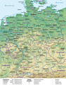
 Germany general map.jpg 1,979 × 2,518; 3.95 MB
-
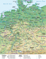 Germany general map.png 1,979 × 2,518; 7 MB
-
 Germany topo.jpg 2,011 × 2,654; 2.55 MB
-
 Hessen Kreise Namen.png 1,466 × 2,048; 5.72 MB
-

-
 Karte Allgäuer Alpen.png 3,488 × 2,013; 2.61 MB
-
 Karte Ammergauer Alpen.png 3,721 × 3,458; 2.54 MB
-
 Karte Bayerische Voralpen2.png 5,632 × 3,096; 3.8 MB
-
 Karte der Gebirgsgruppen in den Alpen.png 9,930 × 5,848; 9.32 MB
-
 Karte Nordschleusenbrücke.png 859 × 821; 426 KB
-
 Karwendel map.png 5,425 × 4,541; 3.94 MB
-
 Lange-Diercke Volksschulatlas (Deutsches Gebirge und Tiefland).jpg 3,749 × 2,410; 3.16 MB
-
 Map-of-Germany.jpg 1,500 × 2,083; 3.36 MB
-
 Nördlinger Ries Relief Map, SRTM-1.jpg 1,600 × 1,200; 1.39 MB
-
 Reliefkarte Deutschland ohne Grenzen.png 3,637 × 4,647; 24.43 MB
-
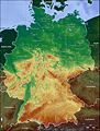
 Reliefkarte Deutschland.png 3,638 × 4,647; 23.88 MB
-
 Road and Bridge Data - Altenkirchen - NARA - 100385125.jpg 8,704 × 6,644; 5.58 MB
-
 Road and Bridge Data - Bergheim - NARA - 100385103.jpg 8,712 × 6,605; 5.31 MB
-
 Road and Bridge Data - Bitterfield (East) - NARA - 100385091.jpg 8,696 × 6,666; 5.62 MB
-
 Road and Bridge Data - Bitterfield (West) - NARA - 100385133.jpg 8,688 × 6,646; 4.85 MB
-
 Road and Bridge Data - Brevenbroich - NARA - 100385097.jpg 8,716 × 6,635; 4.44 MB
-
 Road and Bridge Data - Freudenburg - NARA - 100385115.jpg 8,660 × 6,572; 4.69 MB
-
 Road and Bridge Data - Gummersbach - NARA - 100385101.jpg 8,696 × 6,583; 5.05 MB
-
 Road and Bridge Data - Hachenburg - NARA - 100385127.jpg 8,696 × 6,604; 5.13 MB
-
 Road and Bridge Data - Leverkusen - NARA - 100385099.jpg 8,684 × 6,647; 4.65 MB
-
 Road and Bridge Data - Morsbach - NARA - 100385113.jpg 8,708 × 6,666; 4.96 MB
-
 Road and Bridge Data - Neuss - NARA - 100385093.jpg 8,696 × 6,651; 3.88 MB
-
 Road and Bridge Data - Raguhn - NARA - 100385131.jpg 8,716 × 6,426; 4.66 MB
-
 Road and Bridge Data - Selters - NARA - 100385129.jpg 8,720 × 6,592; 5.96 MB
-
 Road and Bridge Data - Siegen - NARA - 100385117.jpg 8,724 × 6,614; 4.67 MB
-
 Road and Bridge Data - Waldbröl - NARA - 100385111.jpg 8,716 × 6,603; 5.82 MB
-
 Road and Bridge Data - Wenden - NARA - 100385107.jpg 8,700 × 6,588; 5.21 MB
-
 Road and Bridge Data - Weyerbusch - NARA - 100385119.jpg 8,704 × 6,634; 5.64 MB
-
 Road and Bridge Data - Wipperfurth - NARA - 100385095.jpg 8,644 × 6,618; 4.6 MB
-
 Road and Bridge Data - Wissen - NARA - 100385121.jpg 8,700 × 6,629; 6.01 MB
-
 Schmittsche Karte von Südwestdeutschland - Berchtesgadener Alpen.jpg 7,059 × 7,170; 14.21 MB
-
 Werra-Zuflüsse topo.png 1,280 × 1,305; 2.72 MB
-
 Weser basin topo.png 2,544 × 4,260; 14.31 MB
-
 Weser Flusssystem topo.png 2,544 × 4,260; 14.22 MB
-
 Wettersteingebirge map.png 3,731 × 1,630; 1.07 MB
-
 Wettersteingebirge und Mieminger Kette.png 3,731 × 3,009; 1.98 MB


.jpg)
.jpg)


.jpg)


_-_NARA_-_100385091.jpg)
_-_NARA_-_100385133.jpg)


