Category:Topographic maps of Georgia
Countries of Europe: Albania · Andorra · Armenia‡ · Austria · Azerbaijan‡ · Belarus · Belgium · Bosnia and Herzegovina · Bulgaria · Croatia · Cyprus‡ · Czech Republic · Denmark · Estonia · Finland · France‡ · Georgia‡ · Germany · Greece · Hungary · Iceland · Republic of Ireland · Italy · Kazakhstan‡ · Latvia · Liechtenstein · Lithuania · Luxembourg · Malta · Moldova · Monaco · Montenegro · Netherlands‡ · North Macedonia · Norway · Poland · Portugal‡ · Romania · Russia‡ · San Marino · Serbia · Slovakia · Slovenia · Spain‡ · Sweden · Switzerland · Turkey‡ · Ukraine · United Kingdom
Specific status: Faroe Islands · Isle of Man · Svalbard – Limited recognition: Kosovo
‡: partly located in Europe
Specific status: Faroe Islands · Isle of Man · Svalbard – Limited recognition: Kosovo
‡: partly located in Europe
Countries of Asia: Afghanistan · Armenia‡ · Azerbaijan‡ · Bangladesh · Bhutan · Brunei · Cambodia · People's Republic of China · Cyprus‡ · East Timor · Egypt‡ · Georgia‡ · India · Indonesia‡ · Iran · Iraq · Israel · Japan · Jordan · Kazakhstan‡ · Kuwait · Kyrgyzstan · Laos · Lebanon · Malaysia · Mongolia · Myanmar · Nepal · North Korea · Oman · Pakistan · Philippines · Qatar · Russia‡ · Saudi Arabia · Singapore · South Korea · Sri Lanka · Syria · Tajikistan · Thailand · Turkey‡ · Turkmenistan · Uzbekistan · Vietnam · Yemen
Limited recognition: Taiwan · State of Palestine – Other territories: Macau
‡: partly located in Asia
Limited recognition: Taiwan · State of Palestine – Other territories: Macau
‡: partly located in Asia
Subcategories
This category has only the following subcategory.
S
- SVG topographic maps of Georgia (42 F)
Media in category "Topographic maps of Georgia"
The following 13 files are in this category, out of 13 total.
-
 Armenia Railway.jpg 3,851 × 2,999; 1.63 MB
-
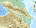
 Caucasus Mtns 42to44N 40to48E Topo Rainbow Zebra 1530.jpg 9,600 × 2,400; 16.39 MB
-
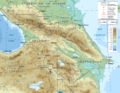
 Caucasus region 1994.jpg 3,119 × 2,392; 1.18 MB
-
 Caucasus topographic map-hu.png 2,000 × 1,555; 4.06 MB
-
 Caucasus topo map-blank.jpg 1,155 × 898; 198 KB
-
 Caucasus topographic map-fr.png 1,155 × 898; 1.35 MB
-
 Georgia topographic map DEMIS.jpg 1,462 × 882; 194 KB
-
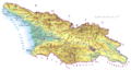
 Georgia Topography.png 1,926 × 1,217; 3.62 MB
-
 Gruzja.png 3,067 × 1,638; 1.84 MB
-
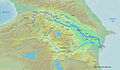 Kurarivermap.jpg 1,484 × 866; 1.57 MB
-
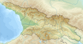 Relief Map of Georgia.png 1,182 × 629; 1.08 MB
-
 Topographic30deg N30E30.png 1,800 × 1,800; 1.18 MB
-
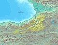 Çoruhrivermap.jpg 864 × 671; 864 KB


