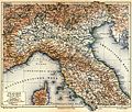
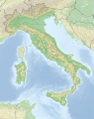
Category:Topographic maps of Italy
Countries of Europe: Albania · Andorra · Armenia‡ · Austria · Azerbaijan‡ · Belarus · Belgium · Bosnia and Herzegovina · Bulgaria · Croatia · Cyprus‡ · Czech Republic · Denmark · Estonia · Finland · France‡ · Georgia‡ · Germany · Greece · Hungary · Iceland · Republic of Ireland · Italy · Kazakhstan‡ · Latvia · Liechtenstein · Lithuania · Luxembourg · Malta · Moldova · Monaco · Montenegro · Netherlands‡ · North Macedonia · Norway · Poland · Portugal‡ · Romania · Russia‡ · San Marino · Serbia · Slovakia · Slovenia · Spain‡ · Sweden · Switzerland · Turkey‡ · Ukraine · United Kingdom
Specific status: Faroe Islands · Isle of Man · Svalbard – Limited recognition: Kosovo
‡: partly located in Europe
Specific status: Faroe Islands · Isle of Man · Svalbard – Limited recognition: Kosovo
‡: partly located in Europe
Subcategories
This category has the following 11 subcategories, out of 11 total.
*
- DEM maps of Italy (5 F)
S
- SVG topographic maps of Italy (19 F)
T
- Topographic maps of Apulia (1 F)
- Topographic maps of Liguria (2 F)
- Topographic maps of Lombardy (3 F)
- Topographic maps of Piedmont (3 F)
- Topographic maps of Sardinia (21 F)
- Topographic maps of Sicily (32 F)
- Topographic maps of Veneto (4 F)
Media in category "Topographic maps of Italy"
The following 98 files are in this category, out of 98 total.
-
 1943 Po Valley Terrain (30249098183).jpg 3,067 × 2,327; 1.31 MB
-
 449x562-GMT-Italie-R1.jpg 450 × 562; 88 KB
-
 Ampezzaner Dolomiten.png 4,311 × 5,006; 5.5 MB
-
 Bernina-Alpen.png 4,917 × 3,633; 3.2 MB
-
 Capri sights.png 2,000 × 1,100; 1.05 MB
-
 CARTE ITALIE R2.png 302 × 376; 282 KB
-
 Central Italy 40to45N 8to17E Topo Rainbow Zebra 714.jpg 10,800 × 6,000; 23.14 MB
-
 Central Italy relief location map.jpg 468 × 351; 138 KB
-
 Cherta Sela Saslonch DÖAV Freytag Berndt 1904.jpg 8,272 × 6,200; 38.47 MB
-
 Civettagruppe.png 4,311 × 5,006; 5.48 MB
-
 Fanesgruppe ohne Parseispitze.png 4,311 × 5,006; 5.49 MB
-
 Fanesgruppe.png 4,311 × 5,006; 5.49 MB
-
 Federico Tonetti, Mappa della Valsesia (VC) - 1891.jpg 3,156 × 2,796; 7.55 MB
-
 Geislergruppe Karte.png 4,311 × 5,006; 5.49 MB
-
 ITA Brunico, Hotel Falkensteiner 030.jpg 4,032 × 3,024; 1.75 MB
-
 Italien Relief.png 2,949 × 3,743; 8.66 MB
-
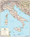
 Italy Map.jpg 1,300 × 1,339; 421 KB
-
 Italy Physiography.jpg 2,000 × 2,463; 1.64 MB
-
 Italy PoE.png 1,024 × 1,207; 2.12 MB
-
 Italy relief location map-blank.jpg 1,034 × 1,299; 431 KB
-
 Italy relief location map.jpg 1,034 × 1,299; 458 KB
-
 Italy Topography Map.jpg 2,456 × 3,508; 1.84 MB
-
 Italymap2.png 617 × 722; 454 KB
-
 Karte Adamello-Presanella-Alpen.png 3,165 × 3,750; 3.3 MB
-
 Karte Bergamasker Alpen.png 3,705 × 2,426; 3.27 MB
-
 Karte Brentagruppe.png 2,988 × 3,084; 1.99 MB
-
 Karte der Gebirgsgruppen in den Alpen.png 9,930 × 5,848; 9.32 MB
-
 Karte der Nonsberggruppe.png 674 × 690; 263 KB
-
 Karte Dolomiten Bosconero.png 4,311 × 5,006; 5.48 MB
-
 Karte Dolomiten mit Cimonegagruppe.png 4,311 × 5,006; 5.5 MB
-
 Karte Dolomiten mit Grappastock.png 4,311 × 5,006; 5.47 MB
-
 Karte Dolomiten.png 4,311 × 5,006; 5.46 MB
-
 Karte Fleimstaler Alpen.png 5,204 × 4,861; 5.48 MB
-
 Karte Gardaseeberge.png 2,287 × 1,961; 1.8 MB
-
 Karte Livigno-Alpen.png 1,500 × 1,603; 1.04 MB
-
 Karte Mont-Blanc-Gruppe.png 1,884 × 1,981; 1.8 MB
-
 Karte Sesvennagruppe.png 4,644 × 3,800; 2.97 MB
-
 Karte Tessiner Alpen.png 2,855 × 3,041; 3.21 MB
-
 Karte Tyrrhenisches Meer.jpg 794 × 893; 361 KB
-
 Karte Vesuv MK1888.png 771 × 498; 126 KB
-
 Karte Vizentiner Alpen.png 5,255 × 4,783; 7.19 MB
-
 Karte Zillertaler Alpen.png 4,014 × 3,603; 3.51 MB
-
 Lagekarte der Langkofelgruppe.png 4,311 × 5,006; 5.52 MB
-
 Lagekarte Latemar.png 4,311 × 5,006; 5.37 MB
-
 Lagekarte Marmarole.png 4,311 × 5,006; 5.38 MB
-
 Lagekarte Sella.png 4,311 × 5,006; 5.48 MB
-
 Lange diercke sachsen europaeische landschaften neapel.jpg 1,258 × 932; 528 KB
-
 Langkofelgruppe nach Bergalbum.png 4,311 × 5,006; 5.52 MB
-
 Lazio SRTM annotata.png 2,521 × 2,170; 6.84 MB
-
 Lazio SRTM.png 2,521 × 2,170; 7.48 MB
-
 Lüsner Berge.png 4,311 × 5,006; 5.5 MB
-
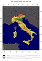
 Map of Italy (w.o. Labels).jpg 1,142 × 709; 183 KB
-
 Mapa de Italia, 5 de septiembre de 2022.jpg 4,128 × 2,322; 3.44 MB
-
 MapoftheLagaBasinItaly.png 1,428 × 1,302; 3.86 MB
-
 Mappa di Vulcano.jpg 2,948 × 2,794; 4.15 MB
-
 Mappa-dell'Italia.jpg 1,200 × 1,240; 2 MB
-
 Marmolatagruppe.png 4,311 × 5,006; 5.49 MB
-
 Meyers b9 s0053a.jpg 1,693 × 2,048; 851 KB
-
 Meyers b9 s0053b.jpg 2,048 × 1,691; 989 KB
-
 Meyers b9 s0053c.jpg 2,048 × 1,736; 1.01 MB
-
 Mont Blanc Relief Map, SRTM-1.jpg 1,600 × 1,200; 1.47 MB
-
 Morfologia territorio Santu Lussurgiu.png 726 × 505; 540 KB
-
 Northern Italy relief location map.jpg 636 × 371; 245 KB
-
 Northern Italy river blank map.png 500 × 369; 352 KB
-
 Northern Italy topographic map-blank.png 1,005 × 653; 1.05 MB
-
 Ortler-Alpen (nach Ernst Höhne).png 1,447 × 1,057; 804 KB
-
 Ortler-Alpen.png 1,447 × 1,057; 788 KB
-
 Ortlergruppe (nach Moriggl 1924).png 1,447 × 1,057; 809 KB
-
 Palagruppe.png 4,311 × 5,006; 5.5 MB
-
 PC Globe country detail.png 640 × 480; 9 KB
-
 Peitlerkofel-Plose-Gruppe.png 4,311 × 5,006; 5.5 MB
-
 Peitlerkofelgruppe.png 4,311 × 5,006; 5.5 MB
-
 Pelmostock.png 4,311 × 5,006; 5.49 MB
-
 Pianure italiane.JPG 1,000 × 1,232; 1.02 MB
-
 Pragser Dolomiten.png 4,311 × 5,006; 5.49 MB
-
 PSM V51 D741 Physical geography of italy.png 2,286 × 2,405; 497 KB
-
 Puez-Geisler-Gruppe nach Bergalbum.png 4,311 × 5,006; 5.47 MB
-
 Puez-Geisler-Gruppe nach Höhne.png 4,311 × 5,006; 5.5 MB
-
 Puezgruppe.png 4,311 × 5,006; 5.5 MB
-
 Reliefkarte Italien.png 2,949 × 3,743; 10.27 MB
-
 Rhone bassin topo.png 3,745 × 5,568; 33.54 MB
-
 Rome on Physical Map of Lazio.png 3,361 × 2,893; 8.27 MB
-
 Rosengarten Map.png 4,311 × 5,006; 5.49 MB
-
 Rothert, Bd1Bl14K1 - Rom und das Tiberthal.jpg 1,837 × 1,420; 519 KB
-
 Schiaragruppe.png 4,311 × 5,006; 5.5 MB
-
 Schlerngruppe.png 4,311 × 5,006; 5.58 MB
-
 Sena Gallica in Italy.jpg 477 × 599; 159 KB
-
 Sextner Dolomiten.png 4,311 × 5,006; 5.5 MB
-
 Sobretta-Gavia-Gruppe.png 768 × 669; 271 KB
-
 South Alpine lakes.png 1,240 × 765; 599 KB
-
 Southern Italy relief location map.jpg 513 × 448; 181 KB
-
 Southern Italy topographic map-blank.png 903 × 1,067; 1.15 MB
-
 Südtirol 2019.png 800 × 428; 611 KB
-
 Topographic map of Italy with borders.png 1,544 × 1,783; 1.89 MB
-
 Topographic map of Italy.jpg 1,544 × 1,783; 439 KB
-
 Walliser Alpen.png 2,412 × 1,733; 2.28 MB
-
 Ötztaler Alpen Map.png 4,710 × 4,941; 5.42 MB
-
 Übersicht Sarntaler Alpen.png 6,549 × 6,526; 5.66 MB
.jpg)


_-_1891.jpg)


.jpg)


.png)

.png)


