Category:Topographic maps of Spain
Countries of Europe: Albania · Andorra · Armenia‡ · Austria · Azerbaijan‡ · Belarus · Belgium · Bosnia and Herzegovina · Bulgaria · Croatia · Cyprus‡ · Czech Republic · Denmark · Estonia · Finland · France‡ · Georgia‡ · Germany · Greece · Hungary · Iceland · Republic of Ireland · Italy · Kazakhstan‡ · Latvia · Liechtenstein · Lithuania · Luxembourg · Malta · Moldova · Monaco · Montenegro · Netherlands‡ · North Macedonia · Norway · Poland · Portugal‡ · Romania · Russia‡ · San Marino · Serbia · Slovakia · Slovenia · Spain‡ · Sweden · Switzerland · Turkey‡ · Ukraine · United Kingdom
Specific status: Faroe Islands · Isle of Man · Svalbard – Limited recognition: Kosovo
‡: partly located in Europe
Specific status: Faroe Islands · Isle of Man · Svalbard – Limited recognition: Kosovo
‡: partly located in Europe
 Location |
Subcategories
This category has the following 13 subcategories, out of 13 total.
*
- DEM maps of Spain (2 F)
-
A
- Topographic maps of Andalusia (31 F)
B
C
N
- Topographic maps of Navarre (7 F)
S
- SVG topographic maps of Spain (23 F)
T
- Topographic maps of Cantabria (12 F)
Media in category "Topographic maps of Spain"
The following 55 files are in this category, out of 55 total.
-
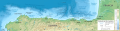
 3d cantábrica.jpg 1,264 × 1,022; 293 KB
-
 Atlas (Gebirge).png 3,261 × 2,025; 11.8 MB
-
 Baleares topographic location map.png 1,536 × 1,000; 385 KB
-
 Blanes-Palamos Mar balear bm wms 2004.jpg 1,200 × 877; 332 KB
-
 Cantabrian Sea bathymetric map-es.svg 2,379 × 604; 4.93 MB
-
 Spain Castile-La Mancha relief map.png 2,167 × 2,189; 5.05 MB
-
 Cornisa Cantabrica.jpg 1,000 × 760; 176 KB
-
 Covalta.png 818 × 596; 283 KB
-
 Curavacas topogáfico.jpg 2,560 × 1,920; 1.51 MB
-
 Espainia.png 778 × 281; 408 KB
-
 España relieve M.png 2,356 × 2,778; 10.26 MB
-
 Garazi eskualde - Pays de Cize.jpg 2,480 × 3,507; 995 KB
-
 Mapa Iberia minifisico.png 294 × 234; 142 KB
-
 Iberian Peninsula black&white.png 830 × 543; 87 KB
-
 Iberian peninsula gmt de.jpg 1,420 × 1,395; 1.59 MB
-
 Iberian peninsula gmt ua.jpg 1,077 × 1,046; 416 KB
-
 Iberian Peninsula scaled.png 830 × 543; 69 KB
-
 Iberian Peninsula w river names in JA.png 764 × 543; 489 KB
-
 Iberian-drainage-divide.png 683 × 496; 580 KB
-
 Illas Cíes Topographic Map en (with shadows).png 1,530 × 2,870; 1.77 MB
-
 Landkarte Spanien.jpg 1,400 × 1,197; 466 KB
-
 Map-of-spain.jpg 1,320 × 1,002; 1.65 MB
-
 Mapa cartográfico de las Chorreras - Enguídanos y Villora (Cuenca).jpg 2,348 × 3,213; 2.77 MB
-
 Mapa de isohipsas 10 m.jpg 5,906 × 5,906; 18.59 MB
-

-
 Mapa de ruta AVE.jpg 4,032 × 3,024; 4.28 MB
-
 Mapa topogràfic de la Serra de Rubió.png 2,096 × 1,152; 522 KB
-
 Mapa topogràfic Ribera del Xúquer.png 997 × 956; 604 KB
-
 Mapapenínsulaibérica.png 1,366 × 662; 1.4 MB
-
 Mar Balear - BM WMS 2004.jpg 1,060 × 989; 210 KB
-
 Peninsula Iberica - Iberian Peninsula.png 830 × 543; 63 KB
-
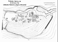
 Plan de los Tres Frentes.jpg 809 × 696; 82 KB
-
 Relief Map of Spain - Military Regions 1990.png 1,197 × 1,027; 1.77 MB
-
 Relief Map of Spain.png 1,197 × 1,027; 1.9 MB
-
 Reliefkarte Spanien.png 3,915 × 3,368; 14.68 MB
-
 Relieve de Península Ibérica.png 793 × 638; 69 KB
-
 San Martiño Island map.png 1,530 × 1,262; 832 KB
-
 Santillana municipio.jpg 633 × 574; 153 KB
-
 Sierra de guadarrama mapa.png 866 × 616; 1.09 MB
-
 Sierra de Mencilla.png 2,697 × 2,110; 5.57 MB
-
 Spain (demis).png 503 × 393; 56 KB
-
 Spain extreme points.png 805 × 463; 134 KB
-
 Spain heb.png 992 × 854; 405 KB
-
 Spain La Rioja relief map.png 773 × 532; 493 KB
-
 Spain topo (cropped).jpg 1,299 × 1,113; 551 KB
-
 Spain topo Sierra de la demanda.jpg 2,834 × 2,440; 356 KB
-
 Spain topo.jpg 1,400 × 1,197; 594 KB
-
 Spain topo.png 992 × 854; 394 KB
-
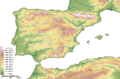
 Spain topography.png 1,240 × 1,068; 452 KB
-
 Spain.png 992 × 854; 380 KB
-
 Spanien topo.jpg 1,400 × 1,197; 605 KB
-
 Val de l'Ebro (orografía).png 836 × 614; 1.12 MB
-
 VisorSIA.PNG 1,000 × 636; 190 KB
-
 VisorSIAsmall.PNG 500 × 318; 137 KB
-
 Μαδρίτη.png 1,197 × 1,027; 1.84 MB

.png)


.png)


.jpg)


.png)


.jpg)


.png)


_proyecto_de_canal_de_regad%C3%ADo.png)