Category:Topographic maps of France
Subcategories
This category has the following 16 subcategories, out of 16 total.
!
- SVG topographic maps of France (36 F)
*
- DEM maps of France (10 F)
C
G
M
P
T
- Topographic map of France, 1864 (34 F)
V
É
Media in category "Topographic maps of France"
The following 85 files are in this category, out of 85 total.
-

-
-
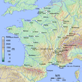
 1800x1730-France-Découpe-Relief.jpg 1,800 × 1,730; 797 KB
-
 1800x1730-France-villes.jpg 1,800 × 1,730; 463 KB
-
 1914 Guerre Européenne 1915. Carte relief no 2, Les Vosges - btv1b10223545n.jpg 6,400 × 5,053; 4.14 MB
-
 2000x2000-France-radar-Régions.jpg 2,000 × 2,000; 1.41 MB
-
 343x340-FRANCE RADAR 1.PNG 400 × 385; 341 KB
-
 500x500-GMT France topo.jpg 500 × 500; 115 KB
-
 600x600 GMT France topo-R1.jpg 600 × 600; 343 KB
-
 800x768-France-Topo-Montagnes.png 800 × 768; 1.26 MB
-
 800x769-France-topo-R1.jpg 800 × 769; 209 KB
-
 800x769-France-topo-Régions-R1.jpg 800 × 769; 221 KB
-
 800x769-France-topo-V.svg 800 × 769; 1.4 MB
-
 90 of 'La France Illustrée- géographie générale ... Par F. J' (11200002736).jpg 1,271 × 1,710; 821 KB
-
 After Action Report - Amiens - NARA - 100384897.jpg 10,796 × 7,810; 10.95 MB
-
 After Action Report - Arlon - NARA - 100384899.jpg 10,800 × 7,776; 10.46 MB
-
 After Action Report - Verdun - NARA - 100384901.jpg 10,792 × 7,773; 10.49 MB
-

-
 Bassigny-localisation.jpg 720 × 688; 101 KB
-
 Bordeaux dot2.png 567 × 568; 559 KB
-
 Borne (rivière de l'Ardèche) OSM.png 872 × 1,192; 2.02 MB
-
 Carte de la France avec ses établissements politiques, militaires, civils et religieux (15521001).jpg 30,252 × 20,234; 170.67 MB
-

-
 Carte du nivellement général de la France figuré par des courbes d'altitude - btv1b53083207m.jpg 15,129 × 15,791; 39.76 MB
-

-
 Carte France geo R2.png 645 × 634; 321 KB
-
 Carte France geo R2c.png 645 × 634; 282 KB
-
 Carte-de-France.jpg 1,454 × 1,352; 2.57 MB
-
 DEMsuedlicher-oberrhein.jpg 3,172 × 2,084; 833 KB
-
 France airport map.pdf 1,283 × 1,181; 513 KB
-
 France alti nord.png 1,500 × 623; 596 KB
-
 France alti sud.png 1,350 × 624; 677 KB
-
 France cities.png 1,797 × 1,796; 3.53 MB
-
 France jms.png 280 × 278; 28 KB
-
 France Large East topographic map-fr.png 2,000 × 1,922; 4.63 MB
-
 France Large East topographic map.png 2,000 × 1,922; 4.63 MB
-
 France Midi 45° Latitude.jpg 2,003 × 1,924; 2.25 MB
-
 France NL regions.png 742 × 722; 899 KB
-
 France radar 2.jpg 2,172 × 2,074; 3.13 MB
-
 France radar.jpg 2,172 × 2,074; 3.2 MB
-
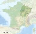
 France relief location carte carte regions et departements.png 800 × 769; 946 KB
-
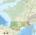
 France relief location map Large South west highlighted.png 2,000 × 1,922; 4.65 MB
-
 France relief location map South East highlighted-fr.png 2,000 × 1,922; 4.66 MB
-
 France relief location map South East highlighted.png 2,000 × 1,922; 4.66 MB
-
 France relief location map South West highlighted-fr.png 2,000 × 1,922; 5.57 MB
-
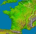
 France relief location map.jpg 2,000 × 1,922; 907 KB
-
 France relief-es.png 1,000 × 961; 57 KB
-
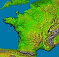
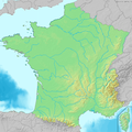
 France relief.png 1,000 × 961; 102 KB
-
 France sites unesco.png 2,000 × 1,796; 4.56 MB
-
 France with Corsica (demis).png 697 × 698; 838 KB
-
 France with Corsica2 (demis).png 697 × 698; 681 KB
-
 France русский.gif 1,050 × 827; 154 KB
-
 France1911topo.png 1,840 × 1,928; 3.28 MB
-
 France2.JPG 1,034 × 1,422; 223 KB
-
 Frankrijk map.png 1,280 × 948; 1.88 MB
-
 Frejus.citiesFrance.png 800 × 765; 228 KB
-
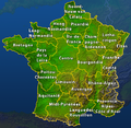
 FrenchTop25Cities.png 1,022 × 970; 1.67 MB
-
 GMT France 2.pdf 1,283 × 1,181; 433 KB
-
 GMT France 2.png 600 × 600; 185 KB
-
 GMT France 20 largest cities.pdf 1,283 × 1,181; 508 KB
-
 GMT France 20 largest cities.png 1,841 × 1,832; 4.3 MB
-
 GMT France with altitudes 30s.png 2,000 × 1,992; 3.57 MB
-
 GMT France with altitudes.pdf 1,181 × 1,181; 145 KB
-
 GMT France with altitudes.png 1,000 × 992; 377 KB
-
 Karte der Gebirgsgruppen in den Alpen.png 9,930 × 5,848; 9.32 MB
-
 La2-demis-france.png 698 × 717; 207 KB
-
 LGV Bordeaux Toulouse sur une carte topographique.svg 1,028 × 885; 2.91 MB
-
 Localisation barrois.jpg 2,172 × 2,074; 1.26 MB
-
 Location Authie and Bresle River-fr.svg 1,145 × 1,200; 567 KB
-
 LondonCalaisParis.png 1,229 × 789; 1.43 MB
-
 Map of Gauray - NARA - 100384779.jpg 7,252 × 5,811; 5.43 MB
-
 Massif central Relief.png 3,447 × 4,772; 2.27 MB
-
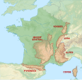 Mountain ranges of France map-fr.svg 2,602 × 2,525; 2.08 MB
-
 Northeast Atlantic bathymetry.png 413 × 323; 347 KB
-
-
 Orographische Karte von Frankreich - btv1b53260595g.jpg 14,634 × 13,200; 26.95 MB
-
 Adour basin.png 395 × 401; 326 KB
-
 Reliefkarte Frankreich.png 2,958 × 2,869; 10.28 MB
-
 Frankreich Relief.png 685 × 660; 837 KB
-
 Sologne France topo.jpg 2,519 × 2,480; 2.02 MB
-
 Sologne localization.jpg 2,172 × 2,074; 1.11 MB
-
 W France slope map.png 3,074 × 5,117; 3.82 MB
-
 WEB-RSF-carte-zone-de-diffusion4.gif 517 × 456; 101 KB
-
 Winde Frankreich.png 828 × 528; 605 KB
-
 الجارون.png 608 × 555; 625 KB
.jpg)
.jpg)


.jpg)


_OSM.png)
.jpg)


.png)
.png)


