Category:United Kingdom photographs taken on 2004-05-02
Countries of Europe: Austria · Belgium · Czech Republic · Estonia · France‡ · Germany · Italy · Netherlands‡ · Russia‡ · Ukraine · United Kingdom
‡: partly located in Europe
‡: partly located in Europe
| ← | 2 May 2004 | → | ||
| ← | May 2004 | → | ||

United Kingdom photographs taken on 2 May 2004.
Image files should be categorized here automatically using {{taken on}} template. Direct categorisation is also possible, if automatic is impossible.
Media in category "United Kingdom photographs taken on 2004-05-02"
The following 108 files are in this category, out of 108 total.
-
 Kings Langley station, 2004 (geograph 5447208).jpg 2,401 × 1,316; 2.78 MB
-
 52° 3°W - geograph.org.uk - 13065.jpg 640 × 480; 75 KB
-
 8098 passing over Lissue Crossing - geograph.org.uk - 342608.jpg 640 × 426; 131 KB
-
 Agricultural Machinery Dealers - geograph.org.uk - 136371.jpg 640 × 483; 76 KB
-

-
 Battersea Powerstation - Across Thames - London - 020504.jpg 1,081 × 750; 54 KB
-
 Benmore Botanic Garden, near Dunoon. - geograph.org.uk - 413531.jpg 427 × 640; 143 KB
-
 Benmore Botanic Garden, near Dunoon. - geograph.org.uk - 413537.jpg 427 × 640; 105 KB
-
 Benmore Botanic Garden, near Dunoon. - geograph.org.uk - 413541.jpg 640 × 427; 152 KB
-
 Benmore Botanic Garden, near Dunoon. - geograph.org.uk - 413545.jpg 640 × 427; 159 KB
-
 Benmore Botanic Garden, near Dunoon. - geograph.org.uk - 413551.jpg 640 × 427; 127 KB
-
 Benmore Botanic Garden. - geograph.org.uk - 413525.jpg 427 × 640; 141 KB
-
 Berth Wood - geograph.org.uk - 888806.jpg 640 × 480; 70 KB
-
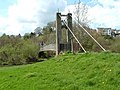
 Bethells Bridge at Sunrise - geograph.org.uk - 64706.jpg 640 × 480; 48 KB
-

-
 Bonny Lands - geograph.org.uk - 891333.jpg 640 × 481; 55 KB
-
 Bridge over the River Avon - geograph.org.uk - 44122.jpg 640 × 427; 137 KB
-

-
 Bryn Deri - geograph.org.uk - 888814.jpg 640 × 480; 65 KB
-

-
 Campston Hill - geograph.org.uk - 888819.jpg 640 × 379; 33 KB
-

-
 Carsaig bay - geograph.org.uk - 845401.jpg 500 × 375; 48 KB
-
 Clock on Harbour Master's Station - geograph.org.uk - 595619.jpg 480 × 640; 70 KB
-
 Columbia Road Market, Bethnal Green - geograph.org.uk - 90843.jpg 640 × 480; 167 KB
-
 Cotheridge Church - geograph.org.uk - 2459.jpg 480 × 640; 38 KB
-
 Cow and Calf Rocks - geograph.org.uk - 101247.jpg 640 × 480; 96 KB
-
 Dalmahoy Hill - geograph.org.uk - 75159.jpg 640 × 480; 88 KB
-
 Dane's Brook with Exmoor Ponies - geograph.org.uk - 875625.jpg 600 × 450; 275 KB
-
 Denman's Cottage - geograph.org.uk - 1009778.jpg 640 × 480; 113 KB
-
 Driffled Town Lock - geograph.org.uk - 64738.jpg 600 × 450; 81 KB
-
 Edensor - geograph.org.uk - 671.jpg 640 × 480; 26 KB
-
 Fill her up ^^ - geograph.org.uk - 34698.jpg 640 × 480; 89 KB
-
 Gardens at Capesthorne Hall, Cheshire - geograph.org.uk - 440825.jpg 640 × 418; 430 KB
-

-
 Grampian Transport Museum - geograph.org.uk - 595614.jpg 640 × 447; 64 KB
-
 Great Wishford church - geograph.org.uk - 44136.jpg 640 × 427; 89 KB
-
 Green Hairstreak - geograph.org.uk - 380223.jpg 640 × 480; 99 KB
-
 Green Knight, Lud's Church - geograph.org.uk - 380225.jpg 480 × 640; 106 KB
-
 Harbour Master's Station, Footdee - geograph.org.uk - 595624.jpg 640 × 480; 63 KB
-
 Itchen Bridge - geograph.org.uk - 22418.jpg 640 × 427; 75 KB
-
 John Walters House, Clapham Common. - geograph.org.uk - 17304.jpg 640 × 480; 164 KB
-
 Kings Cross Platform 9,75.jpg 640 × 477; 42 KB
-
 Landacre Bridge and the Barle - geograph.org.uk - 875648.jpg 600 × 450; 178 KB
-

-

-

-
 Lound Church - geograph.org.uk - 247752.jpg 640 × 481; 82 KB
-
 Lower Brockhampton - geograph.org.uk - 2449.jpg 640 × 480; 45 KB
-
 Lud's Church - geograph.org.uk - 380228.jpg 480 × 640; 150 KB
-
 Mam Tor landslip - geograph.org.uk - 455459.jpg 640 × 480; 231 KB
-
 Mansfield Brewery - geograph.org.uk - 11161.jpg 640 × 480; 63 KB
-
 Marshwood House - geograph.org.uk - 44145.jpg 640 × 427; 103 KB
-
 Michaelchurch Escley - geograph.org.uk - 890905.jpg 640 × 480; 93 KB
-
 Mile Post on the A54 - geograph.org.uk - 34709.jpg 640 × 480; 124 KB
-
 Mill Pond, Emsworth - geograph.org.uk - 1113.jpg 640 × 480; 46 KB
-
 Ocean Village Marina, Southampton - geograph.org.uk - 77203.jpg 600 × 400; 60 KB
-
 Old Sarum - geograph.org.uk - 44116.jpg 640 × 427; 69 KB
-
 Ornamental lake, Capesthorne Hall - geograph.org.uk - 416960.jpg 640 × 444; 161 KB
-

-
 Otley from the Chevin - geograph.org.uk - 101237.jpg 640 × 480; 167 KB
-
 Peartree Green Church - geograph.org.uk - 22405.jpg 640 × 427; 129 KB
-
 Peartree Green Churchyard - geograph.org.uk - 22409.jpg 640 × 427; 122 KB
-
 Pershore Abbey from the S - geograph.org.uk - 3312.jpg 640 × 480; 60 KB
-
 Plumley - Plumley Station.jpg 640 × 427; 118 KB
-
 Powis Castle and terraced gardens - geograph.org.uk - 331285.jpg 570 × 415; 102 KB
-

-
 Sarehole Mill, Hall Green, Birmingham - geograph.org.uk - 88394.jpg 500 × 375; 64 KB
-
 Special Steam Train at Northwich Station - geograph.org.uk - 358550.jpg 640 × 427; 105 KB
-
 St Andrews Church, Tarring - geograph.org.uk - 18397.jpg 640 × 480; 231 KB
-
 St Anne's Church and footbridge - geograph.org.uk - 1702543.jpg 480 × 640; 112 KB
-
 Swing Bridge, Llandeilo - geograph.org.uk - 427013.jpg 640 × 480; 92 KB
-
 Tabley Superior - Gauntlet Birds of Prey Centre.jpg 640 × 548; 294 KB
-
 Teffont Magna - geograph.org.uk - 44147.jpg 640 × 427; 99 KB
-
 Terrace walk, Powis castle - geograph.org.uk - 331294.jpg 570 × 425; 94 KB
-
 The jetty,Mollington - geograph.org.uk - 131144.jpg 480 × 640; 167 KB
-
 The Llech - geograph.org.uk - 888830.jpg 480 × 640; 94 KB
-
 The National Wetlands Centre Wales - geograph.org.uk - 88688.jpg 640 × 480; 131 KB
-
 The River Avon and The Maltings, Salisbury - geograph.org.uk - 44150.jpg 640 × 427; 103 KB
-

-
 Towards the Bristol Channel - geograph.org.uk - 87014.jpg 480 × 640; 139 KB
-

-
 Trevaylor Woods, nr Penzance, Cornwall - geograph.org.uk - 33125.jpg 640 × 480; 185 KB
-
 Upper Dove Dale - geograph.org.uk - 75353.jpg 640 × 480; 122 KB
-
 Upper Woodford - geograph.org.uk - 44125.jpg 640 × 427; 82 KB
-
 Waddington - geograph.org.uk - 1166907.jpg 640 × 479; 139 KB
-
 Within Walled Garden of Denmans Garden - geograph.org.uk - 1009770.jpg 640 × 480; 143 KB
-
-
 Aird an Runair, North Uist - geograph.org.uk - 203464.jpg 640 × 480; 78 KB
-
 Arthur's Stone. - geograph.org.uk - 13067.jpg 640 × 399; 62 KB
-
 Bridge, Flash Bottom - geograph.org.uk - 44678.jpg 640 × 480; 204 KB
-
 Claim Farm near Delamere Forest - geograph.org.uk - 31336.jpg 640 × 480; 91 KB
-
 Cottage at Wylye - geograph.org.uk - 44143.jpg 640 × 427; 90 KB
-
 Country Lane - geograph.org.uk - 44128.jpg 640 × 427; 56 KB
-
 Curbar village - geograph.org.uk - 51304.jpg 640 × 480; 51 KB
-
 Not in Amsterdam, at Valley of the Rocks - geograph.org.uk - 371241.jpg 480 × 640; 172 KB
-
 Rendlesham Forest rifle butts - geograph.org.uk - 258539.jpg 640 × 426; 83 KB
-
 Salterton - geograph.org.uk - 44119.jpg 640 × 427; 84 KB
-
 Summit of Mynydd Merddin - geograph.org.uk - 13063.jpg 640 × 480; 90 KB
-
 The New Inn, Flash - geograph.org.uk - 44681.jpg 640 × 480; 155 KB
-
 The riding school, Boreatton Park - geograph.org.uk - 65363.jpg 640 × 366; 92 KB
-
 The River Coquet meets Rowhope Burn - geograph.org.uk - 73994.jpg 640 × 480; 89 KB
-
 The Skiag - geograph.org.uk - 318615.jpg 640 × 365; 81 KB
-
 Up on the downs - geograph.org.uk - 44135.jpg 640 × 427; 49 KB
-
 View from Arnsheen - geograph.org.uk - 385857.jpg 640 × 480; 61 KB
-
 View of Bakewell to the South West - geograph.org.uk - 667.jpg 640 × 480; 44 KB
-
 West Wittering walking round to 'the spit' - geograph.org.uk - 16538.jpg 640 × 480; 114 KB
-
 Wilton House - geograph.org.uk - 44149.jpg 640 × 427; 67 KB
.jpg)


