Category:United Kingdom photographs taken on 2005-05-02
Countries of Europe: Austria · Belgium · Finland · France‡ · Germany · Greece · Hungary · Republic of Ireland · Italy · Latvia · Netherlands‡ · Poland · Portugal‡ · Russia‡ · Spain‡ · Sweden · Switzerland · Ukraine · United Kingdom
‡: partly located in Europe
‡: partly located in Europe
| ← | 2 May 2005 | → | ||
| ← | May 2005 | → | ||

United Kingdom photographs taken on 2 May 2005.
Image files should be categorized here automatically using {{taken on}} template. Direct categorisation is also possible, if automatic is impossible.
Media in category "United Kingdom photographs taken on 2005-05-02"
The following 200 files are in this category, out of 296 total.
(previous page) (next page)-
 57301-ScottTracy-Preston-CIMG2775 (35264210896).jpg 2,304 × 1,712; 1.77 MB
-
 A ford on the Shell Brook. - geograph.org.uk - 6970.jpg 640 × 480; 163 KB
-
 A.k.a. Bugs Bottom - geograph.org.uk - 8253.jpg 640 × 431; 111 KB
-
 After the final - geograph.org.uk - 458005.jpg 640 × 429; 88 KB
-
 Agustabell AB-206B Jet Ranger - panoramio.jpg 1,600 × 1,200; 640 KB
-
 Alderly Cliff - geograph.org.uk - 6727.jpg 640 × 480; 171 KB
-
 All Saints Church, Spelsbury - geograph.org.uk - 6614.jpg 485 × 640; 115 KB
-
 Ardmachie Burn - geograph.org.uk - 6900.jpg 640 × 402; 215 KB
-
 Arnosvale.broken.graves.arp.jpg 2,158 × 1,647; 3.25 MB
-
 Arnosvale.grassy.graves.arp.jpg 2,215 × 1,666; 3.86 MB
-
 Arnosvale.view.1.arp.jpg 2,288 × 1,712; 877 KB
-
 Arnosvale.view.2.arp.jpg 2,288 × 1,712; 2.65 MB
-
 Arnosvale.war.graves.arp.jpg 1,990 × 1,425; 2.36 MB
-
 Asda, Southgate - geograph.org.uk - 6654.jpg 640 × 480; 95 KB
-
 Ash House, Thorn - geograph.org.uk - 1311399.jpg 640 × 473; 124 KB
-
 Auchenhalrig - geograph.org.uk - 6902.jpg 640 × 440; 154 KB
-
 Augill Castle, Brough, Cumbria - geograph.org.uk - 7424.jpg 640 × 480; 106 KB
-
 Aultmore Forest - geograph.org.uk - 6896.jpg 640 × 332; 79 KB
-
 Balcombe Water Tower - geograph.org.uk - 6824.jpg 640 × 480; 134 KB
-
 Balmaha Bay Loch Lomond - geograph.org.uk - 351132.jpg 640 × 480; 91 KB
-
 Balmaha Bay Loch lomond - geograph.org.uk - 351136.jpg 640 × 480; 70 KB
-

-
 Barn at Smeaton - geograph.org.uk - 138249.jpg 640 × 480; 149 KB
-
 Barton Haven - geograph.org.uk - 6810.jpg 640 × 402; 51 KB
-
 Beckingtonchurch.jpg 640 × 480; 115 KB
-
 Beeston Castle Gatehouse - geograph.org.uk - 28851.jpg 640 × 480; 148 KB
-
 Bell Jet Ranger G-SUEZ - panoramio.jpg 1,600 × 1,200; 603 KB
-
 Berrington Hall 1.jpg 640 × 426; 121 KB
-
 Bluebells in Waresley woods - geograph.org.uk - 275836.jpg 640 × 427; 102 KB
-
 Bluebells-2005-05-02-1.jpg 2,272 × 1,704; 1.52 MB
-
 Bounds Green Tube Station - geograph.org.uk - 6646.jpg 640 × 480; 76 KB
-
 Bradford Dale - geograph.org.uk - 45169.jpg 640 × 480; 193 KB
-
-
 Bridge over Argill Beck, Brough, Cumbria - geograph.org.uk - 7425.jpg 640 × 480; 176 KB
-
 Broadhembury - geograph.org.uk - 6854.jpg 640 × 480; 139 KB
-
 Broadhembury - geograph.org.uk - 6855.jpg 640 × 480; 96 KB
-
 Broughton castle4.jpg 640 × 376; 112 KB
-
 Cafe - geograph.org.uk - 23245.jpg 640 × 479; 131 KB
-
 Candies (11951019).jpg 567 × 452; 45 KB
-
 Catch trap drag.jpg 555 × 646; 87 KB
-
 Cedar Avenue, East Barnet - geograph.org.uk - 6648.jpg 640 × 480; 92 KB
-
 Chalk Hill - geograph.org.uk - 6688.jpg 640 × 462; 48 KB
-
 Chapelford Bridge - geograph.org.uk - 6901.jpg 640 × 341; 149 KB
-
 Charlbury railway station - geograph.org.uk - 6616.jpg 640 × 480; 112 KB
-
 Chazey Heath - geograph.org.uk - 8241.jpg 640 × 431; 125 KB
-
 Chester Castle - geograph.org.uk - 9678.jpg 640 × 480; 130 KB
-
 Chirk Castle - geograph.org.uk - 28853.jpg 640 × 480; 109 KB
-
 Christ Church, Cockfosters - geograph.org.uk - 6653.jpg 640 × 480; 125 KB
-

-
 City Basin - geograph.org.uk - 18089.jpg 640 × 480; 79 KB
-
 Clapper bridge in Bradford Dale.jpg 1,280 × 960; 317 KB
-
 Class 390 390043 (8061888969).jpg 1,280 × 960; 556 KB
-
 Cock and Dragon, Cockfosters - geograph.org.uk - 6652.jpg 640 × 480; 85 KB
-
 Common Barn. - geograph.org.uk - 6895.jpg 640 × 480; 131 KB
-
 Conksbury Bridge.jpg 1,280 × 960; 308 KB
-
 Corps Landing - geograph.org.uk - 64730.jpg 600 × 450; 109 KB
-
 Corston (Somerset) All Saints Church - geograph.org.uk - 67722.jpg 640 × 480; 149 KB
-
 Crossley Hospital East, 1905-1961 - geograph.org.uk - 65251.jpg 640 × 480; 105 KB
-
 Crowdecote longnor beggars bridge 006734 6621accf.jpg 640 × 480; 180 KB
-
 Dearne Valley Country Park - geograph.org.uk - 486245.jpg 640 × 426; 103 KB
-
 Dere Street Newlands Northumberland.jpg 640 × 480; 97 KB
-

-
 Donibristle House - geograph.org.uk - 1162065.jpg 640 × 480; 55 KB
-
 Dowel Dale - geograph.org.uk - 6720.jpg 640 × 480; 100 KB
-
 Drystane Dyke above Pipercroft - geograph.org.uk - 970873.jpg 612 × 640; 117 KB
-
 Eggerslack Woods Bluebells - geograph.org.uk - 381129.jpg 640 × 480; 223 KB
-
 Elsham Hill - geograph.org.uk - 6681.jpg 380 × 480; 24 KB
-
 Epitaph of Raja Rammohun Roy in Arnos Vale Cemetery, Bristol, England.jpg 2,149 × 1,405; 2.06 MB
-
 Field of Rape - geograph.org.uk - 35261.jpg 640 × 480; 133 KB
-
 Finstock Railway Station.jpg 640 × 480; 115 KB
-
 Fish Holm Barn - geograph.org.uk - 64728.jpg 640 × 426; 74 KB
-
 Forest track above Upper Allaloth - geograph.org.uk - 12783.jpg 640 × 426; 174 KB
-
 Former Wesleyan Chapel at Faulkland, Somerset.jpg 640 × 480; 98 KB
-
 Fortifications on Inchmickery - geograph.org.uk - 1162516.jpg 640 × 480; 59 KB
-
 Forts on Inchgarvie - geograph.org.uk - 1162021.jpg 640 × 480; 78 KB
-
 Garden and Stewart Park, Aberdeen - geograph.org.uk - 501179.jpg 640 × 480; 159 KB
-
 Gas tanker at Braefoot Bay - geograph.org.uk - 1162563.jpg 640 × 480; 59 KB
-
 Gilling East - geograph.org.uk - 9335.jpg 480 × 640; 110 KB
-
 Glenfarg Tunnel - geograph.org.uk - 14554.jpg 640 × 480; 146 KB
-
 Glossop, Norfolk Square and Town Hall - geograph.org.uk - 21541.jpg 640 × 475; 89 KB
-
 Gorpley Clough - geograph.org.uk - 17145.jpg 640 × 480; 180 KB
-
 Great Livermere - Church of St Peter.jpg 640 × 480; 75 KB
-
 Greenwich Park overlooking the boating lake - panoramio.jpg 1,944 × 2,592; 3.25 MB
-
 Gulledge Farmhouse - geograph.org.uk - 6821.jpg 640 × 480; 64 KB
-
 Gulls and concrete - geograph.org.uk - 1162541.jpg 640 × 480; 57 KB
-
 Low Street - geograph.org.uk - 44016.jpg 640 × 480; 99 KB
-
 Low Street - geograph.org.uk - 44067.jpg 640 × 480; 95 KB
-
 Low Street, Harby - geograph.org.uk - 94673.jpg 640 × 480; 115 KB
-
 Hardington church.jpg 640 × 480; 131 KB
-
 Harewood House2.jpg 640 × 480; 153 KB
-
 Hearse House, Chapel-en-le-Frith - geograph.org.uk - 21603.jpg 640 × 480; 86 KB
-
 Helbeck Hall, Brough - geograph.org.uk - 7423.jpg 640 × 480; 69 KB
-
 Helman Tor - geograph.org.uk - 51202.jpg 640 × 480; 123 KB
-
 Hemdean Bottom - geograph.org.uk - 8249.jpg 640 × 431; 100 KB
-
 Hill Head - geograph.org.uk - 1092491.jpg 640 × 480; 85 KB
-
 Hindley from Bale Hill - geograph.org.uk - 6658.jpg 640 × 480; 104 KB
-
 Hinton Charterhouse church.jpg 640 × 480; 136 KB
-
 Holy Trinity Church Bath.jpg 640 × 480; 122 KB
-
 Hythe Marina Village - geograph.org.uk - 13903.jpg 640 × 481; 58 KB
-
 Inchcolm landing stage - geograph.org.uk - 1162415.jpg 640 × 480; 64 KB
-
 Inchkeith lighthouse - geograph.org.uk - 1162463.jpg 640 × 480; 51 KB
-
 Keighley and Worth Valley Railway - geograph.org.uk - 53054.jpg 640 × 427; 97 KB
-
 Landing for Lunch in Ardminish Bay - geograph.org.uk - 1232640.jpg 640 × 470; 100 KB
-
 Lathkill Head Cave - geograph.org.uk - 45177.jpg 480 × 640; 203 KB
-
 LAVERTON, Somerset - geograph.org.uk - 65990.jpg 640 × 480; 127 KB
-
 Leawood Pumphouse In Steam - geograph.org.uk - 17554.jpg 457 × 640; 127 KB
-
-
 Low Moor Wood - geograph.org.uk - 45165.jpg 480 × 640; 190 KB
-
 LULLINGTON, Somerset - geograph.org.uk - 65999.jpg 480 × 640; 120 KB
-
 Lumpy little island - geograph.org.uk - 1162471.jpg 640 × 480; 47 KB
-
 M5 at Bredon - geograph.org.uk - 7041.jpg 640 × 480; 100 KB
-
 M5 motorway - geograph.org.uk - 6892.jpg 640 × 480; 60 KB
-

-
 Meols Hall, Churchtown, Southport - geograph.org.uk - 10641.jpg 640 × 479; 115 KB
-
 Metrolink tram at Piccadilly Gardens.jpg 800 × 840; 224 KB
-
 Michaelchurch Escley - geograph.org.uk - 1755210.jpg 640 × 403; 32 KB
-
 Monkton Combe (Somerset) School Chapel - geograph.org.uk - 67831.jpg 640 × 480; 88 KB
-
 Morecambe Bay, from Hampsfell - geograph.org.uk - 381146.jpg 640 × 480; 101 KB
-
 Moseley Old Hall - geograph.org.uk - 610941.jpg 640 × 480; 139 KB
-
 Moth Sculpture - geograph.org.uk - 66499.jpg 640 × 480; 95 KB
-
 Mouth of the River Don, Aberdeen - geograph.org.uk - 7770.jpg 640 × 480; 78 KB
-
 Muncaster Castle.jpg 640 × 468; 105 KB
-
 Nether Allaloth - geograph.org.uk - 12785.jpg 640 × 426; 232 KB
-
 Noke End Shaw - geograph.org.uk - 8231.jpg 640 × 431; 109 KB
-
 Old Advertising Sign - geograph.org.uk - 7044.jpg 640 × 480; 156 KB
-
 Old petrol pump - geograph.org.uk - 313411.jpg 640 × 480; 95 KB
-
 Old railway junction - geograph.org.uk - 6772.jpg 640 × 480; 132 KB
-
 St Arildas Church, Oldbury on Severn - geograph.org.uk - 102757.jpg 640 × 480; 137 KB
-
 On Ilkley Crags - geograph.org.uk - 12975.jpg 640 × 480; 56 KB
-
 One seal, three gulls - geograph.org.uk - 1162408.jpg 640 × 480; 91 KB
-
 Oxford Canal - geograph.org.uk - 6778.jpg 640 × 480; 164 KB
-
 Ozleworth Church.jpg 640 × 480; 155 KB
-
 Pendragon Castle, Mallerstang, Cumbria - geograph.org.uk - 7419.jpg 640 × 480; 122 KB
-
 Perry Hall Park, Birmingham - Moat - Andy Mabbett.JPG 1,536 × 2,048; 1.03 MB
-
 Pigsties at One Ash Grange.jpg 960 × 1,280; 354 KB
-
 Powis Castle - geograph.org.uk - 324969.jpg 640 × 480; 80 KB
-
 Puleston Bridge. - geograph.org.uk - 6689.jpg 640 × 480; 147 KB
-
 Pull Court, Bushley - geograph.org.uk - 6699.jpg 640 × 479; 101 KB
-
 Queens House, Greenwich Park (11961066).jpg 1,176 × 514; 151 KB
-
 Quickswood Rape Crop - geograph.org.uk - 19396.jpg 640 × 473; 92 KB
-
 Red Campion - Silene dioica - geograph.org.uk - 1163886.jpg 640 × 480; 86 KB
-
 Relay Station in Aultmore Forest - geograph.org.uk - 6898.jpg 536 × 640; 51 KB
-
 Remains of a steamer - geograph.org.uk - 1162524.jpg 640 × 435; 42 KB
-
 River Traffic on the Severn - geograph.org.uk - 6708.jpg 640 × 479; 101 KB
-
 Road through Glen Nevis - geograph.org.uk - 194559.jpg 640 × 480; 63 KB
-
 Rosemoor House,Great Torrington,N.Devon - geograph.org.uk - 266875.jpg 640 × 420; 104 KB
-
 Ruigh-aiteachain Bothy Glen Feshie - geograph.org.uk - 121665.jpg 640 × 480; 115 KB
-
 All Saints Church - geograph.org.uk - 6696.jpg 640 × 468; 56 KB
-
 Sea Lane, Dunster - geograph.org.uk - 34697.jpg 640 × 464; 36 KB
-
 Sea Pink clumps, west cliffs, Fair Isle - geograph.org.uk - 9231.jpg 640 × 405; 169 KB
-

-
-
 Sheffield, Lyceum Theatre - geograph.org.uk - 473792.jpg 640 × 427; 82 KB
-
 Shell Brook. - geograph.org.uk - 6912.jpg 480 × 640; 177 KB
-
 Shopping City, Wood Green - geograph.org.uk - 6644.jpg 640 × 480; 92 KB
-
 Silburn Lock - geograph.org.uk - 6669.jpg 640 × 480; 110 KB
-
 Sproxton Parish Church - geograph.org.uk - 9331.jpg 640 × 480; 177 KB
-
 St Benedict's Church - geograph.org.uk - 19933.jpg 640 × 480; 76 KB
-
 St Catherine's Chapel, Lydiate - geograph.org.uk - 56298.jpg 640 × 480; 175 KB
-
 St Colm's Abbey - geograph.org.uk - 1162546.jpg 640 × 480; 63 KB
-
 St Gregorys Minster 01.jpg 640 × 528; 169 KB
-
 St Hilda's , Danby - geograph.org.uk - 9322.jpg 640 × 484; 147 KB
-
 St Hilda's, Beadlam - geograph.org.uk - 9327.jpg 640 × 480; 136 KB
-
 St Hubert's Chapel, Idsworth - geograph.org.uk - 13121.jpg 640 × 480; 91 KB
-
 St Mary's Church, Wootton - geograph.org.uk - 6735.jpg 480 × 640; 115 KB
-
 St Michael's Church - geograph.org.uk - 6701.jpg 640 × 480; 147 KB
-
 Summit of High Wheeldon - geograph.org.uk - 6729.jpg 480 × 640; 118 KB
-
 Surfers at Coldingham Bay - geograph.org.uk - 30777.jpg 640 × 480; 103 KB
-
 Sutton on the Forest - geograph.org.uk - 7680.jpg 480 × 640; 195 KB
-
 Sweeties (11951045).jpg 640 × 480; 55 KB
-
 Tan Hill Inn, Yorkshire - geograph.org.uk - 9062.jpg 640 × 480; 86 KB
-
 Taston Cross - geograph.org.uk - 6620.jpg 486 × 640; 120 KB
-
 The abbey on Inchcolm - geograph.org.uk - 1162424.jpg 640 × 480; 61 KB
-
 The Boat Inn - geograph.org.uk - 6684.jpg 640 × 480; 132 KB
-
 The Chelmsford, Ebchester. - geograph.org.uk - 6662.jpg 640 × 480; 106 KB
-
 The Edge, Alderley Edge - geograph.org.uk - 8300.jpg 640 × 123; 51 KB
-
 The fish ponds at Harewood House - geograph.org.uk - 28099.jpg 640 × 480; 117 KB
-
 The Green, Bilton - geograph.org.uk - 6759.jpg 640 × 480; 198 KB
-

-

-
 The Severn Way - Footpath - geograph.org.uk - 6687.jpg 640 × 479; 87 KB
-

-
 Tithe Barn at Bredon - geograph.org.uk - 7039.jpg 640 × 480; 149 KB
-
 Tomb of Raja Rammohun Roy in Arnos Vale Cemetery, Bristol, England.jpg 2,115 × 1,518; 2.73 MB
-

-
 Track in Tay Forest Park - geograph.org.uk - 67599.jpg 640 × 480; 165 KB
-
 Trawsfynydd Reservoir - geograph.org.uk - 10538.jpg 640 × 425; 80 KB
-
 Trench Green - geograph.org.uk - 8244.jpg 640 × 431; 50 KB
-
 Tump triangulation pillar - geograph.org.uk - 1755201.jpg 640 × 480; 74 KB
-
 Underneath Kingston Bridge - geograph.org.uk - 14089.jpg 600 × 450; 60 KB
-
 Upper Allaloth - geograph.org.uk - 12788.jpg 640 × 395; 201 KB
-
 Upper Dallachy - geograph.org.uk - 6907.jpg 640 × 378; 183 KB
-
 Urishay Common - geograph.org.uk - 1755216.jpg 640 × 480; 101 KB
-
 Ventilation shafts - geograph.org.uk - 6751.jpg 640 × 480; 184 KB
-
 Wain Wath Force, near Keld - geograph.org.uk - 9058.jpg 640 × 480; 136 KB
-
 Walton Hill.jpg 640 × 480; 256 KB
-
 Water tower - geograph.org.uk - 6762.jpg 640 × 480; 135 KB
-
 Weir Wood Reservoir - geograph.org.uk - 6827.jpg 640 × 480; 111 KB
-
 Wood anemones - geograph.org.uk - 51207.jpg 640 × 479; 159 KB
-
 Wood at Brokerswood Country Park - geograph.org.uk - 45750.jpg 640 × 437; 134 KB
.jpg)


.jpg)


.jpg)


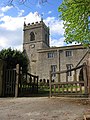
_All_Saints_Church_-_geograph.org.uk_-_67722.jpg)


_School_Chapel_-_geograph.org.uk_-_67831.jpg)


.jpg)


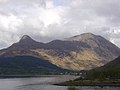
_and_Sgorr_Nam_Fiannaidh_-_geograph.org.uk_-_172066.jpg)


.jpg)


