Category:United Kingdom photographs taken on 2005-04-26
Countries of Europe: Belgium · Czech Republic · France‡ · Germany · Greece · Italy · Netherlands‡ · Poland · Portugal‡ · Romania · Russia‡ · Serbia · Slovakia · Spain‡ · Switzerland · Turkey‡ · United Kingdom
‡: partly located in Europe
‡: partly located in Europe
| ← | 26 April 2005 | → | ||
| ← | April 2005 | → | ||

United Kingdom photographs taken on 26 April 2005.
Image files should be categorized here automatically using {{taken on}} template. Direct categorisation is also possible, if automatic is impossible.
Subcategories
This category has only the following subcategory.
Media in category "United Kingdom photographs taken on 2005-04-26"
The following 104 files are in this category, out of 104 total.
-
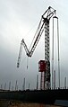 "Praying Mantis" Crane - geograph.org.uk - 765042.jpg 408 × 640; 43 KB
-
 Acharacle Free Church - geograph.org.uk - 38904.jpg 640 × 480; 144 KB
-
 Ancient-pollarded-beech-savernake-2005-04-26.JPG 1,600 × 1,200; 1.52 MB
-
 Autumn Ivy (11015559).jpg 614 × 476; 94 KB
-
 Barred4life (11015561).jpg 461 × 228; 32 KB
-
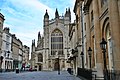 Bath-Abbey14.jpg 2,496 × 1,664; 2.62 MB
-
 Bath-Abbey15.jpg 1,664 × 2,470; 2.71 MB
-
 Blackley Cemetery - geograph.org.uk - 6179.jpg 640 × 480; 121 KB
-
 Blackmore Park Lodge - geograph.org.uk - 5874.jpg 640 × 479; 68 KB
-
 Bradley Green Church - geograph.org.uk - 5820.jpg 640 × 480; 70 KB
-
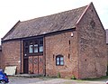
 Brockhurst School (Marlston House) - geograph.org.uk - 5841.jpg 640 × 480; 354 KB
-
 Brumwheel (11015576).jpg 689 × 530; 73 KB
-
 Building the brumwheel (11015573).jpg 688 × 538; 86 KB
-
 Cold Elm Road Junction - geograph.org.uk - 5866.jpg 640 × 479; 65 KB
-
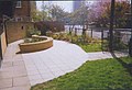 Community garden at St Matthew's - geograph.org.uk - 846457.jpg 640 × 437; 86 KB
-
 Creag Coire nan Each - geograph.org.uk - 766563.jpg 498 × 640; 97 KB
-
 Early morning outside Birmingham Airport (11015613).jpg 250 × 496; 8 KB
-
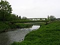 Footbridge over Glaze Brook - geograph.org.uk - 6199.jpg 640 × 480; 119 KB
-
-
 German market -1 (11015621).jpg 629 × 468; 82 KB
-
 German market -2 (11015623).jpg 640 × 480; 70 KB
-
 German market -3 (11015628).jpg 640 × 480; 92 KB
-
 German market -4 (11015631).jpg 640 × 480; 72 KB
-
 Glaze Brook, Cadishead, Salford - geograph.org.uk - 6197.jpg 640 × 480; 115 KB
-
 Grazeley Green - geograph.org.uk - 5746.jpg 640 × 427; 252 KB
-
 Heathrow Airport - geograph.org.uk - 6602.jpg 640 × 480; 72 KB
-
 Hethpool Linn - geograph.org.uk - 75751.jpg 640 × 480; 214 KB
-
 Hips Heugh - geograph.org.uk - 75767.jpg 640 × 88; 26 KB
-
 Humbleton Hill hill fort - geograph.org.uk - 75771.jpg 640 × 480; 127 KB
-

-
 King of Digbeth (11015637).jpg 640 × 448; 92 KB
-
 London Routemaster bus, route 38, Victoria, 26 April 2005.jpg 204 × 255; 53 KB
-
 Low Wash - geograph.org.uk - 66889.jpg 400 × 533; 33 KB
-

-
 Church at Marlston House - geograph.org.uk - 5842.jpg 640 × 480; 467 KB
-
 North ridge of Carn Eige - geograph.org.uk - 766546.jpg 640 × 480; 64 KB
-
 Northern slopes of Beinn Fhionnlaidh - geograph.org.uk - 766508.jpg 640 × 480; 67 KB
-
 Outcrop on Beinn Dubh - geograph.org.uk - 820448.jpg 640 × 480; 21 KB
-
 Peace Garden (11015643).jpg 380 × 564; 52 KB
-
 Pingewood - geograph.org.uk - 5741.jpg 640 × 427; 243 KB
-
 Pingewood - geograph.org.uk - 5742.jpg 640 × 427; 306 KB
-
 Pingewood - geograph.org.uk - 5743.jpg 640 × 427; 249 KB
-
 Pingewood - geograph.org.uk - 5744.jpg 640 × 427; 265 KB
-
 Pingewood - geograph.org.uk - 5745.jpg 640 × 427; 208 KB
-
 Pittendreich - geograph.org.uk - 13079.jpg 640 × 418; 137 KB
-
 Purple and white "Bluebells" - geograph.org.uk - 1241839.jpg 640 × 425; 130 KB
-
 St. Peters church, Rous Lench. - geograph.org.uk - 5735.jpg 640 × 480; 67 KB
-
 Royal Mail box at Radford. - geograph.org.uk - 5731.jpg 480 × 640; 113 KB
-

-
 Shallow Ford near Bucklebury - geograph.org.uk - 5812.jpg 640 × 480; 364 KB
-
 Slow down, there's a bend ahead - geograph.org.uk - 353813.jpg 640 × 426; 109 KB
-
 St Matthew at the Elephant - geograph.org.uk - 846450.jpg 640 × 480; 85 KB
-
 St Thomas's Church, Bowlee - geograph.org.uk - 6192.jpg 640 × 480; 130 KB
-
 Tayfen estate and lake with rainbow - geograph.org.uk - 951380.jpg 640 × 480; 55 KB
-
 The Cairn on Humbleton Hill - geograph.org.uk - 75769.jpg 640 × 164; 39 KB
-
 The gates to Jacqueline Close - geograph.org.uk - 951479.jpg 640 × 480; 132 KB
-
 The six foot waterfall - geograph.org.uk - 1498108.jpg 640 × 483; 88 KB
-
 Three Mile Cross - geograph.org.uk - 5738.jpg 640 × 427; 226 KB
-
 Three Mile Cross - geograph.org.uk - 5739.jpg 640 × 427; 251 KB
-
 Tor-Na-Dee Hospital - geograph.org.uk - 214205.jpg 640 × 480; 76 KB
-
 Tor-Na-Dee Hospital - geograph.org.uk - 214207.jpg 640 × 480; 94 KB
-
 Tor-Na-Dee Hospital - geograph.org.uk - 214209.jpg 640 × 480; 106 KB
-
 Towards centenary square (11015570).jpg 688 × 516; 78 KB
-
 Waterfall on Allt Coire an Lochain - geograph.org.uk - 766356.jpg 480 × 640; 110 KB
-
 Approaching Amberwood Inclosure - geograph.org.uk - 75025.jpg 640 × 480; 75 KB
-
 Beinn Dubh - Trig Pillar S7257 - geograph.org.uk - 820364.jpg 640 × 480; 33 KB
-
 Beinn Dubh, 514m - geograph.org.uk - 820386.jpg 640 × 480; 20 KB
-
 Bookilber (Barn) - geograph.org.uk - 633148.jpg 640 × 480; 99 KB
-
 Burns tumble into Loch Mullardoch - geograph.org.uk - 766338.jpg 640 × 480; 69 KB
-
 Danemoor Farm, Welland - geograph.org.uk - 5871.jpg 640 × 479; 56 KB
-
 Farmland between Bucklebury and Frilsham - geograph.org.uk - 5817.jpg 640 × 480; 323 KB
-
 Feral Goats on the side of Easter Tor - geograph.org.uk - 75761.jpg 640 × 480; 268 KB
-
 Harbour side cottages in Charlestown - geograph.org.uk - 373820.jpg 640 × 411; 68 KB
-
 Hawkridge Farm - geograph.org.uk - 5834.jpg 640 × 480; 467 KB
-
 Hawkridge House and Farmland - geograph.org.uk - 5837.jpg 640 × 480; 418 KB
-

-
 Looking through the Pass of Glencoe - geograph.org.uk - 385984.jpg 640 × 480; 71 KB
-
 Magpie Farm near Frilsham - geograph.org.uk - 5850.jpg 640 × 480; 536 KB
-
 Mariners Lane, Bradfield Southend - geograph.org.uk - 5823.jpg 640 × 480; 473 KB
-
 Marlston Farmland - geograph.org.uk - 5845.jpg 640 × 480; 427 KB
-
 Mitre Farm, Cold Elm - geograph.org.uk - 5868.jpg 640 × 479; 62 KB
-
 Monday Cleugh and Harehope Hill - geograph.org.uk - 75773.jpg 640 × 480; 128 KB
-
 Neat rows of vegetables at Bretforton. - geograph.org.uk - 5729.jpg 640 × 480; 77 KB
-
 New Barn Farm, Pig Farm - geograph.org.uk - 5853.jpg 640 × 480; 457 KB
-
 Northumberland Road - geograph.org.uk - 5933.jpg 640 × 480; 113 KB
-
 NSA Headquarters, Malvern - geograph.org.uk - 5872.jpg 640 × 495; 72 KB
-
-
 Penhale Sands - geograph.org.uk - 12028.jpg 640 × 480; 89 KB
-
 Plant Hill Park - geograph.org.uk - 6165.jpg 640 × 480; 109 KB
-
 Pond at Manor House Farm - geograph.org.uk - 5828.jpg 640 × 480; 460 KB
-
 Rhodes Green - geograph.org.uk - 6193.jpg 640 × 480; 94 KB
-
 River Barn Farmland and Stream - geograph.org.uk - 5815.jpg 640 × 480; 340 KB
-
 River Irk, Higher Blackley - geograph.org.uk - 6173.jpg 640 × 480; 162 KB
-
 River Irk, Rhodes near Middleton - geograph.org.uk - 6194.jpg 640 × 480; 157 KB
-
 Summit , Ruardean Hill. - geograph.org.uk - 6792.jpg 640 × 480; 72 KB
-
 Tesco's store Evesham - geograph.org.uk - 5736.jpg 640 × 480; 52 KB
-
 The Alders near Frilsham - geograph.org.uk - 5848.jpg 640 × 480; 602 KB
-
 The avenue to Lawn Farm - geograph.org.uk - 5862.jpg 640 × 479; 91 KB
-
 The Water Towers at Blackmore. - geograph.org.uk - 5875.jpg 640 × 556; 90 KB
-
 Treelined Country Road to Frilsham - geograph.org.uk - 5838.jpg 640 × 480; 493 KB
-
 Trees at River Barn Farm, Bucklebury - geograph.org.uk - 5814.jpg 640 × 480; 367 KB
-
 View from Pot Kiln Pub near Frilsham - geograph.org.uk - 5852.jpg 640 × 480; 394 KB
-
 Walnut Tree Cottages near Bucklebury - geograph.org.uk - 5825.jpg 640 × 480; 414 KB
-
 Werth Farm, Chaceley - geograph.org.uk - 5864.jpg 640 × 479; 50 KB


.jpg)
.jpg)


_-_geograph.org.uk_-_5841.jpg)
.jpg)
.jpg)


.jpg)


.jpg)
.jpg)
.jpg)
.jpg)


.jpg)


.jpg)


.jpg)


_-_geograph.org.uk_-_633148.jpg)


