Category:United Kingdom photographs taken on 2004-09-05
| ← | Sunday 5 September 2004 | → | ||
| ← | September 2004 | → | ||

United Kingdom photographs taken on 5 September 2004.
Image files should be categorized here automatically using {{taken on}} template. Direct categorisation is also possible, if automatic is impossible.
Media in category "United Kingdom photographs taken on 2004-09-05"
The following 104 files are in this category, out of 104 total.
-
 "Fairy Glen "from across Glen Conon - geograph.org.uk - 112631.jpg 640 × 480; 70 KB
-
 "TS Royalist" Sail Training Ship - geograph.org.uk - 18442.jpg 640 × 480; 152 KB
-
 3 Graces - geograph.org.uk - 688771.jpg 640 × 480; 68 KB
-
 A Quiet Time - geograph.org.uk - 55289.jpg 640 × 414; 140 KB
-

-

-

-
 Albion Street - geograph.org.uk - 1098147.jpg 640 × 480; 119 KB
-
 Allen River, Alderholt Mill, Alderholt - geograph.org.uk - 784964.jpg 640 × 480; 156 KB
-
 Alleyway to the rear of Albion Street. - geograph.org.uk - 1098152.jpg 640 × 480; 110 KB
-
 Birkenhead North Station (1)-by-E-Pollock.jpg 640 × 481; 80 KB
-
 Birkenhead North Station-by-E-Pollock.jpg 640 × 481; 59 KB
-
 Black clock, white clock - geograph.org.uk - 479984.jpg 640 × 429; 79 KB
-
 Bridge at Henlle Hall, Chirk Bank - geograph.org.uk - 50548.jpg 640 × 480; 154 KB
-
 Bridge over the river Otter - geograph.org.uk - 410103.jpg 480 × 640; 208 KB
-
 Cadley Lock No 54, Kennet and Avon Canal - geograph.org.uk - 856305.jpg 640 × 480; 124 KB
-
 Chatsworth House - geograph.org.uk - 58219.jpg 640 × 443; 150 KB
-
 Claverton Pumping Station - geograph.org.uk - 158573.jpg 640 × 425; 132 KB
-

-

-
 Dancing Ledge - geograph.org.uk - 170518.jpg 480 × 640; 108 KB
-
 Dead Oak - geograph.org.uk - 1503211.jpg 480 × 640; 100 KB
-
 Deer in the Heath at Arne - geograph.org.uk - 85102.jpg 640 × 452; 99 KB
-
 Departure from Harman's Cross - geograph.org.uk - 85104.jpg 640 × 480; 130 KB
-

-
 Drigg railway station in 2004.jpg 640 × 480; 60 KB
-

-
 Exeter School.jpg 640 × 480; 85 KB
-
 Field Wall - geograph.org.uk - 1503223.jpg 640 × 480; 131 KB
-
 Foggintor Quarry - geograph.org.uk - 224168.jpg 640 × 480; 158 KB
-
-
 Gathering Sheep - geograph.org.uk - 128037.jpg 640 × 480; 85 KB
-
 Gilwern - geograph.org.uk - 1280135.jpg 640 × 457; 357 KB
-
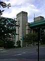
 Holy Jesus Hospital - detail - geograph.org.uk - 726529.jpg 640 × 538; 115 KB
-
 Holy Jesus Hospital - geograph.org.uk - 726519.jpg 640 × 480; 64 KB
-
 Hook colliery quay from footpath - geograph.org.uk - 844356.jpg 640 × 480; 96 KB
-
 Iron Bridge, Brabyn's Park.jpg 2,048 × 1,536; 725 KB
-
 Llyn Ogwen - geograph.org.uk - 234934.jpg 640 × 480; 147 KB
-
 Login's well, Stromness. - geograph.org.uk - 79444.jpg 640 × 480; 161 KB
-

-

-
 Lytham Assembly Rooms - geograph.org.uk - 11285.jpg 640 × 526; 80 KB
-
 No words needed - geograph.org.uk - 725959.jpg 640 × 470; 104 KB
-
 North Berwick Beach.jpg 640 × 480; 59 KB
-
 Nostell Priory.jpg 640 × 476; 113 KB
-
 Pencils (255816850) (2).jpg 1,404 × 1,414; 248 KB
-
 Pentrebach hamlet - geograph.org.uk - 1181965.jpg 480 × 640; 100 KB
-

-
 Railway Viaduct over Dean Street - geograph.org.uk - 725920.jpg 480 × 640; 81 KB
-
 River Weaver near Runcorn - geograph.org.uk - 74145.jpg 640 × 480; 87 KB
-
 Road junction - geograph.org.uk - 825311.jpg 640 × 457; 356 KB
-
 Road junction - geograph.org.uk - 825320.jpg 640 × 457; 320 KB
-
-
 Royal Mail - geograph.org.uk - 823965.jpg 640 × 457; 322 KB
-

-
 Sage and Tyne - geograph.org.uk - 725928.jpg 640 × 480; 62 KB
-
 Site preparation - geograph.org.uk - 1280140.jpg 640 × 457; 259 KB
-
 Site preparation - geograph.org.uk - 823962.jpg 640 × 457; 371 KB
-
 Site preparation - geograph.org.uk - 823963.jpg 640 × 457; 354 KB
-
 Snowdon Railway - geograph.org.uk - 158550.jpg 640 × 480; 96 KB
-
 Snowdon Summit - geograph.org.uk - 158543.jpg 640 × 480; 148 KB
-
 Spare London Bridge Corbels - geograph.org.uk - 224173.jpg 640 × 480; 154 KB
-
 Sports Day (1) - geograph.org.uk - 726452.jpg 640 × 480; 66 KB
-
 Sports Day (2) - geograph.org.uk - 726454.jpg 480 × 640; 58 KB
-
 St George's Church. Harnham - geograph.org.uk - 365095.jpg 640 × 480; 182 KB
-
 St John's House, Warnford Park, Hampshire - geograph.org.uk - 52560.jpg 640 × 480; 123 KB
-
 Stanley Place - geograph.org.uk - 1098188.jpg 640 × 480; 107 KB
-
 Stone Wall near Sykes - geograph.org.uk - 1503229.jpg 640 × 480; 149 KB
-
 Temple of Minerva - geograph.org.uk - 1098163.jpg 640 × 480; 125 KB
-
 Thames Path sign, Thames Barrier.jpg 1,600 × 1,200; 765 KB
-
 The Blue Beacon, Gateshead (geograph 726503).jpg 480 × 640; 97 KB
-
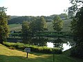 The Fedw Pool, Late Evening - geograph.org.uk - 203556.jpg 640 × 480; 320 KB
-
 The Old Vicarage Dale Bottom - geograph.org.uk - 1503195.jpg 640 × 480; 85 KB
-
 The road down to Saddle Bridge - geograph.org.uk - 224696.jpg 640 × 480; 149 KB
-
 The Swing and the High - geograph.org.uk - 725995.jpg 640 × 470; 79 KB
-

-
 Too much choice^ - geograph.org.uk - 726472.jpg 640 × 480; 78 KB
-
 Tyne Bridge towers - geograph.org.uk - 726500.jpg 480 × 640; 68 KB
-
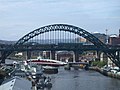 Tyne view from the Baltic - geograph.org.uk - 729608.jpg 640 × 480; 76 KB
-
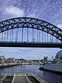 Tynescape - geograph.org.uk - 725967.jpg 480 × 640; 77 KB
-
 Tyrley wharf - geograph.org.uk - 679.jpg 640 × 481; 64 KB
-

-
 Wensley Bridge - geograph.org.uk - 107071.jpg 640 × 480; 127 KB
-

-
 Blacksmith's Cottage - geograph.org.uk - 43999.jpg 640 × 480; 132 KB
-

-
 Bratch Locks, Wombourne - geograph.org.uk - 360164.jpg 640 × 512; 119 KB
-
 Bridge at Ringland over the River Wensum - geograph.org.uk - 43455.jpg 640 × 480; 101 KB
-
 Cam Gill - geograph.org.uk - 101182.jpg 640 × 480; 35 KB
-
 Crofton Pumping Station - geograph.org.uk - 158567.jpg 640 × 412; 53 KB
-
 Danby Beacon - geograph.org.uk - 1602.jpg 640 × 427; 69 KB
-
 Fairhaven Lake - geograph.org.uk - 11282.jpg 640 × 480; 52 KB
-
 Hot Air Balloon - geograph.org.uk - 94699.jpg 640 × 480; 73 KB
-
 Lydiate Parish Council Village Green - geograph.org.uk - 689799.jpg 640 × 483; 93 KB
-

-
 Park Gill. - geograph.org.uk - 101177.jpg 640 × 480; 44 KB
-
 Path to Ben Vrackie - geograph.org.uk - 34054.jpg 480 × 640; 73 KB
-
 Sheigra Beach - geograph.org.uk - 405592.jpg 640 × 167; 21 KB
-
 Sparrow - geograph.org.uk - 543320.jpg 640 × 480; 135 KB
-

-
 The Bratch Locks at Wombourne - geograph.org.uk - 360148.jpg 640 × 480; 137 KB
-
 Top Mere Road - geograph.org.uk - 27517 (cropped).jpg 561 × 421; 32 KB
-
 Top Mere Road - geograph.org.uk - 27517.jpg 640 × 480; 44 KB
-
 Treeline on the path to Ben Vrackie - geograph.org.uk - 34056.jpg 640 × 480; 67 KB


-by-E-Pollock.jpg)


_(2).jpg)


_-_geograph.org.uk_-_726452.jpg)
_-_geograph.org.uk_-_726454.jpg)


.jpg)


.jpg)