Category:United Kingdom photographs taken on 2004-09-12
| ← | Sunday 12 September 2004 | → | ||
| ← | September 2004 | → | ||

United Kingdom photographs taken on 12 September 2004.
Image files should be categorized here automatically using {{taken on}} template. Direct categorisation is also possible, if automatic is impossible.
Media in category "United Kingdom photographs taken on 2004-09-12"
The following 40 files are in this category, out of 40 total.
-

-
 AA Box 137 - geograph.org.uk - 1077678.jpg 536 × 640; 101 KB
-
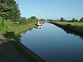
 Bridge 39 Shropshire Union Canal - geograph.org.uk - 81582.jpg 640 × 448; 88 KB
-
 Castletown - geograph.org.uk - 416638.jpg 640 × 427; 85 KB
-
 Coven of Witches, Burley - geograph.org.uk - 360167.jpg 640 × 480; 112 KB
-
 Dover harbour - panoramio (1).jpg 1,235 × 745; 366 KB
-
 Dunstanburgh Castle - geograph.org.uk - 286530.jpg 640 × 480; 85 KB
-
 Dunstanburgh Castle - geograph.org.uk - 286531.jpg 640 × 480; 69 KB
-
 Ford at Blo Norton - geograph.org.uk - 814111.jpg 640 × 480; 64 KB
-
 Forton Aqueduct - geograph.org.uk - 98665.jpg 640 × 480; 104 KB
-

-
 Grisedale Pike from Hobcarton Crag - geograph.org.uk - 97562.jpg 240 × 320; 17 KB
-
 Hednesford Raceway - geograph.org.uk - 32780.jpg 640 × 480; 111 KB
-
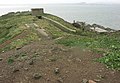
 Inchkeith Island - geograph.org.uk - 14269.jpg 640 × 480; 134 KB
-
 Inchkeith Island - geograph.org.uk - 14270.jpg 640 × 442; 141 KB
-
 Inchkeith Island - geograph.org.uk - 14271.jpg 640 × 456; 136 KB
-
 Johnstone Castle - geograph.org.uk - 927914.jpg 640 × 426; 86 KB
-
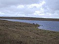
 Loch an Tuim - geograph.org.uk - 732782.jpg 640 × 480; 28 KB
-
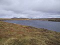 Loch Ceann Thallabhat - geograph.org.uk - 732767.jpg 640 × 480; 37 KB
-
 Misty morning Loweswater - geograph.org.uk - 1007683.jpg 640 × 394; 52 KB
-
 Norbury Junction - geograph.org.uk - 98690.jpg 639 × 449; 87 KB
-
 Nottingham Marathon 2004 in Parkside - geograph.org.uk - 1210416.jpg 640 × 480; 115 KB
-
 Ormesby Hall - geograph.org.uk - 38489.jpg 640 × 476; 118 KB
-
 OrmesbyHall(JohnDavidson)Sep2004.jpg 640 × 476; 125 KB
-
 Priestgate, Barton-Upon-Humber - geograph.org.uk - 143531.jpg 640 × 479; 127 KB
-
 Reeves Green Cottage , Wareside - geograph.org.uk - 302444.jpg 640 × 480; 200 KB
-
 Shieling at Loch nan Caorach - geograph.org.uk - 732773.jpg 640 × 480; 32 KB
-
 Shropshire union canal - geograph.org.uk - 1984.jpg 640 × 481; 31 KB
-
 South end of Loch Airigh Seibh - geograph.org.uk - 732776.jpg 640 × 480; 33 KB
-
 View from Woodcock Hill - geograph.org.uk - 746315.jpg 640 × 480; 80 KB
-
 Across the fields to Boltby - geograph.org.uk - 166021.jpg 640 × 480; 137 KB
-
 Country lanes - geograph.org.uk - 165077.jpg 480 × 640; 191 KB
-
 Deopham Countryside - geograph.org.uk - 3333.jpg 640 × 480; 77 KB
-
 Forest Tracks - geograph.org.uk - 166029.jpg 640 × 480; 207 KB
-
 River Mersey near Chorlton Water Park - geograph.org.uk - 8560.jpg 640 × 480; 224 KB
-
 Sneck Yate Bank - geograph.org.uk - 165565.jpg 480 × 640; 225 KB
-
 The Aire valley from Druids Altar - geograph.org.uk - 638385.jpg 640 × 90; 20 KB
-
 The gateway - geograph.org.uk - 166025.jpg 480 × 640; 196 KB
-
 The River Isla near Coupar Angus - geograph.org.uk - 7356.jpg 640 × 480; 163 KB
-
 Views towards Felixkirk - geograph.org.uk - 166032.jpg 640 × 480; 206 KB


.jpg)


Sep2004.jpg)


