Category:United Kingdom photographs taken on 2004-10-16
Countries of Europe: Austria · Belgium · Czech Republic · Denmark · France‡ · Germany · Italy · Netherlands‡ · Portugal‡ · Russia‡ · Spain‡ · Switzerland · United Kingdom
‡: partly located in Europe
‡: partly located in Europe
| ← | 16 October 2004 | → | ||
| ← | October 2004 | → | ||

United Kingdom photographs taken on 16 October 2004.
Image files should be categorized here automatically using {{taken on}} template. Direct categorisation is also possible, if automatic is impossible.
Media in category "United Kingdom photographs taken on 2004-10-16"
The following 71 files are in this category, out of 71 total.
-
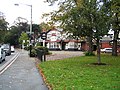
 4 Courtney Road, Rock Ferry - geograph.org.uk - 93809.jpg 640 × 480; 91 KB
-
 A Busy Watergate Street near the Cross - geograph.org.uk - 12479.jpg 640 × 480; 132 KB
-
 A summit, Druim a'Chuirn - geograph.org.uk - 8839.jpg 640 × 433; 58 KB
-
 Aerospatiale SA-365F Dauphin 2 Irish Air Corps.jpg 1,200 × 786; 330 KB
-
 AgaricusSilvaticus.JPG 960 × 1,280; 291 KB
-

-
 Berntsen, Bridge of Orchy - geograph.org.uk - 1327058.jpg 640 × 480; 92 KB
-
 Black Bull, Gateacre Village.jpg 428 × 320; 87 KB
-
 Castle Keep - Bolsover Castle - geograph.org.uk - 70625.jpg 640 × 480; 71 KB
-
 Coledale from Coledale Hause - geograph.org.uk - 1762397.jpg 2,272 × 1,712; 925 KB
-
 Coledale Hause - geograph.org.uk - 1762406.jpg 2,272 × 1,712; 914 KB
-
 Cussacombe Common - geograph.org.uk - 479598.jpg 640 × 480; 70 KB
-
 Dartington Hall gardens - geograph.org.uk - 970536.jpg 640 × 480; 174 KB
-
 End of Loch Arkaig - geograph.org.uk - 8842.jpg 640 × 480; 68 KB
-

-
 Gunwharf Quay - panoramio - Alistair Cunningham.jpg 1,024 × 768; 338 KB
-
 Gunwharf Quay - panoramio.jpg 1,024 × 768; 322 KB
-
 Highland bull, Glen Dessarry - geograph.org.uk - 8825.jpg 640 × 480; 89 KB
-
 Hole Cottage, near Cowden, Kent - geograph.org.uk - 40462.jpg 640 × 427; 142 KB
-
 Leaf Removal Train, Eaglescliffe Station - geograph.org.uk - 75385.jpg 640 × 480; 120 KB
-
 Little Town and the Newlands Valley - geograph.org.uk - 1761607.jpg 2,272 × 1,712; 716 KB
-
 Lower Slopes of Cairn of Claise - geograph.org.uk - 22545.jpg 640 × 480; 63 KB
-
 Mathew Street, Liverpool - geograph.org.uk - 94332.jpg 640 × 480; 102 KB
-
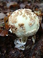 MushroomEmerging.JPG 960 × 1,280; 285 KB
-
 Nearing the top of Causey Pike - geograph.org.uk - 1762301.jpg 2,272 × 1,712; 620 KB
-

-
 Old Portsmouth - panoramio.jpg 1,024 × 768; 264 KB
-
 Oxwich Castle 1.jpg 640 × 474; 42 KB
-
 Path to Kinn - geograph.org.uk - 1762801.jpg 2,272 × 1,712; 730 KB
-
 Plumpton Rocks - geograph.org.uk - 32590.jpg 640 × 277; 60 KB
-
 Portsmouth Harbour - panoramio - Alistair Cunningham (2).jpg 1,024 × 768; 242 KB
-
 Portsmouth Harbour - panoramio - Alistair Cunningham (3).jpg 1,024 × 768; 247 KB
-
 Portsmouth Harbour - panoramio - Alistair Cunningham.jpg 1,024 × 768; 241 KB
-
 Portsmouth Harbour - panoramio.jpg 1,024 × 768; 241 KB
-
 PsathyrellapiluliformisClump.jpg 1,280 × 960; 301 KB
-
 Quantocks - geograph.org.uk - 504469.jpg 640 × 480; 32 KB
-
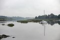
 River Deben - geograph.org.uk - 1734.jpg 640 × 427; 76 KB
-
 Rivet, Bridge of Orchy - geograph.org.uk - 1327065.jpg 640 × 480; 114 KB
-
 RollerCoaster Ride in West Sussex - Flickr - cloudzilla.jpg 1,280 × 960; 131 KB
-
 Scotland Welcomes You^ - geograph.org.uk - 7129.jpg 640 × 480; 93 KB
-
 Sheep in Campbell Park - geograph.org.uk - 5151.jpg 640 × 384; 46 KB
-
 Snape Maltings - geograph.org.uk - 1729.jpg 640 × 579; 137 KB
-
 St Mary's, South Hayling, Hampshire - geograph.org.uk - 53305.jpg 640 × 480; 72 KB
-
 Stepping stones across a stream - geograph.org.uk - 948681.jpg 640 × 480; 149 KB
-
 The Black Bull, Gateacre, Liverpool - geograph.org.uk - 93218.jpg 640 × 480; 150 KB
-

-
 The lower Newlands Valley - geograph.org.uk - 1761600.jpg 2,272 × 1,712; 988 KB
-
 The north western side of Eel Crag - geograph.org.uk - 1762387.jpg 2,272 × 1,712; 881 KB
-
 The path down from Grisedale Pike - geograph.org.uk - 1762795.jpg 2,272 × 1,712; 801 KB
-
 The Rose and Crown, Cheapside, Liverpool - geograph.org.uk - 94329.jpg 640 × 480; 112 KB
-
 The side of Barrow in autumn - geograph.org.uk - 1761603.jpg 2,272 × 1,712; 1.18 MB
-
 The top of Grisedale Pike - geograph.org.uk - 1762421.jpg 2,272 × 1,712; 639 KB
-
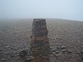 The trig point on Eel Crag - geograph.org.uk - 1762373.jpg 2,272 × 1,712; 820 KB
-
 The way up Causey Pike - geograph.org.uk - 1761597.jpg 2,272 × 1,712; 773 KB
-
 Thorpeness, The Meare - geograph.org.uk - 1738.jpg 640 × 427; 88 KB
-
 Wagn 317 346.JPG 717 × 538; 109 KB
-

-
 Bridge of Orchy - geograph.org.uk - 8846.jpg 640 × 480; 80 KB
-
 Cairn on High Spy - geograph.org.uk - 19525.jpg 640 × 457; 51 KB
-
 Corrie Chicheanais - geograph.org.uk - 8832.jpg 640 × 480; 66 KB
-
 Crop of sugar beet. - geograph.org.uk - 163606.jpg 640 × 462; 106 KB
-
 Fishing boats on the beach at Aldeburgh - geograph.org.uk - 1739.jpg 640 × 382; 45 KB
-
 Lane in Bradfield Common - geograph.org.uk - 2543.jpg 640 × 480; 92 KB
-
 Martlesham Creek - geograph.org.uk - 1736.jpg 640 × 286; 33 KB
-
 Martlesham Creek - geograph.org.uk - 1737.jpg 640 × 427; 30 KB
-
 Moorings at Snape - geograph.org.uk - 1730.jpg 425 × 640; 69 KB
-
 Stanmore Hall Touring Park - geograph.org.uk - 371179.jpg 640 × 479; 108 KB
-
 Summit, Sgurr Cos na Breachd-laoidh - geograph.org.uk - 8834.jpg 640 × 441; 91 KB
-
 The Cioch - geograph.org.uk - 8836.jpg 640 × 447; 67 KB
-
 The new Lodge, Glen Dessarry - geograph.org.uk - 8827.jpg 640 × 446; 47 KB
-


.jpg)
.jpg)


