Category:United Kingdom photographs taken on 2005-08-03
| ← | Wednesday 3 August 2005 | → | ||
| ← | August 2005 | → | ||

United Kingdom photographs taken on 3 August 2005.
Image files should be categorized here automatically using {{taken on}} template. Direct categorisation is also possible, if automatic is impossible.
Media in category "United Kingdom photographs taken on 2005-08-03"
The following 200 files are in this category, out of 448 total.
(previous page) (next page)-
 A272 road - geograph.org.uk - 33042.jpg 640 × 480; 117 KB
-
 A272 road near the nursery - geograph.org.uk - 33045.jpg 640 × 480; 140 KB
-
 A34 and Open Land near Beedon - geograph.org.uk - 33271.jpg 640 × 480; 317 KB
-
 A589 bridge over Lune at Lancaster - geograph.org.uk - 35056.jpg 640 × 429; 76 KB
-
 Abbey Gate, St. Albans, Herts. - geograph.org.uk - 118956.jpg 640 × 480; 92 KB
-
 Across the valley made by Kinchie Burn - geograph.org.uk - 47842.jpg 640 × 479; 107 KB
-

-
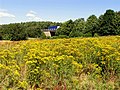
 All Saints, Hempstead, Norfolk - geograph.org.uk - 317420.jpg 640 × 476; 107 KB
-
 All Saints, Hempstead, Norfolk - geograph.org.uk - 317421.jpg 640 × 455; 113 KB
-
 All Saints, Hempstead, Norfolk - geograph.org.uk - 317422.jpg 640 × 396; 106 KB
-

-
 All Saints, Sharrington, Norfolk - geograph.org.uk - 317446.jpg 519 × 640; 101 KB
-
 All Saints, Sharrington, Norfolk - geograph.org.uk - 317449.jpg 497 × 640; 99 KB
-
 All Saints, Sharrington, Norfolk.jpg 476 × 640; 115 KB
-
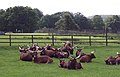 Ankole Cattle at Longleat Safari Park - geograph.org.uk - 315238.jpg 640 × 410; 88 KB
-
 Archbishop's Palace, Charing - geograph.org.uk - 34772.jpg 640 × 480; 115 KB
-
 Arnfield Reservoir, Tintwistle - geograph.org.uk - 33003.jpg 640 × 480; 66 KB
-
 Auchtertool Kirk from the South - geograph.org.uk - 616331.jpg 640 × 247; 45 KB
-
 Ballater St.Marine - geograph.org.uk - 902936.jpg 640 × 480; 102 KB
-
 Barley Field near East Ilsley - geograph.org.uk - 33276.jpg 640 × 480; 232 KB
-
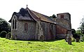
 St Mary, Barningham Winter, Norfolk - geograph.org.uk - 318224.jpg 640 × 458; 114 KB
-
 St Mary, Barningham Winter, Norfolk - geograph.org.uk - 318225.jpg 531 × 640; 130 KB
-
 St Mary, Barningham Winter, Norfolk - geograph.org.uk - 318226.jpg 640 × 498; 137 KB
-

-
 Beach structures - geograph.org.uk - 136694.jpg 640 × 480; 102 KB
-
 World's End Village - geograph.org.uk - 33270.jpg 640 × 480; 166 KB
-
 Beedon Village - geograph.org.uk - 34259.jpg 640 × 480; 172 KB
-
 Bescaby Oaks near Croxton Park and Bescaby - geograph.org.uk - 33221.jpg 432 × 324; 114 KB
-
 Big Ben Parketik - panoramio.jpg 1,200 × 1,600; 468 KB
-
 Black Law Wind Farm S Lanarkshire - geograph.org.uk - 33122.jpg 640 × 480; 44 KB
-
 Black Tor Blowing House - geograph.org.uk - 233421.jpg 640 × 480; 210 KB
-
 Blackmill Farm - geograph.org.uk - 37279.jpg 640 × 480; 59 KB
-
 Boat House, Loch Davan - geograph.org.uk - 33893.jpg 640 × 480; 93 KB
-

-
 Boathouse, N end of Loch Muick - geograph.org.uk - 35854.jpg 640 × 480; 177 KB
-
 Bothampstead Farm, Bothampstead - geograph.org.uk - 33263.jpg 640 × 480; 208 KB
-

-
 Bradford GS.jpg 640 × 480; 121 KB
-
 Brantingham Wold - geograph.org.uk - 120096.jpg 480 × 640; 96 KB
-
 Bratton Church and woodland - geograph.org.uk - 86574.jpg 640 × 449; 65 KB
-
 Brecon Beacons - geograph.org.uk - 713149.jpg 640 × 480; 42 KB
-
 Bridge over Paddock Beck - geograph.org.uk - 33001.jpg 402 × 536; 98 KB
-
 Bridges - geograph.org.uk - 60209.jpg 640 × 480; 123 KB
-

-
 Buckinham Palace aurrean, goardia aldaketa ikustearen zain - panoramio.jpg 1,200 × 1,600; 517 KB
-
 Bude Castle - geograph.org.uk - 130886.jpg 640 × 424; 122 KB
-
 Bude Lifeboat Station - geograph.org.uk - 130881.jpg 640 × 424; 111 KB
-
 Burghfield Mill , Private Estate - geograph.org.uk - 35392.jpg 640 × 480; 144 KB
-
 Burrator Dam (the other side) - geograph.org.uk - 83276.jpg 640 × 480; 123 KB
-
 Bus Shelter, near Ordie - geograph.org.uk - 38198.jpg 640 × 480; 56 KB
-
 Bushmills Distillery - geograph.org.uk - 1139055.jpg 640 × 414; 81 KB
-
 Byway at World's End - geograph.org.uk - 33269.jpg 640 × 480; 239 KB
-
 Byway Bridge over M4, Oare - geograph.org.uk - 33247.jpg 640 × 480; 190 KB
-
-
 Cartwright Hall - geograph.org.uk - 33170.jpg 640 × 480; 112 KB
-
 Causeway Hotel (415732347).jpg 3,456 × 2,304; 3.16 MB
-
 Central Gully, Creag an Dubh Loch. - geograph.org.uk - 35828.jpg 603 × 640; 191 KB
-

-
 Cheadle Hulme Cenotaph. - geograph.org.uk - 268713.jpg 429 × 640; 176 KB
-
 Cheadle Hulme cenotaph.jpg 429 × 640; 143 KB
-
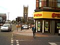
 Cheam Village Crossroads - geograph.org.uk - 32938.jpg 640 × 480; 86 KB
-
 Chepstow - Cows in Meadow at Castleford - geograph.org.uk - 205410.jpg 640 × 480; 411 KB
-

-
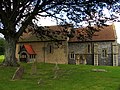
 Chevington - Church of All Saints.jpg 640 × 427; 97 KB
-
 Church Cove - geograph.org.uk - 34901.jpg 640 × 480; 107 KB
-
 Church of St Winwaloe, Church Cove - geograph.org.uk - 34902.jpg 640 × 480; 111 KB
-
 Comber Dale on the Wolds Way - geograph.org.uk - 120098.jpg 640 × 480; 122 KB
-
 Combine harvester - geograph.org.uk - 148023.jpg 640 × 425; 49 KB
-
 Crag below N side of Cairn Bannoch - geograph.org.uk - 35827.jpg 640 × 357; 146 KB
-
 Crash gates, Edinburgh Airport. - geograph.org.uk - 33072.jpg 640 × 480; 106 KB
-
 Cropredy - geograph.org.uk - 82431.jpg 640 × 480; 146 KB
-
 Cross roads in the centre of Waltham - geograph.org.uk - 33231.jpg 640 × 480; 166 KB
-
 Cuddington Recreation Ground - geograph.org.uk - 32932.jpg 640 × 480; 69 KB
-
 Curry Church - geograph.org.uk - 34963.jpg 640 × 512; 91 KB
-

-

-
 Disused railway, Newbridge. - geograph.org.uk - 33070.jpg 480 × 640; 117 KB
-
 Down Farm Land near Worlds End - geograph.org.uk - 34268.jpg 640 × 480; 189 KB
-
 Drabblegate Common - geograph.org.uk - 1093241.jpg 640 × 268; 42 KB
-
 Dunsop Bridge - geograph.org.uk - 33111.jpg 640 × 435; 131 KB
-

-
 East Haddon - geograph.org.uk - 33768.jpg 640 × 480; 81 KB
-
 East Haddon Bus Shelter - geograph.org.uk - 33772.jpg 640 × 480; 150 KB
-
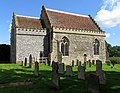
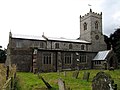
 East Haddon Church - geograph.org.uk - 33767.jpg 640 × 480; 62 KB
-
 Edinburgh Ingliston park and ride.jpg 640 × 448; 66 KB
-
 Entrance gates to Winthill Farm - geograph.org.uk - 33069.jpg 640 × 479; 155 KB
-

-
 Evening at Peel Harbour - geograph.org.uk - 1618737.jpg 640 × 429; 83 KB
-
 Exeter , Marsh Barton Retail Park - geograph.org.uk - 1224918.jpg 640 × 480; 58 KB
-
 Farmland at Ickworth - geograph.org.uk - 33117.jpg 640 × 427; 87 KB
-

-
 Ford near Warnborough Green - geograph.org.uk - 66849.jpg 640 × 425; 136 KB
-
 Ford Place, near Wrotham - geograph.org.uk - 33315.jpg 640 × 480; 116 KB
-
 Foreland Point from Lynton - geograph.org.uk - 1304256.jpg 640 × 480; 73 KB
-
 Fortescue, Sidmouth - geograph.org.uk - 35071.jpg 640 × 349; 100 KB
-
 Forth Bridge from Dalmeny Station. - geograph.org.uk - 33087.jpg 534 × 640; 75 KB
-
 Forth Road and Rail Bridges - geograph.org.uk - 378789.jpg 640 × 442; 105 KB
-
 Fossil tree stump in Lister Park - geograph.org.uk - 33186.jpg 640 × 480; 207 KB
-
 Gardens and lake, The Vyne estate - geograph.org.uk - 64468.jpg 640 × 425; 132 KB
-
 George and Dragon - geograph.org.uk - 33008.jpg 640 × 497; 126 KB
-

-
 Glasgow Gallery of "Modern Art"^ - geograph.org.uk - 57813.jpg 479 × 640; 94 KB
-
 Glaze Brook - geograph.org.uk - 33283.jpg 640 × 480; 111 KB
-

-
 Goonhilly Downs - geograph.org.uk - 34899.jpg 640 × 480; 97 KB
-

-
 Great Brington - geograph.org.uk - 33760.jpg 640 × 480; 103 KB
-
 Great Brington Church - geograph.org.uk - 33765.jpg 480 × 640; 97 KB
-
 Grittlesend Hamlet - geograph.org.uk - 33066.jpg 640 × 479; 172 KB
-
 Guildhall, Swansea - geograph.org.uk - 33205.jpg 640 × 359; 48 KB
-
 Gully near to Cac Carn Mor, Lochnagar - geograph.org.uk - 35803.jpg 640 × 480; 166 KB
-
 Hangars at Duxford Air Museum - geograph.org.uk - 260120.jpg 640 × 480; 54 KB
-

-
 Harvesting down Arthurs - geograph.org.uk - 1110704.jpg 640 × 480; 79 KB
-
 Harvesting the wheat - geograph.org.uk - 144209.jpg 640 × 425; 38 KB
-
 Haytor Granite Tramway - geograph.org.uk - 224171.jpg 640 × 480; 151 KB
-
 Haytor Quarries - geograph.org.uk - 224169.jpg 640 × 480; 168 KB
-
 Head of Swindale, on the Wolds Way - geograph.org.uk - 120099.jpg 640 × 480; 99 KB
-

-

-
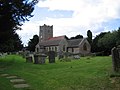
 Holy Trinity Church - geograph.org.uk - 33145.jpg 640 × 480; 57 KB
-
 In Keevil Village - geograph.org.uk - 86580.jpg 640 × 480; 87 KB
-
 John Millington.jpg 640 × 449; 138 KB
-
 Keevil Church - geograph.org.uk - 86576.jpg 640 × 480; 70 KB
-
 Kimpton Park Industrial Estate - geograph.org.uk - 32935.jpg 640 × 480; 123 KB
-
 Kirkliston - geograph.org.uk - 33073.jpg 639 × 429; 52 KB
-
 Len Valley Walk approaching Lenham - geograph.org.uk - 34050.jpg 640 × 480; 95 KB
-

-
 Leys with Morven in the Distance - geograph.org.uk - 33906.jpg 640 × 480; 59 KB
-
 Loch Davan - geograph.org.uk - 38193.jpg 360 × 480; 52 KB
-
 Loch na Corrobha, Ross of Mull - geograph.org.uk - 39115.jpg 640 × 480; 95 KB
-
 Longleat House and Gardens - geograph.org.uk - 308618.jpg 640 × 409; 109 KB
-

-
 Looking west along the railway near Lenham - geograph.org.uk - 34739.jpg 640 × 480; 127 KB
-
 Lownde Wood, Ickworth - geograph.org.uk - 33120.jpg 640 × 427; 92 KB
-
 Lune Aqueduct, Lancaster - geograph.org.uk - 35060.jpg 640 × 473; 68 KB
-
 Lune cycleway going under the aqueduct - geograph.org.uk - 35061.jpg 429 × 640; 112 KB
-
 Lytham RNLI station at sunset - geograph.org.uk - 33240.jpg 640 × 480; 55 KB
-
 M4 from Oareborough Lane, Oare - geograph.org.uk - 33250.jpg 640 × 480; 171 KB
-
 Main line - geograph.org.uk - 835560.jpg 640 × 457; 382 KB
-
 Mapperton House and Gardens - geograph.org.uk - 33559.jpg 640 × 480; 129 KB
-
 Marshy ground beside Allt an Dubh-loch - geograph.org.uk - 35824.jpg 640 × 538; 168 KB
-
 Mary Lane, Bescaby - geograph.org.uk - 1569911.jpg 640 × 480; 123 KB
-
 Mathon - geograph.org.uk - 33105.jpg 640 × 479; 138 KB
-

-
 Melgum and Cot Hill - geograph.org.uk - 37286.jpg 640 × 480; 40 KB
-
 Melledgan - Scilly - geograph.org.uk - 34888.jpg 640 × 425; 102 KB
-
 Milepost, Old Road - geograph.org.uk - 32993.jpg 640 × 480; 99 KB
-
 Milestone at East Haddon - geograph.org.uk - 33770.jpg 480 × 640; 141 KB
-
 Milestone, Pecket Well - geograph.org.uk - 32991.jpg 402 × 536; 117 KB
-
 Moss Side, Rixton - geograph.org.uk - 33237.jpg 640 × 480; 114 KB
-
 Newbold Comyn Leisure Centre - geograph.org.uk - 33861.jpg 640 × 480; 75 KB
-
 Nonsuch Mansion, Nonsuch Park, Surrey - geograph.org.uk - 32984.jpg 640 × 487; 64 KB
-
 Nonsuch Park, Surrey - geograph.org.uk - 32985.jpg 640 × 166; 145 KB
-
 North Downs from railway near Lenham - geograph.org.uk - 34743.jpg 640 × 480; 105 KB
-
 Northgate locks - geograph.org.uk - 835561.jpg 457 × 640; 361 KB
-
 Northgate locks - geograph.org.uk - 835562.jpg 640 × 457; 334 KB
-

-
 Old Town Mill and Cricket Club - geograph.org.uk - 32988.jpg 640 × 480; 85 KB
-
 Ordie, Hamlet with Telephone Box - geograph.org.uk - 38191.jpg 640 × 480; 63 KB
-
 Orwell bridge - geograph.org.uk - 123563.jpg 640 × 183; 30 KB
-
 Pecket Well Mill - geograph.org.uk - 32990.jpg 640 × 480; 143 KB
-
 Pigeon Lock, Oxford Canal - geograph.org.uk - 1122075.jpg 640 × 480; 113 KB
-
 Pipelines crossing the River Avon. - geograph.org.uk - 33981.jpg 640 × 426; 114 KB
-
 Portico, Southernhay, Exeter - geograph.org.uk - 1089505.jpg 640 × 480; 94 KB
-
 Post Office, Dunsop Bridge - geograph.org.uk - 33110.jpg 640 × 480; 138 KB
-
 Poultry unit near Forth S Lanarkshire - geograph.org.uk - 33132.jpg 640 × 480; 58 KB
-
 Pulteney Bridge, Bath - from river level - geograph.org.uk - 33985.jpg 640 × 426; 158 KB
-
 Railway crossing Glazebrook Moss - geograph.org.uk - 33238.jpg 640 × 480; 161 KB
-

-
 Rape ready for harvest near Lenham - geograph.org.uk - 34049.jpg 640 × 480; 78 KB
-
 Ratho Station - geograph.org.uk - 33065.jpg 640 × 480; 92 KB
-
 Reach for the Sky - geograph.org.uk - 100510.jpg 480 × 640; 79 KB
-
 Research station, Cock Hill, Oxenhope Moor - geograph.org.uk - 32994.jpg 640 × 480; 111 KB
-

-
 River Avon near Corston - geograph.org.uk - 34172.jpg 640 × 426; 112 KB
-
 River Avon near Saltford - geograph.org.uk - 33970.jpg 640 × 426; 118 KB
-
 River Avon on the Western fringes of Bath - geograph.org.uk - 33978.jpg 640 × 426; 126 KB
-
 River Avon, passing through Kelston Park. - geograph.org.uk - 34171.jpg 640 × 426; 112 KB
-
 River Etherow, below Woolley Bridge - geograph.org.uk - 33025.jpg 640 × 480; 119 KB
-
 River Wye, Millers Dale - geograph.org.uk - 1318973.jpg 2,048 × 1,536; 1.51 MB
-
 Robin Hood Inn, Pecket Well - geograph.org.uk - 32989.jpg 640 × 480; 128 KB
-
 Rope bridge (415743200).jpg 2,010 × 3,304; 1.45 MB
-
 Rusty Winding gear, Haytor Quarry - geograph.org.uk - 224170.jpg 640 × 480; 193 KB
-
 Sainsbury's, North Cheam - geograph.org.uk - 32934.jpg 640 × 480; 81 KB
-
 Scabbacombe Sands - geograph.org.uk - 730156.jpg 640 × 480; 93 KB
-
 St Augustine of Canterbury Church, Scaynes Hill (033017 5ced43b3).jpg 640 × 480; 101 KB
-
 Sea defences at Church Cove - geograph.org.uk - 34904.jpg 480 × 640; 118 KB
-
 Shipley Branch - geograph.org.uk - 33173.jpg 640 × 480; 107 KB
-
 Skerton Bridge.jpg 640 × 429; 86 KB
-
 Sound of Mull From Salen - geograph.org.uk - 86635.jpg 640 × 337; 89 KB
-

-
 St Barnabas Church, Heaton - geograph.org.uk - 33176.jpg 640 × 480; 185 KB
-
 St Barnabas Church, Heaton - geograph.org.uk - 33178.jpg 640 × 480; 165 KB
-
 St Keverne Church - geograph.org.uk - 186927.jpg 640 × 478; 92 KB
-
 St Mark's Portadown - geograph.org.uk - 60204.jpg 640 × 480; 124 KB
-
 St Mary, Baconsthorpe, Norfolk.jpg 640 × 480; 103 KB
-
 St Marys Church, English Bicknor - geograph.org.uk - 201052.jpg 640 × 480; 75 KB
-
 St Nicholas, Beedon - geograph.org.uk - 34263.jpg 640 × 480; 257 KB
-
 St Paul's, Howell Hill - geograph.org.uk - 32939.jpg 640 × 480; 101 KB


_-_geograph.org.uk_-_83276.jpg)


.jpg)


.jpg)


.jpg)


